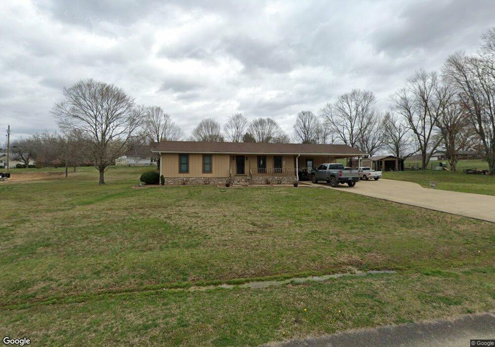
221 Townsend Loop Parsons, TN 38363
Estimated Value: $155,438 - $238,000
Studio
2
Baths
1,333
Sq Ft
$143/Sq Ft
Est. Value
About This Home
This home is located at 221 Townsend Loop, Parsons, TN 38363 and is currently estimated at $191,110, approximately $143 per square foot. 221 Townsend Loop is a home located in Decatur County with nearby schools including Parsons Elementary School, Decaturville Elementary School, and Decatur County Middle School.
Ownership History
Date
Name
Owned For
Owner Type
Purchase Details
Closed on
Oct 1, 2020
Sold by
Cruse Pete and Cruse Jean
Bought by
Scates Ashley
Current Estimated Value
Purchase Details
Closed on
Oct 9, 1986
Bought by
Cruse Pete and Cruse Jean
Purchase Details
Closed on
Jun 1, 1976
Create a Home Valuation Report for This Property
The Home Valuation Report is an in-depth analysis detailing your home's value as well as a comparison with similar homes in the area
Home Values in the Area
Average Home Value in this Area
Purchase History
| Date | Buyer | Sale Price | Title Company |
|---|---|---|---|
| Scates Ashley | -- | None Available | |
| Cruse Pete | $5,500 | -- | |
| -- | -- | -- |
Source: Public Records
Tax History
| Year | Tax Paid | Tax Assessment Tax Assessment Total Assessment is a certain percentage of the fair market value that is determined by local assessors to be the total taxable value of land and additions on the property. | Land | Improvement |
|---|---|---|---|---|
| 2025 | -- | $43,725 | $3,775 | $39,950 |
| 2024 | -- | $21,550 | $3,350 | $18,200 |
| 2023 | $707 | $21,550 | $3,350 | $18,200 |
| 2022 | $739 | $21,550 | $3,350 | $18,200 |
| 2021 | $731 | $21,300 | $3,350 | $17,950 |
| 2020 | $731 | $21,300 | $3,350 | $17,950 |
| 2019 | $675 | $21,425 | $2,800 | $18,625 |
| 2018 | $619 | $21,425 | $2,800 | $18,625 |
| 2017 | $630 | $21,425 | $2,800 | $18,625 |
| 2016 | $604 | $20,425 | $2,800 | $17,625 |
| 2015 | $605 | $20,425 | $2,800 | $17,625 |
| 2014 | $604 | $20,409 | $0 | $0 |
Source: Public Records
Map
Nearby Homes
- 479 Pentecost St
- 0 E Main St Unit 242952
- 1944 Highway 412 E
- 36 E 8th St
- 14 E 8th St
- 366 Kentucky Ave S
- 41 E 7th St
- 724 Tennessee Ave S
- 750 Tennessee Ave S
- 279 Evans St
- 280 Evans St
- 0 W 9th St
- 91 E 2nd St
- 40 Pine Cove
- 230 Texas Ave
- Lot 141 Creek Ridge Cove
- 869 W 4th St
- Lot 140 Creek Ridge Cove
- 109 Durbin Ln
- 220 Jennings Ave
- 220 Townsend Lp
- 1182 Old Perryville Rd
- 1150 Old Perryville Rd
- 1264 Old Perryville Rd
- 149 Townsend Loop
- 293 Townsend Loop
- 1221 Old Perryville Rd
- 1100 Old Perryville Rd
- 1141 Old Perryville Rd
- 1070 Old Perryville Rd
- 1346 Old Perryville Rd
- 486 Kenneth Graves Ln
- 0 Old Perryville Rd Unit 203756
- 888 Old Perryville Rd
- 624 Kenneth Graves Ln
- 0 Wayne Townsend Ln
- 103 Rains Creek Ln
- 175 Rains Creek Ln
- 123 Jimmy Evans Rd
- 207 Rains Creek Ln
Your Personal Tour Guide
Ask me questions while you tour the home.