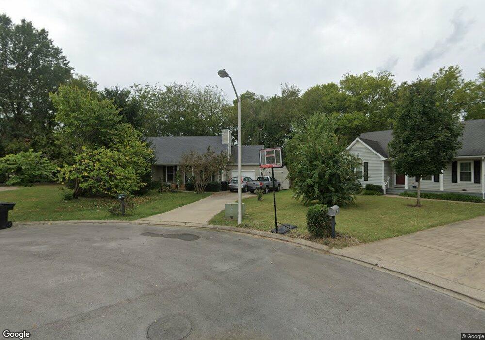
221 Turtle Rock Ct Murfreesboro, TN 37129
Estimated Value: $306,364 - $369,000
--
Bed
2
Baths
1,310
Sq Ft
$263/Sq Ft
Est. Value
About This Home
This home is located at 221 Turtle Rock Ct, Murfreesboro, TN 37129 and is currently estimated at $344,591, approximately $263 per square foot. 221 Turtle Rock Ct is a home located in Rutherford County with nearby schools including Erma Siegel Elementary School, Walter Hill Elementary School, and Siegel Middle School.
Ownership History
Date
Name
Owned For
Owner Type
Purchase Details
Closed on
Aug 4, 2003
Sold by
Lambert Killen Michele G
Bought by
Killen Robert V and Killen Michele G
Current Estimated Value
Home Financials for this Owner
Home Financials are based on the most recent Mortgage that was taken out on this home.
Original Mortgage
$101,700
Interest Rate
5.42%
Create a Home Valuation Report for This Property
The Home Valuation Report is an in-depth analysis detailing your home's value as well as a comparison with similar homes in the area
Home Values in the Area
Average Home Value in this Area
Purchase History
| Date | Buyer | Sale Price | Title Company |
|---|---|---|---|
| Killen Robert V | -- | -- |
Source: Public Records
Mortgage History
| Date | Status | Borrower | Loan Amount |
|---|---|---|---|
| Closed | Killen Robert V | $101,700 |
Source: Public Records
Tax History Compared to Growth
Tax History
| Year | Tax Paid | Tax Assessment Tax Assessment Total Assessment is a certain percentage of the fair market value that is determined by local assessors to be the total taxable value of land and additions on the property. | Land | Improvement |
|---|---|---|---|---|
| 2025 | $1,833 | $64,800 | $13,750 | $51,050 |
| 2024 | $1,833 | $64,800 | $13,750 | $51,050 |
| 2023 | $1,216 | $64,800 | $13,750 | $51,050 |
| 2022 | $1,047 | $64,800 | $13,750 | $51,050 |
| 2021 | $1,035 | $46,650 | $9,375 | $37,275 |
| 2020 | $1,035 | $46,650 | $9,375 | $37,275 |
| 2019 | $1,035 | $46,650 | $9,375 | $37,275 |
| 2018 | $1,422 | $46,650 | $0 | $0 |
| 2017 | $1,253 | $32,225 | $0 | $0 |
| 2016 | $1,253 | $32,225 | $0 | $0 |
| 2015 | $1,253 | $32,225 | $0 | $0 |
| 2014 | $801 | $32,225 | $0 | $0 |
| 2013 | -- | $29,075 | $0 | $0 |
Source: Public Records
Map
Nearby Homes
- 3502 Winterfell Dr
- 0 Thompson Rd Unit RTC3030765
- 0 Thompson Rd Unit RTC2925050
- 3535 Caroline Farms Dr
- 3434 Magruder Dr
- 3524 Magruder Dr
- 3544 Magruder Dr
- 3429 John Richards Dr
- 3425 John Richards Dr
- 3419 John Richards Dr
- 3435 John Richards Dr
- 3431 John Richards Dr
- 3423 John Richards Dr
- 3505 John Richards Dr
- 3407 John Richards Dr
- 3417 John Richards Dr
- 3411 John Richards Dr
- 3508 Pershing Dr
- 3703 Lexington Ct
- 3813 Lebanon Rd
- 225 Turtle Rock Ct
- 217 Turtle Rock Ct
- 244 W Thompson Ln
- 236 W Thompson Ln
- 254 W Thompson Ln
- 222 Turtle Rock Ct
- 213 Turtle Rock Ct
- 218 Turtle Rock Ct
- 264 W Thompson Ln
- 214 Turtle Rock Ct
- 224 W Thompson Ln
- 209 Turtle Rock Ct
- 223 Cobblefield Ave
- 227 Cobblefield Ave
- 219 Cobblefield Ave
- 210 Turtle Rock Ct
- 270 W Thompson Ln
- 205 Turtle Rock Ct
- 215 Cobblefield Ave
- 206 Turtle Rock Ct