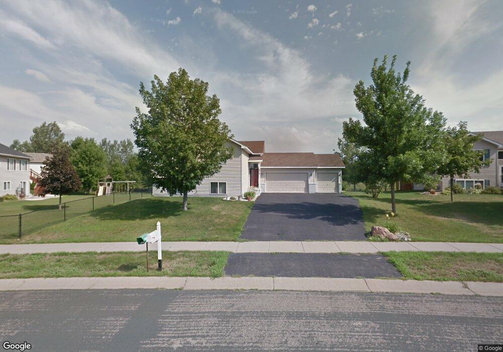
2210 Belfast St W Rosemount, MN 55068
Estimated Value: $397,000 - $434,000
4
Beds
2
Baths
1,161
Sq Ft
$362/Sq Ft
Est. Value
About This Home
This home is located at 2210 Belfast St W, Rosemount, MN 55068 and is currently estimated at $419,988, approximately $361 per square foot. 2210 Belfast St W is a home located in Dakota County with nearby schools including Red Pine Elementary School, Rosemount Middle School, and Rosemount Senior High School.
Ownership History
Date
Name
Owned For
Owner Type
Purchase Details
Closed on
Mar 31, 2004
Sold by
Deinhurt Patricia C
Bought by
Shiwpaul Pritraj and Shiwpaul Christina M
Current Estimated Value
Purchase Details
Closed on
Mar 16, 2001
Sold by
Heemstra John L and Heemstra Heather C
Bought by
Deinhart Patricia C
Purchase Details
Closed on
Apr 13, 2000
Sold by
Brandl/Anderson Homes Inc
Bought by
Heemstra John L and Heemstra Heather C
Purchase Details
Closed on
Apr 3, 2000
Sold by
Heritage Development Of Minnesota Inc
Bought by
Brandl/Anderson Homes Inc
Create a Home Valuation Report for This Property
The Home Valuation Report is an in-depth analysis detailing your home's value as well as a comparison with similar homes in the area
Home Values in the Area
Average Home Value in this Area
Purchase History
| Date | Buyer | Sale Price | Title Company |
|---|---|---|---|
| Shiwpaul Pritraj | $245,000 | -- | |
| Deinhart Patricia C | $176,000 | -- | |
| Heemstra John L | $160,466 | -- | |
| Brandl/Anderson Homes Inc | $38,900 | -- |
Source: Public Records
Tax History Compared to Growth
Tax History
| Year | Tax Paid | Tax Assessment Tax Assessment Total Assessment is a certain percentage of the fair market value that is determined by local assessors to be the total taxable value of land and additions on the property. | Land | Improvement |
|---|---|---|---|---|
| 2024 | $4,148 | $378,300 | $113,800 | $264,500 |
| 2023 | $4,148 | $383,700 | $115,100 | $268,600 |
| 2022 | $3,462 | $374,200 | $114,600 | $259,600 |
| 2021 | $3,272 | $311,300 | $93,600 | $217,700 |
| 2020 | $3,374 | $289,600 | $89,200 | $200,400 |
| 2019 | $3,055 | $287,000 | $84,900 | $202,100 |
| 2018 | $2,986 | $273,700 | $80,900 | $192,800 |
| 2017 | $2,969 | $259,800 | $77,100 | $182,700 |
| 2016 | $2,923 | $248,300 | $75,200 | $173,100 |
| 2015 | $2,751 | $224,905 | $68,266 | $156,639 |
| 2014 | -- | $210,626 | $64,003 | $146,623 |
| 2013 | -- | $189,698 | $58,221 | $131,477 |
Source: Public Records
Map
Nearby Homes
- 14049 Belmont Trail
- 14307 Banyan Ln
- 2307 Belfast St W
- 13950 Autumn Ct
- 2097 138th St W
- 13702 Arrowhead Way
- 13842 Arrowhead Way
- 2301 136th St W
- 13569 Birdsong Pth
- 13566 Birdsong Pth
- 2337 136th Ct W
- 2373 136th Ct W
- 2300 136th Ct W
- 13940 Bundoran Ave Unit 134
- 14587 Boxwood Path
- 13930 Bundoran Ave Unit 132
- 14648 Blueberry Ct
- 13830 Atwood Ave
- 14238 Atwood Cir
- 2067 Bonaire Path W
- 2226 Belfast St W
- 14060 Belmont Trail
- 14056 Belmont Trail
- 2242 Belfast St W
- 2243 Belfast St W
- 14052 Belmont Trail
- 14068 Belmont Trail
- 2258 Belfast St W
- 2259 Belfast St W
- 14237 Banyan Ln
- 14239 Banyan Ln
- 14053 Belmont Trail
- 14241 Banyan Ln
- 14048 Belmont Trail
- 14057 Belmont Trail
- 14072 Belmont Trail
- 14243 Banyan Ln
- 2274 Belfast St W
- 2275 Belfast St W
- 14287 Banyan Ln