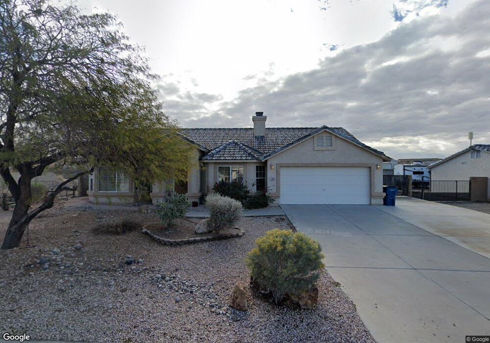
2210 E Jamie Rd Fort Mohave, AZ 86426
Estimated Value: $316,865 - $396,000
3
Beds
2
Baths
1,521
Sq Ft
$237/Sq Ft
Est. Value
About This Home
This home is located at 2210 E Jamie Rd, Fort Mohave, AZ 86426 and is currently estimated at $360,716, approximately $237 per square foot. 2210 E Jamie Rd is a home located in Mohave County with nearby schools including Fort Mohave Elementary School, Camp Mohave Elementary School, and Mohave Valley Junior High School.
Ownership History
Date
Name
Owned For
Owner Type
Purchase Details
Closed on
Nov 1, 2006
Sold by
Watson Connie L
Bought by
Brown Charles T and Mcfadden Sandra S
Current Estimated Value
Home Financials for this Owner
Home Financials are based on the most recent Mortgage that was taken out on this home.
Original Mortgage
$40,000
Outstanding Balance
$23,753
Interest Rate
6.28%
Mortgage Type
New Conventional
Estimated Equity
$336,963
Purchase Details
Closed on
Dec 15, 2003
Sold by
Watson Connie I
Bought by
Watson Connie I
Purchase Details
Closed on
May 16, 2002
Sold by
First Amer Title Ins Agency Mohave Inc
Bought by
Ramsey Home Development Inc
Purchase Details
Closed on
Dec 26, 2001
Sold by
Ramsey Home Development Inc
Bought by
Watson Connie I
Create a Home Valuation Report for This Property
The Home Valuation Report is an in-depth analysis detailing your home's value as well as a comparison with similar homes in the area
Home Values in the Area
Average Home Value in this Area
Purchase History
| Date | Buyer | Sale Price | Title Company |
|---|---|---|---|
| Brown Charles T | $249,900 | Capital Title Agency Inc | |
| Watson Connie I | -- | -- | |
| Ramsey Home Development Inc | $20,650 | First American Title | |
| Watson Connie I | $125,810 | Transnation Title Insurance |
Source: Public Records
Mortgage History
| Date | Status | Borrower | Loan Amount |
|---|---|---|---|
| Open | Brown Charles T | $40,000 |
Source: Public Records
Tax History Compared to Growth
Tax History
| Year | Tax Paid | Tax Assessment Tax Assessment Total Assessment is a certain percentage of the fair market value that is determined by local assessors to be the total taxable value of land and additions on the property. | Land | Improvement |
|---|---|---|---|---|
| 2026 | $653 | -- | -- | -- |
| 2025 | $1,245 | $24,307 | $0 | $0 |
| 2024 | $1,245 | $27,720 | $0 | $0 |
| 2023 | $1,245 | $22,478 | $0 | $0 |
| 2022 | $1,222 | $18,125 | $0 | $0 |
| 2021 | $1,281 | $16,894 | $0 | $0 |
| 2019 | $1,190 | $13,706 | $0 | $0 |
| 2018 | $1,156 | $13,097 | $0 | $0 |
| 2017 | $1,146 | $12,228 | $0 | $0 |
| 2016 | $999 | $11,277 | $0 | $0 |
| 2015 | $1,013 | $10,330 | $0 | $0 |
Source: Public Records
Map
Nearby Homes
- 2213 E Jamie Rd
- 4188 S Nicholas Ct
- 2164 E Marissa Dr
- 2123 E Marissa Dr
- 2312 E Sundance Dr
- 2041 E Sundance Dr
- 4099 S Cassidy Dr
- 1962 E Via San Marino
- 1946 E Via San Marino
- 4393 S Colorado Rd
- 1949 E Via Aventino
- 1973 E La Entrada Place
- 1909 E Via Aventino
- 2386 E Sundance Dr
- 4334 S Tamara Terrace
- 2219 Bonanza Ct
- 1863 E La Entrada Place
- 2106 Shadow Canyon Dr
- 2344 Shadow Canyon Dr
- 1824 Stovall St
- 2204 E Jamie Rd
- 2202 E Jamie Ct
- 2216 E Jamie Rd
- 2207 E Jamie Rd
- 2199 E Jamie Rd
- 2222 E Roberts Way
- 2198 E Jamie Ct
- 2191 E Jamie Rd
- 2228 E Roberts Way
- 2184 E Jamie Ct
- 2186 E Jamie Ct
- 2194 E Jamie Ct
- 2196 E Jamie Ct
- 2234 E Roberts Way
- 2192 E Jamie Ct
- 2192 E Jamie Ct
- 2192 E Jamie Ct
- 2183 E Jamie Rd
- 2190 E Jamie Ct
- 2190 Jamie Ct E