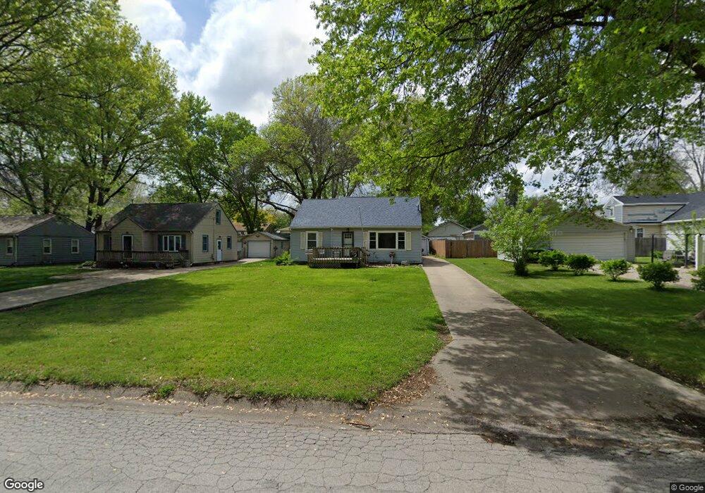
2210 Glenbrook Dr Des Moines, IA 50316
Union Park NeighborhoodEstimated Value: $193,000 - $240,000
3
Beds
2
Baths
1,511
Sq Ft
$144/Sq Ft
Est. Value
About This Home
This home is located at 2210 Glenbrook Dr, Des Moines, IA 50316 and is currently estimated at $217,797, approximately $144 per square foot. 2210 Glenbrook Dr is a home located in Polk County with nearby schools including Cattell Elementary School, Goodrell Middle School, and North High School.
Ownership History
Date
Name
Owned For
Owner Type
Purchase Details
Closed on
Dec 8, 2021
Sold by
Neil Moon Clint and Neil Hollie
Bought by
Moon Terri Leann
Current Estimated Value
Purchase Details
Closed on
Jan 7, 2000
Sold by
Braymen Walter M and Brayman Linda J
Bought by
Moon Clint N and Moon Terri L
Home Financials for this Owner
Home Financials are based on the most recent Mortgage that was taken out on this home.
Original Mortgage
$85,400
Interest Rate
7.5%
Create a Home Valuation Report for This Property
The Home Valuation Report is an in-depth analysis detailing your home's value as well as a comparison with similar homes in the area
Home Values in the Area
Average Home Value in this Area
Purchase History
| Date | Buyer | Sale Price | Title Company |
|---|---|---|---|
| Moon Terri Leann | -- | None Listed On Document | |
| Moon Clint N | $89,500 | -- |
Source: Public Records
Mortgage History
| Date | Status | Borrower | Loan Amount |
|---|---|---|---|
| Previous Owner | Moon Clint N | $85,400 |
Source: Public Records
Tax History Compared to Growth
Tax History
| Year | Tax Paid | Tax Assessment Tax Assessment Total Assessment is a certain percentage of the fair market value that is determined by local assessors to be the total taxable value of land and additions on the property. | Land | Improvement |
|---|---|---|---|---|
| 2025 | $3,314 | $200,000 | $33,200 | $166,800 |
| 2024 | $3,314 | $178,900 | $29,300 | $149,600 |
| 2023 | $3,474 | $178,900 | $29,300 | $149,600 |
| 2022 | $3,446 | $156,300 | $26,700 | $129,600 |
| 2021 | $3,242 | $156,300 | $26,700 | $129,600 |
| 2020 | $3,362 | $138,500 | $23,600 | $114,900 |
| 2019 | $3,042 | $138,500 | $23,600 | $114,900 |
| 2018 | $3,006 | $121,700 | $20,300 | $101,400 |
| 2017 | $2,912 | $121,700 | $20,300 | $101,400 |
| 2016 | $2,832 | $116,200 | $19,100 | $97,100 |
| 2015 | $2,832 | $116,200 | $19,100 | $97,100 |
| 2014 | $2,872 | $121,100 | $19,500 | $101,600 |
Source: Public Records
Map
Nearby Homes
- 1617 Guthrie Ave
- 1602 Wilson Ave
- 1514 Guthrie Ave
- 1530 Mattern Ave
- 1443 Wilson Ave
- 1434 Mattern Ave
- 1526 E Jefferson Ave
- 1427 Mattern Ave
- 1424 Milton Ave
- 1400 Mattern Ave
- 2517 Sampson St
- 2529 Glenbrook Dr
- 1822 E 14th St
- 2018 York St
- 1432 Royer St
- 1501 Osceola Ave
- 1916 York St
- 2706 E 16th St
- 2336 E 13th St
- 1332 E Sheridan Ave
- 2206 Glenbrook Dr
- 1613 Guthrie Ave
- 2202 Glenbrook Dr
- 1609 Guthrie Ave
- 2209 E 16th St
- 2205 E 16th St
- 1605 Guthrie Ave
- 2201 E 16th St
- 1601 Guthrie Ave
- 2209 Glenbrook Dr
- 2213 Glenbrook Dr
- 2114 Glenbrook Dr
- 2223 Glenbrook Dr
- 1614 Thompson Ave
- 1608 Thompson Ave
- 1614 Guthrie Ave
- 4018 E 16th St
- 1425 E 16th St
- 1610 Guthrie Ave
- 2203 Glenbrook Dr