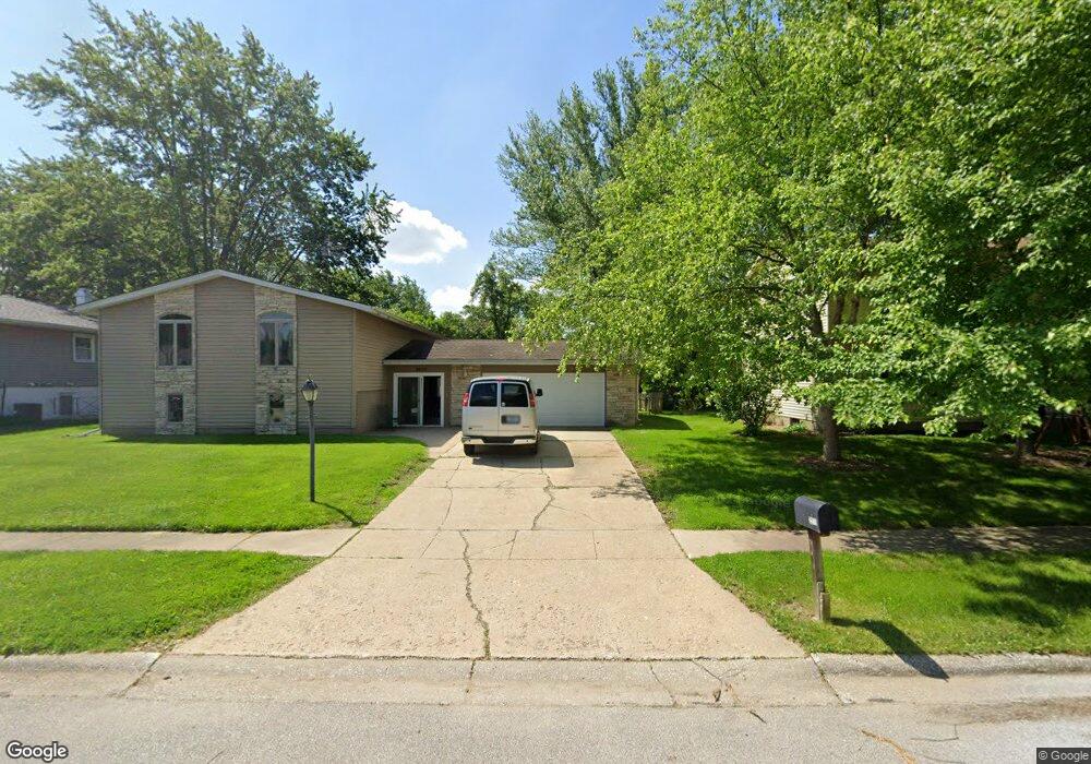
2210 Mccord Rd Valparaiso, IN 46383
Estimated Value: $336,622 - $387,000
5
Beds
3
Baths
2,464
Sq Ft
$149/Sq Ft
Est. Value
About This Home
This home is located at 2210 Mccord Rd, Valparaiso, IN 46383 and is currently estimated at $366,541, approximately $148 per square foot. 2210 Mccord Rd is a home located in Porter County with nearby schools including Flint Lake Elementary School, Thomas Jefferson Middle School, and Valparaiso High School.
Ownership History
Date
Name
Owned For
Owner Type
Purchase Details
Closed on
May 3, 2010
Sold by
Vas Living Trust
Bought by
In Pact Inc
Current Estimated Value
Home Financials for this Owner
Home Financials are based on the most recent Mortgage that was taken out on this home.
Original Mortgage
$137,000
Outstanding Balance
$91,826
Interest Rate
5.05%
Mortgage Type
Purchase Money Mortgage
Estimated Equity
$274,715
Create a Home Valuation Report for This Property
The Home Valuation Report is an in-depth analysis detailing your home's value as well as a comparison with similar homes in the area
Home Values in the Area
Average Home Value in this Area
Purchase History
| Date | Buyer | Sale Price | Title Company |
|---|---|---|---|
| In Pact Inc | -- | Community Title Company |
Source: Public Records
Mortgage History
| Date | Status | Borrower | Loan Amount |
|---|---|---|---|
| Open | In Pact Inc | $137,000 |
Source: Public Records
Tax History Compared to Growth
Tax History
| Year | Tax Paid | Tax Assessment Tax Assessment Total Assessment is a certain percentage of the fair market value that is determined by local assessors to be the total taxable value of land and additions on the property. | Land | Improvement |
|---|---|---|---|---|
| 2024 | $20 | $290,400 | $45,200 | $245,200 |
| 2023 | $20 | $295,400 | $42,300 | $253,100 |
| 2022 | $20 | $271,000 | $42,300 | $228,700 |
| 2021 | $20 | $242,600 | $42,300 | $200,300 |
| 2020 | $20 | $229,800 | $36,800 | $193,000 |
| 2019 | $20 | $191,900 | $36,800 | $155,100 |
| 2018 | $20 | $195,900 | $36,800 | $159,100 |
| 2017 | $20 | $187,200 | $36,800 | $150,400 |
| 2016 | $20 | $192,500 | $40,500 | $152,000 |
| 2014 | $20 | $169,700 | $35,800 | $133,900 |
| 2013 | -- | $170,700 | $37,600 | $133,100 |
Source: Public Records
Map
Nearby Homes
- 1710 Peachtree Dr
- 1401 Peachtree Dr
- 2411 Jonathan Dr
- 2110 Yorktowne Dr
- 4409 Evans Ave
- 2706 Baldwin Ct
- 1716 Whittier Park Dr
- 1802 Evans Ave
- 2004 Eisenhower Ave
- TBD Silhavy Rd
- 2107 Berwick Dr
- 2106 Worthington Dr
- 1703 Lind Ln
- 2507 Eisenhower Ave
- 1602 Truman Ave
- 1603 Eisenhower Ave
- 406 Sturdy Rd Unit A-12
- 406 Sturdy Rd Unit 2A
- 2403 Inverness Dr
- 402 Sturdy Rd Unit 2C
- 2300 Mccord Rd
- 2208 Mccord Rd
- 2207 Shallowford Dr
- 2301 Shallowford Dr
- 2205 Shallowford Dr
- 2206 Mccord Rd
- 2302 Mccord Rd
- 1411 Carriage Dr
- 2209 Mccord Rd
- 2207 Mccord Rd
- 2301 Mccord Rd
- 2205 Mccord Rd
- 2303 Shallowford Dr
- 2203 Shallowford Dr
- 2204 Mccord Rd
- 2203 Mccord Rd
- 2303 Mccord Rd
- 653 Carriage Dr
- 2201 Shallowford Dr
- 2300 Shallowford Dr