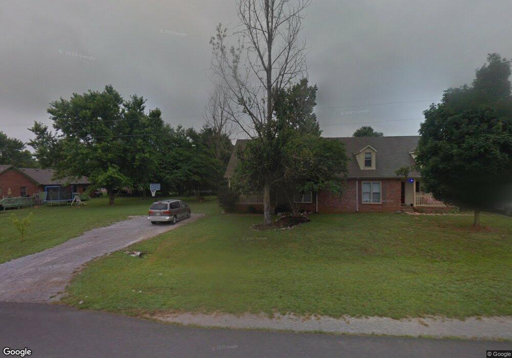
2210 Patriot Dr Murfreesboro, TN 37130
Estimated Value: $256,000 - $349,000
--
Bed
3
Baths
1,575
Sq Ft
$188/Sq Ft
Est. Value
About This Home
This home is located at 2210 Patriot Dr, Murfreesboro, TN 37130 and is currently estimated at $296,559, approximately $188 per square foot. 2210 Patriot Dr is a home located in Rutherford County with nearby schools including John Pittard Elementary School, Oakland Middle School, and Oakland High School.
Ownership History
Date
Name
Owned For
Owner Type
Purchase Details
Closed on
Mar 11, 2022
Sold by
Fuchcar Heidi C
Bought by
Fuchcar Stephen L and Fucher Heidi C
Current Estimated Value
Home Financials for this Owner
Home Financials are based on the most recent Mortgage that was taken out on this home.
Original Mortgage
$77,000
Outstanding Balance
$62,137
Interest Rate
3.15%
Mortgage Type
New Conventional
Estimated Equity
$234,422
Create a Home Valuation Report for This Property
The Home Valuation Report is an in-depth analysis detailing your home's value as well as a comparison with similar homes in the area
Home Values in the Area
Average Home Value in this Area
Purchase History
| Date | Buyer | Sale Price | Title Company |
|---|---|---|---|
| Fuchcar Stephen L | -- | Macbeth Glenn S | |
| Fuchcar Stephen L | -- | None Listed On Document |
Source: Public Records
Mortgage History
| Date | Status | Borrower | Loan Amount |
|---|---|---|---|
| Open | Fuchcar Stephen L | $77,000 | |
| Closed | Fuchcar Stephen L | $77,000 |
Source: Public Records
Tax History Compared to Growth
Tax History
| Year | Tax Paid | Tax Assessment Tax Assessment Total Assessment is a certain percentage of the fair market value that is determined by local assessors to be the total taxable value of land and additions on the property. | Land | Improvement |
|---|---|---|---|---|
| 2025 | $1,458 | $51,525 | $8,750 | $42,775 |
| 2024 | $1,458 | $51,525 | $8,750 | $42,775 |
| 2023 | $967 | $51,525 | $8,750 | $42,775 |
| 2022 | $833 | $51,525 | $8,750 | $42,775 |
| 2021 | $830 | $37,400 | $6,000 | $31,400 |
| 2020 | $830 | $37,400 | $6,000 | $31,400 |
| 2019 | $830 | $37,400 | $6,000 | $31,400 |
| 2018 | $1,140 | $37,400 | $0 | $0 |
| 2017 | $1,002 | $25,800 | $0 | $0 |
| 2016 | $1,002 | $25,800 | $0 | $0 |
| 2015 | $1,002 | $25,800 | $0 | $0 |
| 2014 | $642 | $25,800 | $0 | $0 |
| 2013 | -- | $24,225 | $0 | $0 |
Source: Public Records
Map
Nearby Homes
- 2164 White Poplar Ct
- 2223 Brick Way
- 2111 Lovelace Ln
- 2110 Stillwell Ct
- 0 Pitts Ln
- 1512 Mirabella Way
- 1430 Avellino Cir
- 2403 English Hill Dr
- 1640 Drayton Dr
- 2427 Donald Bradley Ct
- 2510 Mission Ridge Dr
- 2607 Mission Ridge Dr
- 1409 E Northfield Blvd
- 2428 Sandstone Cir
- 2326 Laurelstone Dr
- 2328 Laurelstone Dr
- 2514 Sandstone Cir
- 2336 Laurelstone Dr
- 1728 Shagbark Trail
- 2406 Laurelstone Dr
- 2210 Patriot Dr Unit 2210
- 2208 Patriot Dr
- 2208 Patriot Dr Unit 2208
- 2588 Oak Hill Dr
- 2214 Patriot Dr
- 2593 Concord Ct
- 2586 Oak Hill Dr
- 2585 Concord Ct
- 2583 Concord Ct
- 2578 Oak Hill Dr
- 2575 Concord Ct
- 2576 Oak Hill Dr
- 2595 Oak Hill Dr
- 2597 Oak Hill Dr
- 2587 Oak Hill Dr
- 2573 Concord Ct
- 2585 Oak Hill Dr
- 2220 Patriot Dr
- 2566 Oak Hill Dr Unit 2568
- 2565 Concord Ct