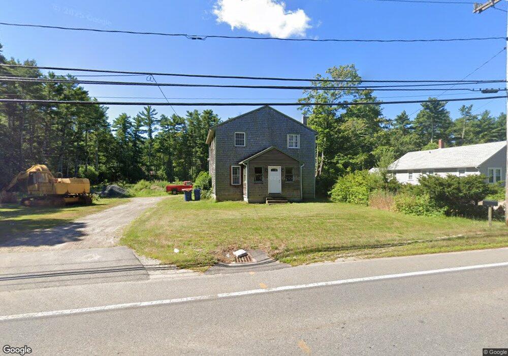
2211 Cranberry Hwy West Wareham, MA 02576
Estimated Value: $492,515 - $506,000
3
Beds
2
Baths
1,680
Sq Ft
$297/Sq Ft
Est. Value
About This Home
This home is located at 2211 Cranberry Hwy, West Wareham, MA 02576 and is currently estimated at $499,129, approximately $297 per square foot. 2211 Cranberry Hwy is a home located in Plymouth County.
Ownership History
Date
Name
Owned For
Owner Type
Purchase Details
Closed on
Mar 6, 2020
Sold by
Tremont Enterprise Corp
Bought by
Graziano Francis A
Current Estimated Value
Home Financials for this Owner
Home Financials are based on the most recent Mortgage that was taken out on this home.
Original Mortgage
$264,001
Outstanding Balance
$233,255
Interest Rate
3.6%
Mortgage Type
New Conventional
Estimated Equity
$265,874
Purchase Details
Closed on
Nov 9, 2007
Sold by
Weller Nancy L
Bought by
Tremont Enterprise Cor
Home Financials for this Owner
Home Financials are based on the most recent Mortgage that was taken out on this home.
Original Mortgage
$260,000
Interest Rate
6.47%
Mortgage Type
Purchase Money Mortgage
Create a Home Valuation Report for This Property
The Home Valuation Report is an in-depth analysis detailing your home's value as well as a comparison with similar homes in the area
Home Values in the Area
Average Home Value in this Area
Purchase History
| Date | Buyer | Sale Price | Title Company |
|---|---|---|---|
| Graziano Francis A | $290,000 | None Available | |
| Graziano Francis A | $290,000 | None Available | |
| Tremont Enterprise Cor | $325,000 | -- | |
| Tremont Enterprise Cor | $325,000 | -- |
Source: Public Records
Mortgage History
| Date | Status | Borrower | Loan Amount |
|---|---|---|---|
| Open | Graziano Francis A | $264,001 | |
| Closed | Graziano Francis A | $264,001 | |
| Previous Owner | Tremont Enterprise Cor | $260,000 | |
| Previous Owner | Tremont Enterprise Cor | $50,000 | |
| Previous Owner | Tremont Enterprise Cor | $8,325 |
Source: Public Records
Tax History Compared to Growth
Tax History
| Year | Tax Paid | Tax Assessment Tax Assessment Total Assessment is a certain percentage of the fair market value that is determined by local assessors to be the total taxable value of land and additions on the property. | Land | Improvement |
|---|---|---|---|---|
| 2025 | $3,903 | $374,600 | $111,600 | $263,000 |
| 2024 | $3,865 | $344,200 | $89,600 | $254,600 |
| 2023 | $3,452 | $305,800 | $81,400 | $224,400 |
| 2022 | $3,452 | $261,900 | $81,400 | $180,500 |
| 2021 | $3,400 | $252,800 | $81,400 | $171,400 |
| 2020 | $3,192 | $240,700 | $81,400 | $159,300 |
| 2019 | $3,187 | $239,800 | $86,100 | $153,700 |
| 2018 | $3,065 | $224,900 | $86,100 | $138,800 |
| 2017 | $2,905 | $216,000 | $86,100 | $129,900 |
| 2016 | $2,740 | $202,500 | $90,400 | $112,100 |
| 2015 | $2,647 | $202,500 | $90,400 | $112,100 |
| 2014 | $2,749 | $213,900 | $85,900 | $128,000 |
Source: Public Records
Map
Nearby Homes
- 2230 Cranberry Hwy Unit 1
- 563 County Rd
- 47 Weaver St
- 72 Papermill Rd Unit 72
- 20 Gault Rd
- 51 Crest Dr
- 103 Castle Dr
- 27 Siesta Dr
- 4 Siesta Dr
- 41 Longboat Rd
- 11 Fonseca Way
- 527 High St
- 7 Forbes Rd
- 490 High St
- 59 Timber Ln
- 87 Great Hill Dr
- 663 Wareham St Unit 8
- 663 Wareham St Unit 6
- 189 Pine View Terrace
- 199 Windswept Rd
- 2211 Cranberry Hwy
- 2209 Cranberry Hwy
- 2214 Cranberry Hwy
- 2218 Cranberry Hwy
- 2215 Cranberry Hwy
- 2201 Cranberry Hwy
- 2201 Cranberry Hwy Unit 2
- 4 Rae Ave
- 2220 Cranberry Hwy Unit D6
- 1 Rae Ave
- 3 Rae Ave
- 5 Rae Ave
- 2226 Cranberry Hwy
- 2227 Cranberry Hwy
- 866 County Rd
- 872 County Rd
- 2229 Cranberry Hwy
- 2228 Cranberry Hwy
- 856 County Rd
- 617 County Rd