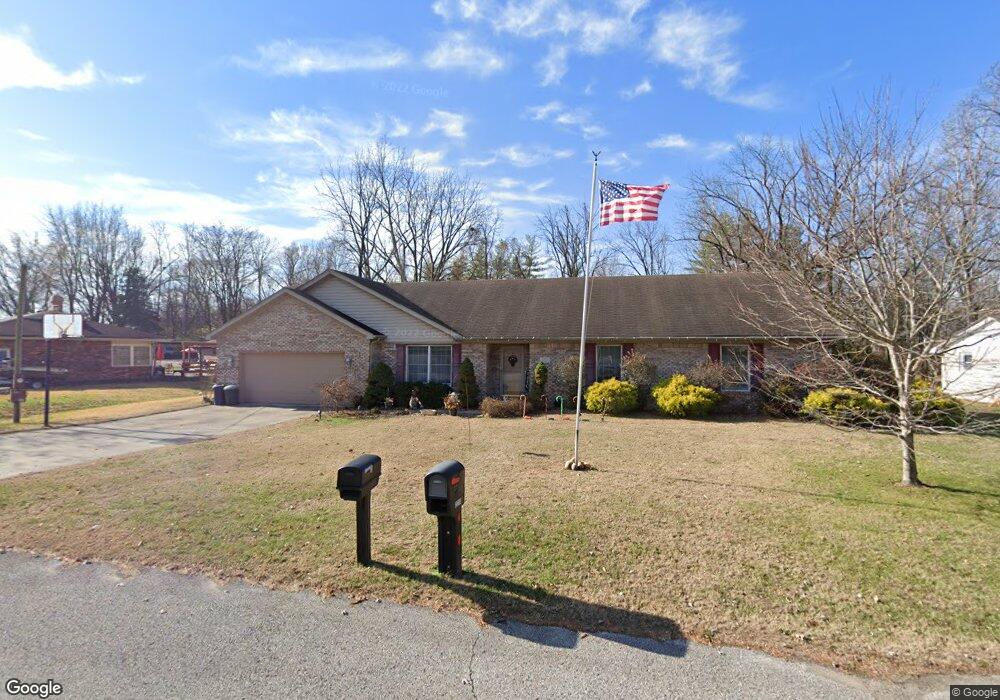
2211 Mark Twain Ave Seymour, IN 47274
Estimated Value: $287,654 - $316,000
3
Beds
2
Baths
2,065
Sq Ft
$144/Sq Ft
Est. Value
About This Home
This home is located at 2211 Mark Twain Ave, Seymour, IN 47274 and is currently estimated at $297,914, approximately $144 per square foot. 2211 Mark Twain Ave is a home located in Jackson County with nearby schools including Seymour-Redding Elementary School, Seymour Middle School, and Seymour Senior High School.
Ownership History
Date
Name
Owned For
Owner Type
Purchase Details
Closed on
Oct 10, 2014
Sold by
Schrink Jeanne A
Bought by
Schmidt David and Schmidt Helen
Current Estimated Value
Purchase Details
Closed on
Jun 30, 2005
Sold by
Wetzel Randolph S and Wetzel Misty
Bought by
Schrink Stephen L and Schrink Jeanne A
Home Financials for this Owner
Home Financials are based on the most recent Mortgage that was taken out on this home.
Original Mortgage
$50,000
Interest Rate
5.69%
Mortgage Type
New Conventional
Create a Home Valuation Report for This Property
The Home Valuation Report is an in-depth analysis detailing your home's value as well as a comparison with similar homes in the area
Home Values in the Area
Average Home Value in this Area
Purchase History
| Date | Buyer | Sale Price | Title Company |
|---|---|---|---|
| Schmidt David | -- | -- | |
| Schrink Stephen L | -- | None Available |
Source: Public Records
Mortgage History
| Date | Status | Borrower | Loan Amount |
|---|---|---|---|
| Previous Owner | Schrink Stephen L | $50,000 |
Source: Public Records
Tax History Compared to Growth
Tax History
| Year | Tax Paid | Tax Assessment Tax Assessment Total Assessment is a certain percentage of the fair market value that is determined by local assessors to be the total taxable value of land and additions on the property. | Land | Improvement |
|---|---|---|---|---|
| 2024 | $1,125 | $197,600 | $27,000 | $170,600 |
| 2023 | $977 | $177,400 | $27,000 | $150,400 |
| 2022 | $1,053 | $175,200 | $27,000 | $148,200 |
| 2021 | $1,229 | $163,000 | $27,000 | $136,000 |
| 2020 | $806 | $164,800 | $27,000 | $137,800 |
| 2019 | $800 | $165,000 | $27,000 | $138,000 |
| 2018 | $770 | $165,100 | $27,000 | $138,100 |
| 2017 | $916 | $163,600 | $27,000 | $136,600 |
| 2016 | $735 | $165,300 | $27,000 | $138,300 |
| 2014 | $873 | $152,300 | $27,000 | $125,300 |
| 2013 | $873 | $152,200 | $26,900 | $125,300 |
Source: Public Records
Map
Nearby Homes
- 720 Redding Rd
- 439 Alisa Ave
- 1935 N Ewing St
- 6778 Redbud Ln
- 6762 Redbud Ln
- 6786 Coreopsis Ln
- 6784 Coreopsis Ln
- 6827 Bluebird Ln
- 6811 Sunflower Ct
- 6809 Sunflower Ct
- 6813 Sunflower Ct
- 6980 Meadow Run
- 6990 Meadow Run
- 6842 Bluebird Ln
- 6823 Bluebird Ln
- 9162 Janelle Dr
- 338 Redwood Dr
- 1510 Shields Ave
- 304 E 14th St
- 500 E 14th St
- 2215 Mark Twain Ave
- 2207 Mark Twain Ave
- 2214 Mark Twain Ave
- 2221 Mark Twain Ave
- 2212 Mark Twain Ave
- 605 Roger Dr
- 627 Roger Dr
- 628 Whittier Dr
- 620 Roger Dr
- 2132 Hillside Dr
- 2227 Mark Twain Ave
- 633 Roger Dr
- 629 Whittier Dr
- 626 Roger Dr
- 634 Whittier Dr
- 515 Roger Dr
- 640 Whittier Dr
- 2124 Hillside Dr
- 646 Whittier Dr
- 2135 Mark Twain Ave