Estimated Value: $244,000 - $267,000
3
Beds
2
Baths
1,372
Sq Ft
$183/Sq Ft
Est. Value
About This Home
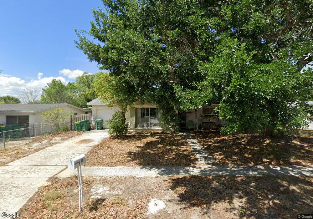
This home is located at 2211 Mercer Dr, Cocoa, FL 32926 and is currently estimated at $251,615, approximately $183 per square foot. 2211 Mercer Dr is a home located in Brevard County with nearby schools including Cocoa High School, Cambridge Elementary Magnet School, and Space Coast Christian Academy.
Ownership History
Date
Name
Owned For
Owner Type
Purchase Details
Closed on
Nov 16, 2015
Sold by
Hersey Donald P
Bought by
Hersey Dana J
Current Estimated Value
Purchase Details
Closed on
Jun 13, 2000
Sold by
Clerk Circuit Court
Bought by
Cenlar Fed Sav Bk and Cenlar Servicing Inc
Purchase Details
Closed on
Feb 22, 2000
Sold by
Dept Housing & Urban Dev
Bought by
Hersey Donald P and Hersey Dana J
Home Financials for this Owner
Home Financials are based on the most recent Mortgage that was taken out on this home.
Original Mortgage
$49,950
Interest Rate
8.37%
Purchase Details
Closed on
Dec 28, 1999
Sold by
Cenlar Fed Sav Bk
Bought by
Housing & Urban Dev
Home Financials for this Owner
Home Financials are based on the most recent Mortgage that was taken out on this home.
Original Mortgage
$49,950
Interest Rate
8.37%
Create a Home Valuation Report for This Property
The Home Valuation Report is an in-depth analysis detailing your home's value as well as a comparison with similar homes in the area
Home Values in the Area
Average Home Value in this Area
Purchase History
| Date | Buyer | Sale Price | Title Company |
|---|---|---|---|
| Hersey Dana J | $25,000 | None Available | |
| Cenlar Fed Sav Bk | -- | -- | |
| Hersey Donald P | $52,600 | -- | |
| Housing & Urban Dev | -- | -- |
Source: Public Records
Mortgage History
| Date | Status | Borrower | Loan Amount |
|---|---|---|---|
| Previous Owner | Hersey Donald P | $49,950 |
Source: Public Records
Tax History
| Year | Tax Paid | Tax Assessment Tax Assessment Total Assessment is a certain percentage of the fair market value that is determined by local assessors to be the total taxable value of land and additions on the property. | Land | Improvement |
|---|---|---|---|---|
| 2025 | $931 | $57,260 | -- | -- |
| 2024 | $914 | $55,650 | -- | -- |
| 2023 | $914 | $54,030 | $0 | $0 |
| 2022 | $859 | $52,460 | $0 | $0 |
| 2021 | $853 | $50,940 | $0 | $0 |
| 2020 | $832 | $50,240 | $0 | $0 |
| 2019 | $808 | $49,120 | $0 | $0 |
| 2018 | $684 | $48,210 | $0 | $0 |
| 2017 | $682 | $47,730 | $0 | $0 |
| 2016 | $688 | $47,810 | $19,000 | $28,810 |
| 2015 | $688 | $47,480 | $19,000 | $28,480 |
| 2014 | $635 | $47,110 | $19,000 | $28,110 |
Source: Public Records
Map
Nearby Homes
- 2319 Elon Dr
- Xxx Rosetine St
- 0000 Null Unknown
- 0 University Ln
- 1417 Walter St
- 1644 Ruth St
- 2426 Granville Dr
- 2413 Cherbourg Rd
- 2500 Fairfield Dr
- 2430 Legay St
- 0000 Unknown
- 00 N Unknown
- 1509 Tate St
- 2515 Fairfield Dr
- 1455 Tate St
- 2029 Ivy Dr
- 1354 S Stetson Dr
- 1523 Furnari St
- 1326 Stetson Ct
- 1531 Paradise Ln
- 2207 Mercer Dr
- 2215 Mercer Dr
- 2210 Dartmouth Dr
- 2206 Dartmouth Dr
- 2202 Mercer Dr
- 2203 Mercer Dr
- 2219 Mercer Dr
- 2210 Mercer Dr
- 2206 Mercer Dr
- 2214 Mercer Dr
- 2202 Dartmouth Dr
- 2214 Dartmouth Dr
- 2218 Mercer Dr
- 2218 Dartmouth Dr
- 2222 Dartmouth Dr
- 2211 Dartmouth Dr
- 2215 Dartmouth Dr
- 2207 Dartmouth Dr
- 2223 Mercer Dr
- 2219 Dartmouth Dr
Your Personal Tour Guide
Ask me questions while you tour the home.