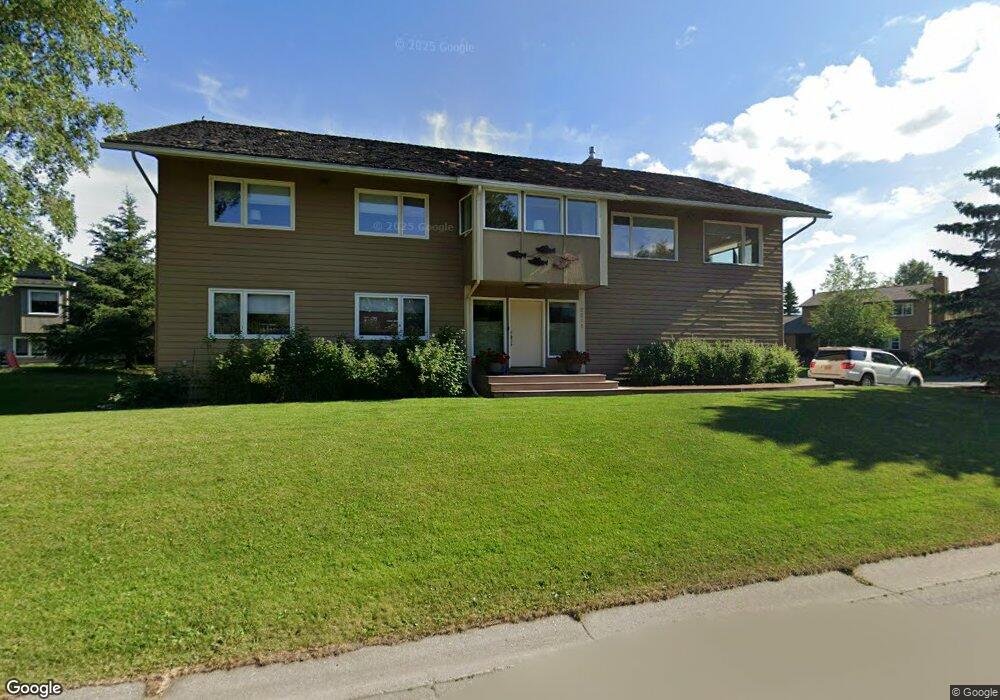
2211 Shore Dr Anchorage, AK 99515
Bayshore-Klatt NeighborhoodEstimated Value: $475,000 - $817,000
4
Beds
3
Baths
3,720
Sq Ft
$170/Sq Ft
Est. Value
About This Home
This home is located at 2211 Shore Dr, Anchorage, AK 99515 and is currently estimated at $632,240, approximately $169 per square foot. 2211 Shore Dr is a home located in Anchorage Municipality with nearby schools including Klatt Elementary School, Goldenview Middle School, and South Anchorage High School.
Ownership History
Date
Name
Owned For
Owner Type
Purchase Details
Closed on
Apr 7, 2009
Sold by
Chenoweth Lane D and Chenoweth Jane H
Bought by
Chenoweth Lane D and Chenoweth Jane H
Current Estimated Value
Purchase Details
Closed on
Aug 3, 1993
Sold by
Rose Alan L and Rose Billie S
Bought by
Chenoweth Lane D and Chenoweth Jane H
Home Financials for this Owner
Home Financials are based on the most recent Mortgage that was taken out on this home.
Original Mortgage
$206,100
Interest Rate
7.34%
Mortgage Type
New Conventional
Purchase Details
Closed on
Jun 7, 1989
Sold by
Alaska Housing Finance Corp
Bought by
Rose Alan L
Home Financials for this Owner
Home Financials are based on the most recent Mortgage that was taken out on this home.
Original Mortgage
$146,400
Interest Rate
11.11%
Mortgage Type
New Conventional
Create a Home Valuation Report for This Property
The Home Valuation Report is an in-depth analysis detailing your home's value as well as a comparison with similar homes in the area
Home Values in the Area
Average Home Value in this Area
Purchase History
| Date | Buyer | Sale Price | Title Company |
|---|---|---|---|
| Chenoweth Lane D | -- | None Available | |
| Chenoweth Lane D | -- | -- | |
| Rose Alan L | -- | -- |
Source: Public Records
Mortgage History
| Date | Status | Borrower | Loan Amount |
|---|---|---|---|
| Previous Owner | Chenoweth Lane D | $206,100 | |
| Previous Owner | Rose Alan L | $146,400 |
Source: Public Records
Tax History Compared to Growth
Tax History
| Year | Tax Paid | Tax Assessment Tax Assessment Total Assessment is a certain percentage of the fair market value that is determined by local assessors to be the total taxable value of land and additions on the property. | Land | Improvement |
|---|---|---|---|---|
| 2025 | $6,502 | $676,300 | $148,700 | $527,600 |
| 2024 | $6,502 | $627,700 | $131,500 | $496,200 |
| 2023 | $9,399 | $551,900 | $125,200 | $426,700 |
| 2022 | $5,828 | $546,100 | $125,200 | $420,900 |
| 2021 | $9,284 | $515,200 | $125,200 | $390,000 |
| 2020 | $5,080 | $500,000 | $125,200 | $374,800 |
| 2019 | $5,117 | $512,800 | $125,200 | $387,600 |
| 2018 | $4,895 | $498,500 | $125,200 | $373,300 |
| 2017 | $7,457 | $496,200 | $125,200 | $371,000 |
| 2016 | $6,930 | $518,500 | $125,200 | $393,300 |
| 2015 | $6,930 | $506,200 | $125,200 | $381,000 |
| 2014 | $6,930 | $491,600 | $125,200 | $366,400 |
Source: Public Records
Map
Nearby Homes
- 2534 Ridge Pointe Dr
- 2541 Brookstone Loop
- 11351 Discovery View Dr Unit 107A
- L8 B8 Spartan Dr
- 11038 Northfleet Dr
- 2935 Seclusion Cove Dr Unit 54
- 2356 Leander Cir
- 11050 Retreat Cir
- 900 Botanical Heights Cir
- 2101 Revere Cir
- 12130 Timberlane Dr
- 2350 Ariel Cir
- 3008 Eaglek Bay Cir
- 2301 Harbor Landing Cir
- L5 B8 Spartan Dr
- L6 B8 Spartan Dr
- 321 Ellen Cir
- 3211 Amber Bay Loop
- 250 Botanical Cir
- 200 W 123rd Ave
- 12010 Shore Cir
- 12000 Shore Cir
- 12021 Shore Cir
- 2141 Shore Dr
- 12011 Shore Cir
- 2220 Shore Dr
- 12001 Victor Rd
- 2210 Shore Dr
- 12001 Shore Cir
- 2200 Shore Dr
- 2222 Hanning Bay Cir
- 2230 Hanning Bay Cir
- 2214 Hanning Bay Cir
- 12020 Forelands Cir
- 12010 Forelands Cir
- 2238 Hanning Bay Cir
- 2206 Hanning Bay Cir
- 12020 Victor Rd
- 2140 Shore Dr
- 12030 Forelands Cir