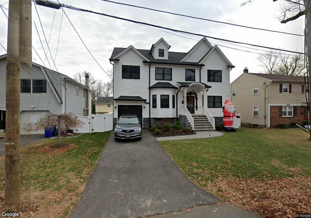
2212 Algonquin Dr Scotch Plains, NJ 07076
Estimated Value: $816,742 - $1,268,000
--
Bed
--
Bath
2,679
Sq Ft
$385/Sq Ft
Est. Value
About This Home
This home is located at 2212 Algonquin Dr, Scotch Plains, NJ 07076 and is currently estimated at $1,030,686, approximately $384 per square foot. 2212 Algonquin Dr is a home located in Union County with nearby schools including William J. McGinn Elementary School, Terrill Middle School, and Scotch Plains-Fanwood High School.
Ownership History
Date
Name
Owned For
Owner Type
Purchase Details
Closed on
Aug 23, 2021
Sold by
2212 Algonquin Drive Llc
Bought by
Cicero John and Cicero Lori
Current Estimated Value
Home Financials for this Owner
Home Financials are based on the most recent Mortgage that was taken out on this home.
Original Mortgage
$415,000
Outstanding Balance
$376,795
Interest Rate
2.8%
Mortgage Type
New Conventional
Estimated Equity
$653,891
Purchase Details
Closed on
Aug 6, 2019
Sold by
Mohn Jeanne
Bought by
2212 Algonquin Drive Llc
Create a Home Valuation Report for This Property
The Home Valuation Report is an in-depth analysis detailing your home's value as well as a comparison with similar homes in the area
Home Values in the Area
Average Home Value in this Area
Purchase History
| Date | Buyer | Sale Price | Title Company |
|---|---|---|---|
| Cicero John | $875,000 | Fortune Title Agency Inc | |
| 2212 Algonquin Drive Llc | $305,000 | Chicago Title Insurance Co |
Source: Public Records
Mortgage History
| Date | Status | Borrower | Loan Amount |
|---|---|---|---|
| Open | Cicero John | $415,000 |
Source: Public Records
Tax History Compared to Growth
Tax History
| Year | Tax Paid | Tax Assessment Tax Assessment Total Assessment is a certain percentage of the fair market value that is determined by local assessors to be the total taxable value of land and additions on the property. | Land | Improvement |
|---|---|---|---|---|
| 2025 | $20,394 | $175,800 | $24,400 | $151,400 |
| 2024 | $19,793 | $173,300 | $24,400 | $148,900 |
| 2023 | $19,793 | $173,300 | $24,400 | $148,900 |
| 2022 | $19,557 | $173,300 | $24,400 | $148,900 |
| 2021 | $4,450 | $39,500 | $24,400 | $15,100 |
| 2020 | $10,124 | $90,300 | $24,400 | $65,900 |
| 2019 | $10,049 | $90,300 | $24,400 | $65,900 |
| 2018 | $9,881 | $90,300 | $24,400 | $65,900 |
| 2017 | $9,661 | $90,300 | $24,400 | $65,900 |
| 2016 | $9,475 | $90,300 | $24,400 | $65,900 |
| 2015 | $9,070 | $90,300 | $24,400 | $65,900 |
| 2014 | $8,763 | $90,300 | $24,400 | $65,900 |
Source: Public Records
Map
Nearby Homes
- 2212 Shady Ln
- 2116 Newark Ave
- 2219 North Ave Unit 6
- 2314 Longfellow Ave
- 345 La Grande Ave
- 2286 Stocker Ln
- 21 Old South Ave
- 2154 W Broad St
- 1933 Mary Ellen Ln
- 119 Lamberts Mill Rd
- 350 W Dudley Ave
- 120 S Martine Ave
- 869 Ternay Ave
- 1933 W Broad St
- 40 1st St
- 9 Timberline Dr
- 4 Lois Place
- 2406 Park Place
- 187 King St
- 5 Robin Rd
- 2216 Algonquin Dr
- 2208 Algonquin Dr
- 2220 Algonquin Dr
- 2222 Algonquin Dr Unit 1
- 2213 New York Ave
- 2207 New York Ave
- 2224 Algonquin Dr
- 1081 Hetfield Ave
- 1081 Hetfield Ave Unit 2
- 1081 Hetfield Ave Unit 1
- 1089 Hetfield Ave
- 2219 New York Ave
- 2213 Algonquin Dr
- 2219 Algonquin Dr
- 1093 Hetfield Ave
- 1073 Hetfield Ave
- 2225 New York Ave
- 2228 Algonquin Dr
- 2223 Algonquin Dr
- 1071 Hetfield Ave