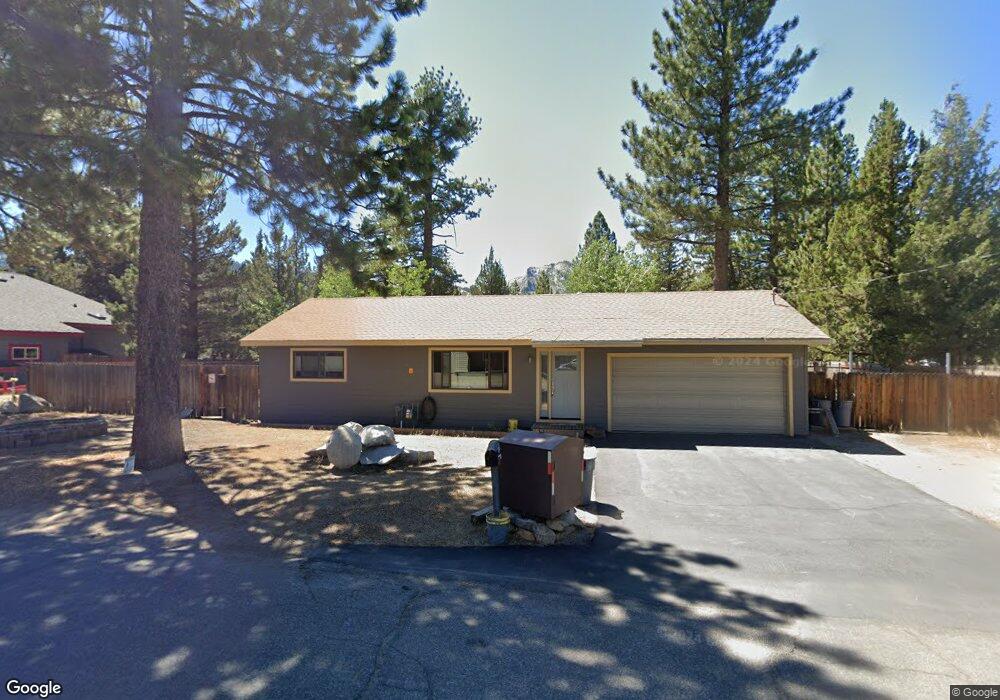
2212 Cornelian Dr South Lake Tahoe, CA 96150
Estimated Value: $634,209 - $671,000
3
Beds
2
Baths
1,598
Sq Ft
$408/Sq Ft
Est. Value
About This Home
This home is located at 2212 Cornelian Dr, South Lake Tahoe, CA 96150 and is currently estimated at $652,552, approximately $408 per square foot. 2212 Cornelian Dr is a home located in El Dorado County with nearby schools including Sierra House Elementary School, South Tahoe Middle School, and South Tahoe High School.
Ownership History
Date
Name
Owned For
Owner Type
Purchase Details
Closed on
Oct 23, 2012
Sold by
Robinson Rick R and Robinson Linda J
Bought by
Robinson Rick R and Robinson Family Revocable Livi
Current Estimated Value
Purchase Details
Closed on
Dec 31, 1993
Sold by
Va
Bought by
Robinson Richard R and Robinson Linda J
Home Financials for this Owner
Home Financials are based on the most recent Mortgage that was taken out on this home.
Original Mortgage
$75,750
Interest Rate
7.29%
Create a Home Valuation Report for This Property
The Home Valuation Report is an in-depth analysis detailing your home's value as well as a comparison with similar homes in the area
Home Values in the Area
Average Home Value in this Area
Purchase History
| Date | Buyer | Sale Price | Title Company |
|---|---|---|---|
| Robinson Rick R | -- | None Available | |
| Robinson Richard R | -- | Founders Title Co |
Source: Public Records
Mortgage History
| Date | Status | Borrower | Loan Amount |
|---|---|---|---|
| Closed | Robinson Richard R | $75,750 |
Source: Public Records
Tax History Compared to Growth
Tax History
| Year | Tax Paid | Tax Assessment Tax Assessment Total Assessment is a certain percentage of the fair market value that is determined by local assessors to be the total taxable value of land and additions on the property. | Land | Improvement |
|---|---|---|---|---|
| 2025 | $2,111 | $198,770 | $21,099 | $177,671 |
| 2024 | $2,111 | $194,874 | $20,686 | $174,188 |
| 2023 | $2,074 | $191,054 | $20,281 | $170,773 |
| 2022 | $2,052 | $187,309 | $19,884 | $167,425 |
| 2021 | $2,017 | $183,638 | $19,495 | $164,143 |
| 2020 | $1,991 | $181,756 | $19,296 | $162,460 |
| 2019 | $2,056 | $178,193 | $18,918 | $159,275 |
| 2018 | $2,011 | $174,700 | $18,548 | $156,152 |
| 2017 | $1,981 | $171,276 | $18,185 | $153,091 |
| 2016 | $1,942 | $167,919 | $17,829 | $150,090 |
| 2015 | $1,922 | $165,399 | $17,562 | $147,837 |
| 2014 | $1,846 | $162,161 | $17,219 | $144,942 |
Source: Public Records
Map
Nearby Homes
- 2189 Cornelian Dr
- 2182 Lindenwood Dr
- 2255 Blitzen Rd
- 2263 Blitzen Rd
- 2181 Pinewood Dr
- 1085 Mulberry Dr
- 972 Shakori Dr
- 968 Shakori Dr
- 1502 Seminole Dr
- 1344 Ottawa Dr
- 2001 Washoe St
- 902 Kekin St
- 2510 Blitzen Rd
- 1935 Apache Ave
- 938 Kekin St
- 2610 Henderson St
- 1940 Apache Ave
- 1982 Cherokee St
- 859 Kekin St
- 980 Kekin St
- 2222 Cornelian Dr
- 2204 Cornelian Dr
- 2217 Cornelian Dr
- 0 Cornelian Dr Unit 113295
- 0 Cornelian Dr Unit 11 120021
- 0 Cornelian Dr
- 2205 Cornelian Dr
- 1037 Elmwood Dr
- 2196 Cornelian Dr
- 2197 Cornelian Dr
- 1045 Elmwood Dr
- 2206 Lindenwood Dr
- 2220 Lindenwood Dr
- 2174 Cornelian Dr
- 1036 Elmwood Dr
- 2200 Lindenwood Dr
- 2190 Cornelian Dr
- 2221 Lindenwood Dr
- 2207 Lindenwood Dr
- 2190 Lindenwood Dr