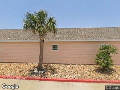
2212 State Highway 361 Unit 118 Port Aransas, TX 78373
Padre Island NeighborhoodEstimated Value: $417,000 - $513,000
2
Beds
2
Baths
1,232
Sq Ft
$377/Sq Ft
Est. Value
About This Home
This home is located at 2212 State Highway 361 Unit 118, Port Aransas, TX 78373 and is currently estimated at $464,129, approximately $376 per square foot. 2212 State Highway 361 Unit 118 is a home located in Nueces County with nearby schools including Olsen Elementary School, Brundrett Middle School, and Port Aransas High School.
Ownership History
Date
Name
Owned For
Owner Type
Purchase Details
Closed on
Feb 9, 2012
Sold by
Pirates Bay Llc
Bought by
Kay Richard and Kay Valerie
Current Estimated Value
Home Financials for this Owner
Home Financials are based on the most recent Mortgage that was taken out on this home.
Original Mortgage
$135,200
Outstanding Balance
$21,118
Interest Rate
3.95%
Mortgage Type
Purchase Money Mortgage
Estimated Equity
$437,518
Purchase Details
Closed on
Oct 11, 2011
Sold by
Pirates Bay Llc
Bought by
Adamek Charles J and Adamek Erinn
Home Financials for this Owner
Home Financials are based on the most recent Mortgage that was taken out on this home.
Original Mortgage
$143,920
Interest Rate
4.28%
Mortgage Type
Purchase Money Mortgage
Create a Home Valuation Report for This Property
The Home Valuation Report is an in-depth analysis detailing your home's value as well as a comparison with similar homes in the area
Home Values in the Area
Average Home Value in this Area
Purchase History
| Date | Buyer | Sale Price | Title Company |
|---|---|---|---|
| Kay Richard | -- | Bay Area Title Services Llc | |
| Adamek Charles J | -- | None Available |
Source: Public Records
Mortgage History
| Date | Status | Borrower | Loan Amount |
|---|---|---|---|
| Open | Kay Richard | $135,200 | |
| Previous Owner | Adamek Charles J | $143,920 |
Source: Public Records
Tax History Compared to Growth
Tax History
| Year | Tax Paid | Tax Assessment Tax Assessment Total Assessment is a certain percentage of the fair market value that is determined by local assessors to be the total taxable value of land and additions on the property. | Land | Improvement |
|---|---|---|---|---|
| 2024 | $6,415 | $498,967 | $126,440 | $372,527 |
| 2023 | $5,856 | $463,369 | $126,440 | $336,929 |
| 2022 | $5,457 | $353,086 | $22,127 | $330,959 |
| 2021 | $4,867 | $287,067 | $22,127 | $264,940 |
| 2020 | $4,215 | $239,255 | $22,127 | $217,128 |
| 2019 | $2,696 | $144,975 | $22,127 | $122,848 |
| 2018 | $3,810 | $208,378 | $22,127 | $186,251 |
| 2017 | $4,986 | $273,216 | $22,127 | $251,089 |
| 2016 | $4,251 | $232,910 | $22,127 | $210,783 |
| 2015 | $4,192 | $241,424 | $31,610 | $209,814 |
| 2014 | $4,192 | $220,946 | $31,610 | $189,336 |
Source: Public Records
Map
Nearby Homes
- 2212 State Highway 361 Unit 119
- 2212 State Highway 361 Unit 219
- 2212 State Highway 361 Unit 213
- 2212 State Highway 361 Unit 220
- 2212 State Highway 361 Unit 204
- 2212 Texas 361 Unit 201
- 172 Paradise Pointe Dr
- 000 State Highway 361
- 214 Sunset Ave Unit 7
- 214 Sunset Ave Unit 5
- 1100 Port St
- 214 Sunset Ave Unit 6
- 1100 Port St Unit 1*
- 1100 Port St Unit 6*
- 214 Sunset Ave Unit 4
- 1100 Port St Unit 25
- 1100 Port St Unit 28
- 1100 Port St Unit 27
- 1100 Port St Unit 18
- 1100 Port St Unit 9
- 2212 Tx-361 Unit ID1060081P
- 2212 State Highway 361 Unit 110
- 2212 State Highway 361 Unit 116
- 2212 State Highway 361 Unit 104
- 2212 State Highway 361 Unit 102
- 2212 State Highway 361 Unit 118
- 2212 State Highway 361 Unit 123
- 2212 State Highway 361 Unit 114
- 2212 State Highway 361 Unit 121
- 2212 State Highway 361 Unit 203
- 2212 State Highway 361 Unit 221
- 2212 State Highway 361 Unit 224
- 2212 State Highway 361 Unit 308
- 2212 State Highway 361 Unit 113
- 2212 State Highway 361 Unit 109