Estimated Value: $232,000 - $248,000
--
Bed
1
Bath
1,426
Sq Ft
$167/Sq Ft
Est. Value
About This Home
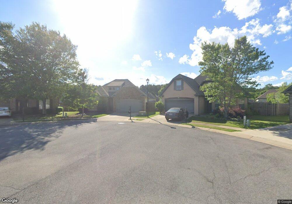
This home is located at 2213 Adkins Cir, Moody, AL 35004 and is currently estimated at $238,351, approximately $167 per square foot. 2213 Adkins Cir is a home located in St. Clair County with nearby schools including Moody Elementary School, Moody Middle School, and Moody High School.
Ownership History
Date
Name
Owned For
Owner Type
Purchase Details
Closed on
Sep 9, 2013
Sold by
Baldwin Bates Angela L
Bought by
Baldwin Crystal A
Current Estimated Value
Purchase Details
Closed on
Jul 21, 2005
Sold by
Hph Properties Llc
Bought by
Baldwin Crystal A and Baldwin Angela L
Home Financials for this Owner
Home Financials are based on the most recent Mortgage that was taken out on this home.
Original Mortgage
$27,680
Interest Rate
5.51%
Mortgage Type
Credit Line Revolving
Create a Home Valuation Report for This Property
The Home Valuation Report is an in-depth analysis detailing your home's value as well as a comparison with similar homes in the area
Home Values in the Area
Average Home Value in this Area
Purchase History
| Date | Buyer | Sale Price | Title Company |
|---|---|---|---|
| Baldwin Crystal A | $71,385 | None Available | |
| Baldwin Crystal A | $138,400 | None Available |
Source: Public Records
Mortgage History
| Date | Status | Borrower | Loan Amount |
|---|---|---|---|
| Previous Owner | Baldwin Crystal A | $27,680 | |
| Previous Owner | Baldwin Crystal A | $110,720 |
Source: Public Records
Tax History Compared to Growth
Tax History
| Year | Tax Paid | Tax Assessment Tax Assessment Total Assessment is a certain percentage of the fair market value that is determined by local assessors to be the total taxable value of land and additions on the property. | Land | Improvement |
|---|---|---|---|---|
| 2024 | $1,068 | $43,760 | $10,000 | $33,760 |
| 2023 | $1,068 | $43,760 | $10,000 | $33,760 |
| 2022 | $863 | $17,852 | $3,850 | $14,002 |
| 2021 | $545 | $17,852 | $3,850 | $14,002 |
| 2020 | $483 | $14,733 | $3,350 | $11,383 |
| 2019 | $484 | $14,776 | $3,000 | $11,776 |
| 2018 | $449 | $13,800 | $0 | $0 |
| 2017 | $452 | $13,500 | $0 | $0 |
| 2016 | $442 | $13,620 | $0 | $0 |
| 2015 | $452 | $13,620 | $0 | $0 |
| 2014 | $452 | $13,880 | $0 | $0 |
Source: Public Records
Map
Nearby Homes
- 1071 Washington Dr
- 4031 Wescott Cir
- 1229 Glenstone Place
- 4007 Verbena Dr
- 4013 Verbena Dr
- 3111 Carl Morgan Rd
- 3049 Iris Ct
- 3209 Fortner Ln
- 3234 Daniel Dr
- The Langford Arbor Ridge
- THE TELFAIR Arbor Ridge
- 6034 Arbor Ridge
- 6078 Arbor Ridge
- 4047 Verbena Dr
- THE LANCASTER Arbor Ridge
- The Bradley Arbor Ridge
- THE AVERY Arbor Ridge
- The Avondale Arbor Ridge
- The Kingswood Arbor Ridge
- 6028 Arbor Ridge
- 2209 Adkins Cir
- 1108 Avalon Dr
- 1112 Avalon Dr
- 1100 Avalon Dr
- 2205 Adkins Cir
- 1116 Avalon Dr
- 1096 Avalon Dr
- 2204 Adkins Cir
- 1120 Avalon Dr
- 2208 Adkins Cir
- 1092 Avalon Dr
- 1124 Avalon Dr
- 2201 Adkins Cir
- 1088 Avalon Dr
- 2033 Spaulding Place
- 2029 Spaulding Place
- 2107 Spaulding Place
- 1084 Avalon Dr
- 2025 Spaulding Place
- 1132 Avalon Dr