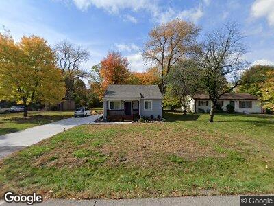
22133 Keefer St Southfield, MI 48033
Estimated Value: $196,487 - $235,000
--
Bed
1
Bath
1,652
Sq Ft
$129/Sq Ft
Est. Value
About This Home
This home is located at 22133 Keefer St, Southfield, MI 48033 and is currently estimated at $212,372, approximately $128 per square foot. 22133 Keefer St is a home located in Oakland County with nearby schools including Glenn W. Levey Middle School, Bradford Academy, and Weston Academy.
Ownership History
Date
Name
Owned For
Owner Type
Purchase Details
Closed on
Mar 18, 2020
Sold by
Southfield Neighborhood Revitalization I
Bought by
Jones Tiffany L
Current Estimated Value
Home Financials for this Owner
Home Financials are based on the most recent Mortgage that was taken out on this home.
Original Mortgage
$133,500
Outstanding Balance
$121,044
Interest Rate
3.4%
Mortgage Type
New Conventional
Purchase Details
Closed on
Oct 23, 2018
Sold by
City Of Southfielid
Bought by
Southfield Neighborhood Revitalization
Purchase Details
Closed on
Jun 29, 2018
Sold by
Meisner Andrew E
Bought by
City Of Southfield
Create a Home Valuation Report for This Property
The Home Valuation Report is an in-depth analysis detailing your home's value as well as a comparison with similar homes in the area
Home Values in the Area
Average Home Value in this Area
Purchase History
| Date | Buyer | Sale Price | Title Company |
|---|---|---|---|
| Jones Tiffany L | $142,000 | Ms Title Agency Llc | |
| Southfield Neighborhood Revitalization | -- | None Available | |
| City Of Southfield | $7,016 | None Available |
Source: Public Records
Mortgage History
| Date | Status | Borrower | Loan Amount |
|---|---|---|---|
| Open | Jones Tiffany L | $133,500 |
Source: Public Records
Tax History Compared to Growth
Tax History
| Year | Tax Paid | Tax Assessment Tax Assessment Total Assessment is a certain percentage of the fair market value that is determined by local assessors to be the total taxable value of land and additions on the property. | Land | Improvement |
|---|---|---|---|---|
| 2022 | $3,898 | $71,100 | $16,530 | $54,570 |
| 2021 | $4,027 | $65,320 | $16,390 | $48,930 |
| 2020 | $160 | $0 | $0 | $0 |
| 2018 | $762 | $36,550 | $16,390 | $20,160 |
| 2015 | -- | $25,070 | $0 | $0 |
| 2014 | -- | $22,280 | $0 | $0 |
| 2011 | -- | $24,720 | $0 | $0 |
Source: Public Records
Map
Nearby Homes
- 22285 Prosper Dr
- 24645 Sargent Ave
- 24264 W 9 Mile Rd
- VL Leewright Ave
- 23888 W Nine Mile Rd
- 23874 W Nine Mile Rd
- 23701 Sargent Ave
- 22555 Nancy Ave
- 23217 Helen St
- 23325 W 9 Mile Rd
- 23610 Edinburgh St
- 22104 Berg Rd
- 23735 Edinburgh St
- 0 Mcallister St
- 000 Mcallister St
- 0000 Mcallister
- 20933 Sherman Ave Unit 16
- 20949 Sherman Ave Unit 20
- 24050 Sunnypoint Dr
- 23705 Rockingham St
- 22133 Keefer St
- 22237 Keefer St
- 22121 Keefer St
- 22289 Keefer St
- 22236 Keefer St
- 22291 Keefer St
- 22290 Keefer St
- 22396 Prosper Dr
- 24123 Sargent Ave
- 22380 Prosper Dr
- 0000 Sargent Dr
- 22400 Prosper Dr
- 22428 Prosper Dr
- 22330 Prosper Dr
- 24067 Sargent Ave
- 24391 Sargent Ave
- 24400 Hazelhurst St
- 24090 Sargent Ave Unit 1
- 24258 Sargent Dr
- 22320 Prosper Dr