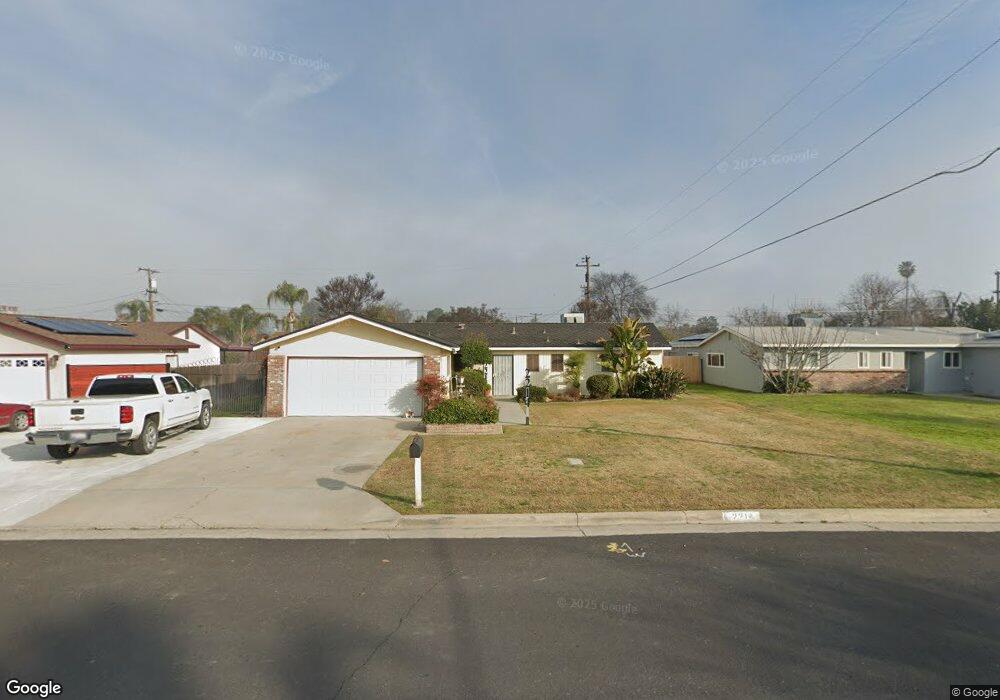
2214 Philip Ave Corcoran, CA 93212
Estimated Value: $248,000 - $313,000
3
Beds
2
Baths
1,600
Sq Ft
$180/Sq Ft
Est. Value
About This Home
This home is located at 2214 Philip Ave, Corcoran, CA 93212 and is currently estimated at $288,114, approximately $180 per square foot. 2214 Philip Ave is a home located in Kings County with nearby schools including John C. Fremont Elementary School, Bret Harte Elementary School, and Mark Twain Elementary School.
Ownership History
Date
Name
Owned For
Owner Type
Purchase Details
Closed on
May 5, 2023
Sold by
Syra Jill
Bought by
Jill A Syra Revocable Trust
Current Estimated Value
Purchase Details
Closed on
May 4, 2020
Sold by
Burruss D Ronald D and Burruss Jan
Bought by
Syra Jill
Purchase Details
Closed on
Mar 20, 2020
Sold by
Burruss D Ronald D and Burruss Jan
Bought by
Burruss D Ronald D and Burruss Jan
Create a Home Valuation Report for This Property
The Home Valuation Report is an in-depth analysis detailing your home's value as well as a comparison with similar homes in the area
Purchase History
| Date | Buyer | Sale Price | Title Company |
|---|---|---|---|
| Jill A Syra Revocable Trust | -- | None Listed On Document | |
| Syra Jill | $135,000 | Stewart Title Of Ca Inc | |
| Burruss D Ronald D | -- | None Available |
Source: Public Records
Tax History
| Year | Tax Paid | Tax Assessment Tax Assessment Total Assessment is a certain percentage of the fair market value that is determined by local assessors to be the total taxable value of land and additions on the property. | Land | Improvement |
|---|---|---|---|---|
| 2025 | $1,837 | $184,057 | $49,212 | $134,845 |
| 2023 | $1,837 | $176,911 | $47,302 | $129,609 |
| 2022 | $1,774 | $173,443 | $46,375 | $127,068 |
| 2021 | $1,739 | $170,043 | $45,466 | $124,577 |
| 2020 | $658 | $68,273 | $8,965 | $59,308 |
| 2019 | $918 | $66,934 | $8,789 | $58,145 |
| 2018 | $909 | $65,622 | $8,617 | $57,005 |
| 2017 | $893 | $64,335 | $8,448 | $55,887 |
| 2016 | $606 | $63,073 | $8,282 | $54,791 |
| 2015 | $604 | $62,126 | $8,158 | $53,968 |
| 2014 | $592 | $60,909 | $7,998 | $52,911 |
Source: Public Records
Map
Nearby Homes
- 2217 Gable Ave
- 2220 North Ave
- 2312 North Ave
- 2009 Charles St
- 310 Wawona Ave
- 1766 North Ave
- 510 Claire Ave
- 508 Claire Ave
- 2211 Bell Ave
- 446 6 1 2 Ave
- 2023 Garvey Ave
- 2323 Patterson Ave
- 2615 Gable Ave
- 2632 North Ave
- 726 Josephine Ave
- 2414 Strepy Ave
- 1901 Patterson Ave
- 900 Keegan Ave
- 0 Patterson Ave
- 915 Dairy Ave
- 2210 Philip Ave
- 2218 Philip Ave
- 2213 Gable Ave
- 2206 Philip Ave
- 427 Denton Ave
- 2209 Gable Ave
- 2205 Gable Ave
- 2221 Gable Ave
- 2213 Philip Ave
- 2217 Philip Ave
- 2202 Philip Ave
- 2211 Philip Ave
- 2201 Gable Ave
- 501 Denton Ave
- 420 Denton Ave
- 2201 Philip Ave
- 430 Denton Ave
- 418 Denton Ave
- 2113 Gable Ave
- 2106 Charles St
Your Personal Tour Guide
Ask me questions while you tour the home.