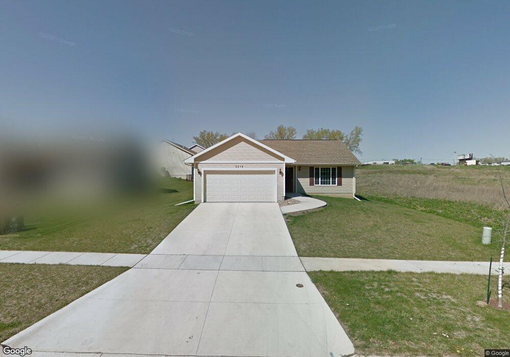
2214 Shady Grove Rd SW Cedar Rapids, IA 52404
Estimated Value: $295,739 - $318,000
3
Beds
2
Baths
1,293
Sq Ft
$234/Sq Ft
Est. Value
About This Home
This home is located at 2214 Shady Grove Rd SW, Cedar Rapids, IA 52404 and is currently estimated at $302,435, approximately $233 per square foot. 2214 Shady Grove Rd SW is a home located in Linn County with nearby schools including Junction City Elementary School, Perryville Elementary School, and Van Buren Elementary School.
Ownership History
Date
Name
Owned For
Owner Type
Purchase Details
Closed on
Oct 6, 2025
Sold by
Harms Anthony J
Bought by
Wenskunas Kaitlyn M and Wenskunas Keegan M
Current Estimated Value
Home Financials for this Owner
Home Financials are based on the most recent Mortgage that was taken out on this home.
Original Mortgage
$105,000
Outstanding Balance
$105,000
Interest Rate
5.69%
Mortgage Type
New Conventional
Estimated Equity
$197,435
Purchase Details
Closed on
Apr 9, 2011
Sold by
Jerrys Homes Inc
Bought by
Harms Anthony J
Home Financials for this Owner
Home Financials are based on the most recent Mortgage that was taken out on this home.
Original Mortgage
$135,000
Interest Rate
4.86%
Mortgage Type
New Conventional
Create a Home Valuation Report for This Property
The Home Valuation Report is an in-depth analysis detailing your home's value as well as a comparison with similar homes in the area
Home Values in the Area
Average Home Value in this Area
Purchase History
| Date | Buyer | Sale Price | Title Company |
|---|---|---|---|
| Wenskunas Kaitlyn M | $305,000 | None Listed On Document | |
| Harms Anthony J | $179,500 | None Available |
Source: Public Records
Mortgage History
| Date | Status | Borrower | Loan Amount |
|---|---|---|---|
| Open | Wenskunas Kaitlyn M | $105,000 | |
| Previous Owner | Harms Anthony J | $135,000 |
Source: Public Records
Tax History Compared to Growth
Tax History
| Year | Tax Paid | Tax Assessment Tax Assessment Total Assessment is a certain percentage of the fair market value that is determined by local assessors to be the total taxable value of land and additions on the property. | Land | Improvement |
|---|---|---|---|---|
| 2025 | $3,922 | $272,000 | $52,600 | $219,400 |
| 2024 | $4,134 | $263,000 | $56,000 | $207,000 |
| 2023 | $4,134 | $232,100 | $50,900 | $181,200 |
| 2022 | $3,888 | $204,900 | $47,500 | $157,400 |
| 2021 | $4,080 | $196,600 | $45,800 | $150,800 |
| 2020 | $4,080 | $193,500 | $34,000 | $159,500 |
| 2019 | $3,662 | $178,400 | $34,000 | $144,400 |
| 2018 | $3,556 | $178,400 | $34,000 | $144,400 |
| 2017 | $3,673 | $172,800 | $34,000 | $138,800 |
| 2016 | $3,673 | $172,800 | $34,000 | $138,800 |
| 2015 | $3,557 | $167,150 | $33,950 | $133,200 |
| 2014 | $3,372 | $167,150 | $33,950 | $133,200 |
| 2013 | $3,294 | $167,150 | $33,950 | $133,200 |
Source: Public Records
Map
Nearby Homes
- 2207 Shady Grove Rd SW
- 2103 Shady Grove Rd SW
- 1913 Holly Meadow Ave SW
- 1824 Holly Meadow Ave SW
- 2020 25th St SW
- 1818 Holly Meadow Ave SW
- 1812 Holly Meadow Ave SW
- 1806 Holly Meadow Ave SW
- 1801 Shady Grove Rd SW
- 1253 20th St SW
- 1960 Rockford Rd SW Unit 45
- 2025 18th St SW
- 1206 18th St SW
- 2150 Rockford Rd SW
- 2126 Snapdragon Cir SW
- 1807 9th Ave SW
- 2433 8th Ave SW
- 3150 Wilson Ave SW Unit H10
- 3150 Wilson Ave SW Unit 7
- 1209 16th St SW
- 2208 Shady Grove Rd SW
- 2220 Shady Grove Rd SW
- 1721 23rd St SW
- 2202 Shady Grove Rd SW
- 1715 23rd St SW
- 2213 Shady Grove Rd SW
- 2203 Holly Meadow Ave SW
- 2219 Shady Grove Rd SW
- 2124 Shady Grove Rd SW
- 2209 Holly Meadow Ave SW
- 2125 Holly Meadow Ave SW
- 2201 Shady Grove Rd SW
- 1728 23rd St SW
- 2225 Shady Grove Rd SW
- 1722 23rd St SW
- 1709 23rd St SW
- 1716 23rd St SW
- 2118 Shady Grove Rd SW
- 2119 Holly Dr SW
- 2309 Shady Grove Rd SW