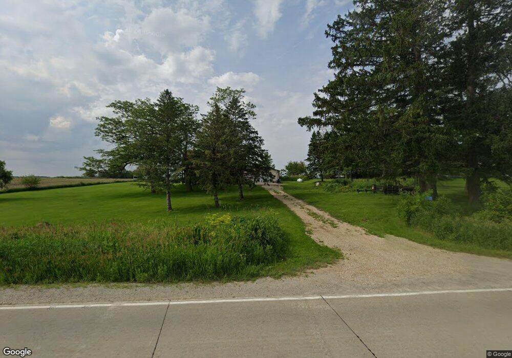
2215 76th Avenue Dr SW Cedar Rapids, IA 52404
Estimated Value: $322,000 - $369,138
4
Beds
2
Baths
2,062
Sq Ft
$167/Sq Ft
Est. Value
About This Home
This home is located at 2215 76th Avenue Dr SW, Cedar Rapids, IA 52404 and is currently estimated at $344,785, approximately $167 per square foot. 2215 76th Avenue Dr SW is a home located in Linn County with nearby schools including Prairie Heights Elementary School, Prairie Crest Elementary School, and Prairie View Elementary School.
Ownership History
Date
Name
Owned For
Owner Type
Purchase Details
Closed on
Nov 19, 2003
Sold by
Novotny Carol A
Bought by
Grant Robert
Current Estimated Value
Home Financials for this Owner
Home Financials are based on the most recent Mortgage that was taken out on this home.
Original Mortgage
$118,900
Outstanding Balance
$54,163
Interest Rate
5.75%
Mortgage Type
Purchase Money Mortgage
Estimated Equity
$290,622
Create a Home Valuation Report for This Property
The Home Valuation Report is an in-depth analysis detailing your home's value as well as a comparison with similar homes in the area
Home Values in the Area
Average Home Value in this Area
Purchase History
| Date | Buyer | Sale Price | Title Company |
|---|---|---|---|
| Grant Robert | $139,500 | -- |
Source: Public Records
Mortgage History
| Date | Status | Borrower | Loan Amount |
|---|---|---|---|
| Open | Grant Robert | $118,900 | |
| Closed | Grant Robert | $21,000 |
Source: Public Records
Tax History Compared to Growth
Tax History
| Year | Tax Paid | Tax Assessment Tax Assessment Total Assessment is a certain percentage of the fair market value that is determined by local assessors to be the total taxable value of land and additions on the property. | Land | Improvement |
|---|---|---|---|---|
| 2025 | $3,776 | $316,300 | $67,600 | $248,700 |
| 2024 | $3,370 | $293,500 | $67,600 | $225,900 |
| 2023 | $3,370 | $294,000 | $67,600 | $226,400 |
| 2022 | $3,326 | $222,600 | $67,600 | $155,000 |
| 2021 | $3,204 | $222,600 | $67,600 | $155,000 |
| 2020 | $3,204 | $200,900 | $50,900 | $150,000 |
| 2019 | $3,020 | $190,800 | $50,900 | $139,900 |
| 2018 | $2,934 | $190,800 | $50,900 | $139,900 |
| 2017 | $2,802 | $176,100 | $50,900 | $125,200 |
| 2016 | $2,668 | $176,100 | $50,900 | $125,200 |
| 2015 | $2,656 | $176,100 | $50,900 | $125,200 |
| 2014 | $2,656 | $176,100 | $50,900 | $125,200 |
| 2013 | $2,494 | $176,100 | $50,900 | $125,200 |
Source: Public Records
Map
Nearby Homes
- 6612 Artesa Bell Dr SW
- 1719 Prairie Rose Dr SW
- 7006 Colpepper Dr SW
- 6614 Scarlet Rose Cir SW
- 6812 Artesa Bell Dr SW
- 1301 Scarlet Sage Dr SW
- 1410 Scarlet Sage Dr SW
- 5943 Muirfield Dr SW Unit 2
- 5919 Muirfield Dr SW Unit 4
- 121 Woodstone Ln SW
- 137 Woodstone Ln SW
- 6620 Preston Terrace Ct SW
- 145 SW Audrey Way
- 145 SW Audrey Way Unit Lot 15
- 8927 SW Griswold Ln
- 8927 SW Griswold Ln Unit Lot 21
- 8515 Aldridge Dr SW
- 139 SW Audrey Way
- 139 SW Audrey Way Unit Lot 16
- 8920 SW Griswold Ln
- 2207 76th Avenue Dr SW
- 8008 C Street Rd SW
- 7207 C Street Rd SW
- 1025 Kirkwood Pkwy SW Unit H
- 1025 Kirkwood Pkwy SW Unit ENTIRE BUILDING
- 1025 Kirkwood Pkwy SW Unit G
- 1025 Kirkwood Pkwy SW Unit ALL
- 1025 Kirkwood Pkwy SW Unit F
- 1025 Kirkwood Pkwy SW Unit E
- 1025 Kirkwood Pkwy SW Unit D
- 1025 Kirkwood Pkwy SW Unit B
- 1025 Kirkwood Pkwy SW Unit D/E/F
- 1025 Kirkwood Pkwy SW Unit A
- 1025 Kirkwood Pkwy SW Unit C
- 1025 Kirkwood Pkwy SW
- 7016 C St SW
- 7014 C St SW
- 7012 C St SW
- 7006 C St SW
- 7004 C St SW
