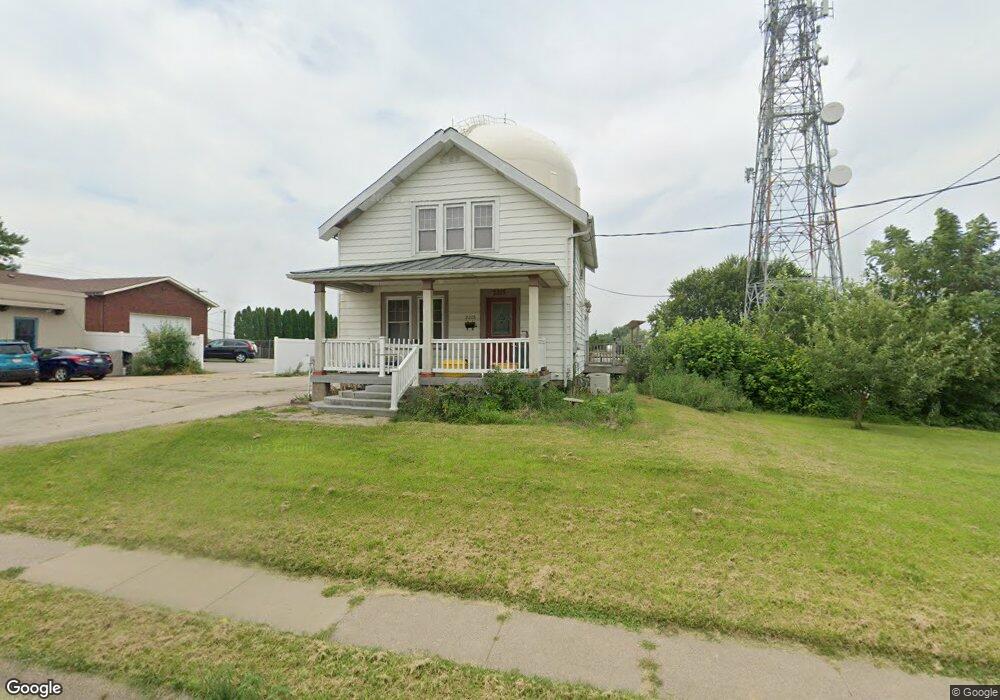
2215 Carter Rd Dubuque, IA 52001
Estimated Value: $137,000 - $220,000
2
Beds
1
Bath
1,074
Sq Ft
$165/Sq Ft
Est. Value
About This Home
This home is located at 2215 Carter Rd, Dubuque, IA 52001 and is currently estimated at $177,247, approximately $165 per square foot. 2215 Carter Rd is a home located in Dubuque County with nearby schools including Eisenhower Elementary School, Eleanor Roosevelt Middle School, and Dubuque Senior High School.
Ownership History
Date
Name
Owned For
Owner Type
Purchase Details
Closed on
Sep 3, 2013
Sold by
Kincad William and Kincad Janice M
Bought by
Neuhaus Ryan
Current Estimated Value
Home Financials for this Owner
Home Financials are based on the most recent Mortgage that was taken out on this home.
Original Mortgage
$75,000
Interest Rate
4.39%
Mortgage Type
New Conventional
Create a Home Valuation Report for This Property
The Home Valuation Report is an in-depth analysis detailing your home's value as well as a comparison with similar homes in the area
Home Values in the Area
Average Home Value in this Area
Purchase History
| Date | Buyer | Sale Price | Title Company |
|---|---|---|---|
| Neuhaus Ryan | -- | None Available |
Source: Public Records
Mortgage History
| Date | Status | Borrower | Loan Amount |
|---|---|---|---|
| Closed | Neuhaus Ryan | $75,000 |
Source: Public Records
Tax History Compared to Growth
Tax History
| Year | Tax Paid | Tax Assessment Tax Assessment Total Assessment is a certain percentage of the fair market value that is determined by local assessors to be the total taxable value of land and additions on the property. | Land | Improvement |
|---|---|---|---|---|
| 2025 | $1,866 | $135,500 | $42,000 | $93,500 |
| 2024 | $1,866 | $129,800 | $40,000 | $89,800 |
| 2023 | $1,812 | $129,800 | $40,000 | $89,800 |
| 2022 | $1,802 | $109,000 | $35,960 | $73,040 |
| 2021 | $1,802 | $109,000 | $35,960 | $73,040 |
| 2020 | $1,754 | $98,590 | $33,970 | $64,620 |
| 2019 | $1,704 | $98,590 | $33,970 | $64,620 |
| 2018 | $1,678 | $91,610 | $31,970 | $59,640 |
| 2017 | $1,632 | $91,610 | $31,970 | $59,640 |
| 2016 | $1,632 | $84,510 | $31,970 | $52,540 |
| 2015 | $1,598 | $84,510 | $31,970 | $52,540 |
| 2014 | $1,536 | $83,480 | $31,970 | $51,510 |
Source: Public Records
Map
Nearby Homes
- 2146 Avalon Rd
- 2290 Theda Dr
- 2035 Broadlawn Rd
- 3112 Kaufmann Ave
- 2281 Pasadena Dr
- 2095 Mullin Rd
- 2347 Coventry Park Unit C-011
- 2380 Trygg Dr
- 3080 Saint Anne Dr
- 2560 Crissy Dr
- 1762 Churchill Dr
- 1930 Scenic View Dr
- 2614 Crissy Dr
- 3462 Asbury Rd
- 1730 Chaney Rd
- 1821 Glendale Ct
- 1896 Floraview Dr
- 3519 Hillcrest Rd
- 2628 Dove St
- 1650 Drexel Ave
- 2221 Carter Rd
- 2233 Carter Rd
- 2210 Woodlawn St
- 2206 Woodlawn St
- 3040 Asbury Rd
- 3040 Asbury Rd Unit 3046 Asbury Road
- 2220 Woodlawn St
- 2222 Woodlawn St
- 2245 Carter Rd
- 2230 Woodlawn St
- 3046 Asbury Rd
- 3046 Asbury Rd Unit 3040 Asbury Road
- 2240 Woodlawn St
- 2246 Woodlawn St
- 3050 Asbury Rd
- 3033 Asbury Rd
- 2225 Woodlawn St
- 2190 Carter Rd
- 2195 Avalon Rd
- 2205 Woodlawn St