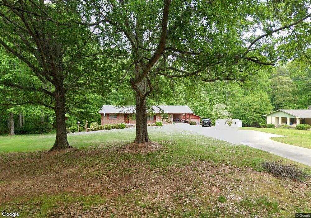
2215 Demorest Mount Airy Hwy Demorest, GA 30535
Estimated Value: $300,341 - $328,000
3
Beds
1
Bath
1,752
Sq Ft
$181/Sq Ft
Est. Value
About This Home
This home is located at 2215 Demorest Mount Airy Hwy, Demorest, GA 30535 and is currently estimated at $317,335, approximately $181 per square foot. 2215 Demorest Mount Airy Hwy is a home located in Habersham County with nearby schools including Demorest Elementary School, Wilbanks Middle School, and Habersham Success Academy.
Ownership History
Date
Name
Owned For
Owner Type
Purchase Details
Closed on
Aug 4, 2022
Sold by
Allen Randy Howard
Bought by
Gaddis Curtis S and Arrowood Kimberly N
Current Estimated Value
Home Financials for this Owner
Home Financials are based on the most recent Mortgage that was taken out on this home.
Original Mortgage
$235,653
Outstanding Balance
$224,915
Interest Rate
5.3%
Mortgage Type
FHA
Estimated Equity
$92,420
Purchase Details
Closed on
Mar 21, 2022
Sold by
Allen Marie Pitts
Bought by
Allen Randy
Create a Home Valuation Report for This Property
The Home Valuation Report is an in-depth analysis detailing your home's value as well as a comparison with similar homes in the area
Home Values in the Area
Average Home Value in this Area
Purchase History
| Date | Buyer | Sale Price | Title Company |
|---|---|---|---|
| Gaddis Curtis S | $240,000 | -- | |
| Allen Randy | -- | -- |
Source: Public Records
Mortgage History
| Date | Status | Borrower | Loan Amount |
|---|---|---|---|
| Open | Gaddis Curtis S | $235,653 |
Source: Public Records
Tax History Compared to Growth
Tax History
| Year | Tax Paid | Tax Assessment Tax Assessment Total Assessment is a certain percentage of the fair market value that is determined by local assessors to be the total taxable value of land and additions on the property. | Land | Improvement |
|---|---|---|---|---|
| 2025 | $2,860 | $118,412 | $23,240 | $95,172 |
| 2024 | $2,768 | $106,628 | $14,472 | $92,156 |
| 2023 | $2,272 | $90,880 | $14,472 | $76,408 |
| 2022 | $1,248 | $57,556 | $12,864 | $44,692 |
| 2021 | $1,086 | $51,436 | $11,256 | $40,180 |
| 2020 | $980 | $46,000 | $11,256 | $34,744 |
| 2019 | $981 | $46,000 | $11,256 | $34,744 |
| 2018 | $489 | $46,000 | $11,256 | $34,744 |
| 2017 | $0 | $40,300 | $8,040 | $32,260 |
| 2016 | $357 | $100,750 | $8,040 | $32,260 |
| 2015 | -- | $100,750 | $8,040 | $32,260 |
| 2014 | $345 | $99,620 | $8,040 | $31,808 |
| 2013 | -- | $39,848 | $8,040 | $31,808 |
Source: Public Records
Map
Nearby Homes
- 204 Linwood Dr
- 254 Oakdale Dr
- 161 Wayward Winds Dr
- 221 Mcallister Rd
- 421 Chase Cir
- 408 Sweetgrass Dr
- 4444 State Highway 365
- 417 Sweetgrass Dr
- 2894 Chase Rd
- 1344 Blue Grass Ct
- 101 Long St
- 676 Sweetgrass Dr
- 1576 Chase Rd
- 310 Wilson Rd
- 368 Sweetgrass Dr
- 323 Sweetgrass Dr
- 877 Sweetgrass Ct
- 394 Sweetgrass Dr
- 865 Sweetgrass Ct
- 2175 Demorest Mount Airy Hwy
- 2253 Demorest Mount Airy Hwy
- 2143 Demorest Mount Airy Hwy
- 2079 Demorest Mount Airy Hwy
- 611 W Russ Stephens Rd
- 2255 Demorest Mount Airy Hwy
- 2252 Demorest Mount Airy Hwy
- E Russ Stephens Rd
- 2041 Demorest Mount Airy Hwy
- 505 W Russ Stephens Rd
- 110 Brookdale Hill Ln
- 116 Brookdale Hill Ln
- 105 Brookdale Hill Ln
- 118 Brookdale Hill Ln
- 600 W Russ Stephens Rd
- 109 Brookdale Hill Ln
- 111 Brookdale Hill Ln
- 120 Brookdale Hill Ln
- 113 Brookdale Hill Ln
- 2346 Demorest Mount Airy Hwy