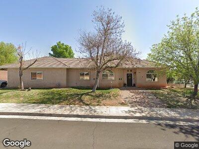
2215 E 50 St S St. George, UT 84790
Estimated Value: $515,000 - $534,000
4
Beds
3
Baths
2,290
Sq Ft
$228/Sq Ft
Est. Value
About This Home
This home is located at 2215 E 50 St S, St. George, UT 84790 and is currently estimated at $521,827, approximately $227 per square foot. 2215 E 50 St S is a home located in Washington County with nearby schools including Panorama School, Pine View Middle School, and Fossil Ridge Intermediate School.
Ownership History
Date
Name
Owned For
Owner Type
Purchase Details
Closed on
Sep 8, 2022
Sold by
Jarrod Cousins
Bought by
Cousins Brittany
Current Estimated Value
Purchase Details
Closed on
Apr 3, 2006
Sold by
Friedel Harold Martin and Friedel Lisa Nichole
Bought by
Garcia Antonio and Garcia Frances
Home Financials for this Owner
Home Financials are based on the most recent Mortgage that was taken out on this home.
Original Mortgage
$248,400
Interest Rate
6%
Mortgage Type
Adjustable Rate Mortgage/ARM
Create a Home Valuation Report for This Property
The Home Valuation Report is an in-depth analysis detailing your home's value as well as a comparison with similar homes in the area
Home Values in the Area
Average Home Value in this Area
Purchase History
| Date | Buyer | Sale Price | Title Company |
|---|---|---|---|
| Cousins Brittany | -- | -- | |
| Garcia Antonio | -- | Southern Utah Title Co |
Source: Public Records
Mortgage History
| Date | Status | Borrower | Loan Amount |
|---|---|---|---|
| Previous Owner | Garcia Antonio | $248,400 |
Source: Public Records
Tax History Compared to Growth
Tax History
| Year | Tax Paid | Tax Assessment Tax Assessment Total Assessment is a certain percentage of the fair market value that is determined by local assessors to be the total taxable value of land and additions on the property. | Land | Improvement |
|---|---|---|---|---|
| 2023 | $1,775 | $265,265 | $60,500 | $204,765 |
| 2022 | $2,401 | $276,760 | $60,500 | $216,260 |
| 2021 | $1,833 | $384,100 | $94,500 | $289,600 |
| 2020 | $1,658 | $327,300 | $73,500 | $253,800 |
| 2019 | $1,645 | $317,100 | $68,300 | $248,800 |
| 2018 | $1,581 | $157,190 | $0 | $0 |
| 2017 | $1,331 | $128,590 | $0 | $0 |
| 2016 | $1,338 | $119,625 | $0 | $0 |
| 2015 | $1,303 | $111,705 | $0 | $0 |
| 2014 | $1,270 | $109,560 | $0 | $0 |
Source: Public Records
Map
Nearby Homes
- 2379 E Crimson Cir
- 51 S 2110 E
- 2295 E 90 S
- 733 W Juniper Hill Dr
- 5664 S Carnelian Pkwy
- 5670 S Carnelian Pkwy
- 2408 E 80 Cir N
- 2365 E 160 S
- 3 2450 St E Unit 3
- 2482 E 10 Cir N
- 27 S 1970 E
- 114 N 2000 E
- 210 N Mall Dr Unit 56
- 210 N Mall Dr Unit 139
- 345 N 2450 E Unit 193
- 134 S 1970 E
- 1908 E 40 S
- 345 N 2450 E Unit 236
- 345 N 2450 E Unit 142
- 345 N 2450 E Unit 239