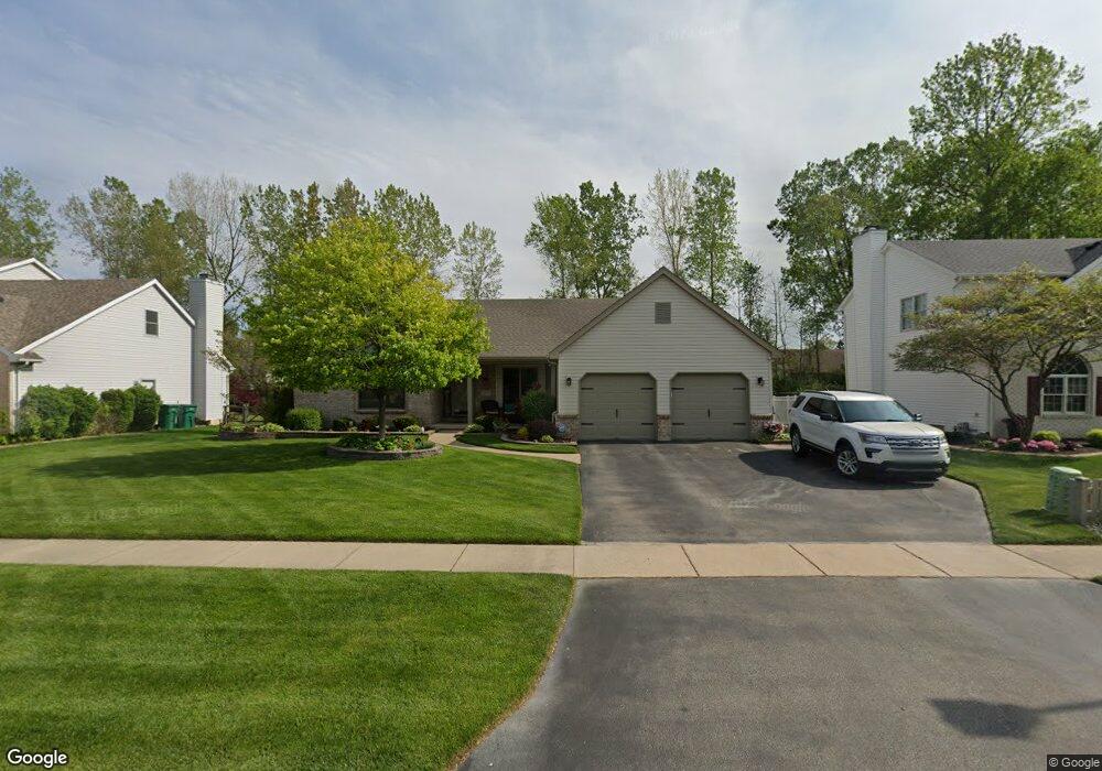
2215 Stirrup Dr Temperance, MI 48182
Estimated Value: $320,269 - $399,000
3
Beds
2
Baths
1,589
Sq Ft
$216/Sq Ft
Est. Value
About This Home
This home is located at 2215 Stirrup Dr, Temperance, MI 48182 and is currently estimated at $343,067, approximately $215 per square foot. 2215 Stirrup Dr is a home located in Monroe County with nearby schools including Douglas Road Elementary School, Bedford Junior High School, and Bedford High School.
Ownership History
Date
Name
Owned For
Owner Type
Purchase Details
Closed on
Feb 10, 1998
Sold by
Huner Thomas
Bought by
Cook David A
Current Estimated Value
Home Financials for this Owner
Home Financials are based on the most recent Mortgage that was taken out on this home.
Original Mortgage
$113,500
Interest Rate
7.12%
Mortgage Type
New Conventional
Create a Home Valuation Report for This Property
The Home Valuation Report is an in-depth analysis detailing your home's value as well as a comparison with similar homes in the area
Home Values in the Area
Average Home Value in this Area
Purchase History
| Date | Buyer | Sale Price | Title Company |
|---|---|---|---|
| Cook David A | $32,500 | -- |
Source: Public Records
Mortgage History
| Date | Status | Borrower | Loan Amount |
|---|---|---|---|
| Closed | Cook David A | $113,500 |
Source: Public Records
Tax History
| Year | Tax Paid | Tax Assessment Tax Assessment Total Assessment is a certain percentage of the fair market value that is determined by local assessors to be the total taxable value of land and additions on the property. | Land | Improvement |
|---|---|---|---|---|
| 2025 | $1,249 | $155,800 | $155,800 | $0 |
| 2024 | $1,212 | $151,900 | $0 | $0 |
| 2023 | $1,154 | $130,600 | $0 | $0 |
| 2022 | $2,980 | $130,600 | $0 | $0 |
| 2021 | $2,647 | $120,100 | $0 | $0 |
| 2020 | $2,540 | $105,000 | $0 | $0 |
| 2019 | $2,491 | $105,000 | $0 | $0 |
| 2018 | $2,271 | $104,800 | $0 | $0 |
| 2017 | $2,136 | $104,800 | $0 | $0 |
| 2016 | $2,136 | $99,500 | $0 | $0 |
| 2015 | $2,005 | $91,400 | $0 | $0 |
| 2014 | $2,005 | $91,400 | $0 | $0 |
| 2013 | $2,213 | $86,900 | $0 | $0 |
Source: Public Records
Map
Nearby Homes
- 2140 Delaware Ln
- 7134 Maplewood Dr
- 7100 Taylor Ave
- 7322 Silo Meadows Dr
- 7346 Silo Meadows Dr
- 7331 Elmwood Dr
- 7292 Powlesland Ave
- 6805 Jackman Rd
- 7494 Montri Dr
- 1944 W Sterns Rd
- 6886 Stockport Dr
- 1641 Spruce Ct Unit 46
- 1660 W Sterns Rd
- 6145 Hiddenbrook Dr
- 3158 Deer Creek Dr
- 3155 Chanson Valley Rd
- 7241 Hidden Valley Dr
- 1747 Center Dr
- 6060 Dixon Ave
- 3215 Edgevale Dr
- 2227 Stirrup Dr
- 2203 Stirrup Dr
- 2239 Stirrup Dr
- 2191 Stirrup Dr
- 2214 Camden Ln
- 2206 Camden Ln
- 2222 Camden Ln
- 2198 Camden Ln
- 2230 Camden Ln
- 2222 Stirrup Dr
- 2210 Stirrup Dr
- 2190 Camden Ln
- 2179 Stirrup Dr
- 2251 Stirrup Dr
- 2238 Camden Ln
- 2198 Stirrup Dr
- 2246 Stirrup Dr
- 2182 Camden Ln
- 2186 Stirrup Dr
- 2167 Stirrup Dr
Your Personal Tour Guide
Ask me questions while you tour the home.