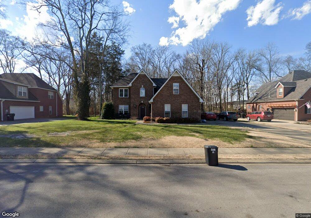
2216 Oakside Ct Murfreesboro, TN 37128
Estimated Value: $483,597 - $566,000
--
Bed
--
Bath
2,540
Sq Ft
$208/Sq Ft
Est. Value
About This Home
This home is located at 2216 Oakside Ct, Murfreesboro, TN 37128 and is currently estimated at $527,899, approximately $207 per square foot. 2216 Oakside Ct is a home located in Rutherford County with nearby schools including Scales Elementary School, Rockvale Middle School, and Rockvale High School.
Ownership History
Date
Name
Owned For
Owner Type
Purchase Details
Closed on
Nov 4, 2005
Sold by
Harrison and Rose
Bought by
Dial and Laura
Current Estimated Value
Home Financials for this Owner
Home Financials are based on the most recent Mortgage that was taken out on this home.
Original Mortgage
$199,920
Outstanding Balance
$114,827
Interest Rate
6.84%
Estimated Equity
$413,072
Purchase Details
Closed on
Feb 23, 2005
Sold by
Wayne Belt T and Wayne Barbara G
Bought by
John Harrison
Create a Home Valuation Report for This Property
The Home Valuation Report is an in-depth analysis detailing your home's value as well as a comparison with similar homes in the area
Home Values in the Area
Average Home Value in this Area
Purchase History
| Date | Buyer | Sale Price | Title Company |
|---|---|---|---|
| Dial | $249,900 | -- | |
| John Harrison | $48,900 | -- | |
| Wayne Belt T | -- | -- |
Source: Public Records
Mortgage History
| Date | Status | Borrower | Loan Amount |
|---|---|---|---|
| Open | Wayne Belt T | $199,920 | |
| Closed | Wayne Belt T | $49,980 |
Source: Public Records
Tax History Compared to Growth
Tax History
| Year | Tax Paid | Tax Assessment Tax Assessment Total Assessment is a certain percentage of the fair market value that is determined by local assessors to be the total taxable value of land and additions on the property. | Land | Improvement |
|---|---|---|---|---|
| 2025 | $3,082 | $108,950 | $13,750 | $95,200 |
| 2024 | $3,082 | $108,950 | $13,750 | $95,200 |
| 2023 | $1,971 | $105,050 | $13,750 | $91,300 |
| 2022 | $1,698 | $105,050 | $13,750 | $91,300 |
| 2021 | $1,616 | $72,825 | $13,750 | $59,075 |
| 2020 | $1,616 | $72,825 | $13,750 | $59,075 |
| 2019 | $1,616 | $72,825 | $13,750 | $59,075 |
| 2018 | $2,220 | $72,825 | $0 | $0 |
| 2017 | $2,295 | $59,050 | $0 | $0 |
| 2016 | $2,296 | $59,050 | $0 | $0 |
| 2015 | $2,296 | $59,050 | $0 | $0 |
| 2014 | $1,468 | $59,050 | $0 | $0 |
| 2013 | -- | $59,125 | $0 | $0 |
Source: Public Records
Map
Nearby Homes
- 3409 Nightshade Dr
- 3429 Deerview Dr
- 1315 Elevation ABC Plan at Evergreen Farms
- 3525 Nightshade Dr
- 1944 Colyn Ave
- 3508 Donerail Cir
- 1943 Odessa Ave
- 2017 Victory Gallop Ln
- 2018 Debonair Ln
- 2339 Shafer Dr
- 2012 Victory Gallop Ln
- 2044 Alysheba Run
- 2040 Alysheba Run
- 1919 Debonair Ln
- 2003 Tabasco Way
- 3216 Terrapin Ct
- 3217 Mapleside Ln
- 1428 Ovaldale Dr
- 1819 Allwood Ave
- 1417 Ovaldale Dr
- 2212 Oakside Ct
- 2217 Oakside Ct
- 2224 Oakside Ct
- 2221 Oakside Ct
- 2213 Oakside Ct
- 3416 Deerview Dr
- 2223 Hard Spun Ct
- 2221 Hard Spun Ct
- 2221 Hard Spun Ct Unit 2221
- 2221 Hard Spun Ct
- 2221 Hard Spun Ct
- 2219 Hard Spun Ct
- 2219 Hard Spun Ct
- 2225 Oakside Ct
- 3420 Deerview Dr
- 2217 Hard Spun Ct
- 2217 Hard Spun Ct
- 2209 Oakside Ct
- 2204 Oakside Ct
- 2222 Saint Andrews Dr