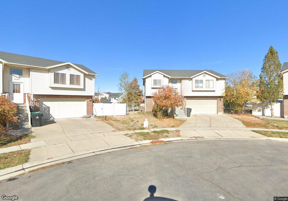
2216 S 2685 W Syracuse, UT 84075
Estimated Value: $448,000 - $468,000
4
Beds
3
Baths
1,711
Sq Ft
$269/Sq Ft
Est. Value
About This Home
This home is located at 2216 S 2685 W, Syracuse, UT 84075 and is currently estimated at $460,199, approximately $268 per square foot. 2216 S 2685 W is a home located in Davis County with nearby schools including Buffalo Point School, Syracuse Junior High School, and Syracuse High School.
Ownership History
Date
Name
Owned For
Owner Type
Purchase Details
Closed on
Sep 27, 2012
Sold by
Dayton Troy C and Dayton Dora L
Bought by
Ah4r I Ut Llc
Current Estimated Value
Purchase Details
Closed on
Sep 5, 2005
Sold by
Lessig Gary and Lessig Chris
Bought by
Dayton Troy C and Dayton Dora L
Home Financials for this Owner
Home Financials are based on the most recent Mortgage that was taken out on this home.
Original Mortgage
$142,759
Interest Rate
5.7%
Mortgage Type
FHA
Purchase Details
Closed on
Mar 7, 2005
Sold by
Out West Developers Llc
Bought by
Lessig Gary and Lessig Chris
Home Financials for this Owner
Home Financials are based on the most recent Mortgage that was taken out on this home.
Original Mortgage
$10,000
Interest Rate
5.6%
Mortgage Type
Unknown
Create a Home Valuation Report for This Property
The Home Valuation Report is an in-depth analysis detailing your home's value as well as a comparison with similar homes in the area
Home Values in the Area
Average Home Value in this Area
Purchase History
| Date | Buyer | Sale Price | Title Company |
|---|---|---|---|
| Ah4r I Ut Llc | -- | Mountain View Title & Es | |
| Dayton Troy C | -- | Heritage West Title Ins Agen | |
| Lessig Gary | -- | None Available |
Source: Public Records
Mortgage History
| Date | Status | Borrower | Loan Amount |
|---|---|---|---|
| Previous Owner | Dayton Troy C | $142,759 | |
| Previous Owner | Lessig Gary | $10,000 | |
| Previous Owner | Lessig Gary | $114,675 |
Source: Public Records
Tax History
| Year | Tax Paid | Tax Assessment Tax Assessment Total Assessment is a certain percentage of the fair market value that is determined by local assessors to be the total taxable value of land and additions on the property. | Land | Improvement |
|---|---|---|---|---|
| 2025 | $2,337 | $225,501 | $112,063 | $113,438 |
| 2024 | $2,356 | $228,799 | $87,745 | $141,054 |
| 2023 | $2,192 | $213,400 | $74,485 | $138,914 |
| 2022 | $2,375 | $419,000 | $121,472 | $297,528 |
| 2021 | $2,064 | $310,000 | $97,531 | $212,469 |
| 2020 | $1,836 | $267,000 | $77,508 | $189,492 |
| 2019 | $1,769 | $254,000 | $82,140 | $171,860 |
| 2018 | $1,463 | $208,434 | $80,288 | $128,146 |
| 2016 | $1,400 | $104,610 | $34,130 | $70,480 |
| 2015 | $1,373 | $97,735 | $34,130 | $63,605 |
| 2014 | $1,403 | $101,735 | $34,130 | $67,605 |
| 2013 | -- | $88,799 | $25,850 | $62,949 |
Source: Public Records
Map
Nearby Homes
- 2803 W 2025 S
- 2376 S 2885 W
- 2475 Craig Ln
- 2961 S 2425 W Unit 1123
- 2696 2495 S Unit 207
- 2188 S 2325 W
- 2971 S 2425 W Unit 1124
- 3062 W Solace St
- 2635 S 2430 W Unit 114
- 2574 S 2430 W Unit 503
- 2594 S 2430 W Unit 501
- 2982 S 3000 W
- 2679 W Antelope Dr
- 4344 W 1825 S Unit 102
- 4354 W 1825 S Unit 104
- 2653 S 2430 W Unit 115
- 2666 S 2430 W Unit 103
- 2735 S Shoreline Dr
- 2138 Craig Ln
- 2423 S 3300 W
Your Personal Tour Guide
Ask me questions while you tour the home.