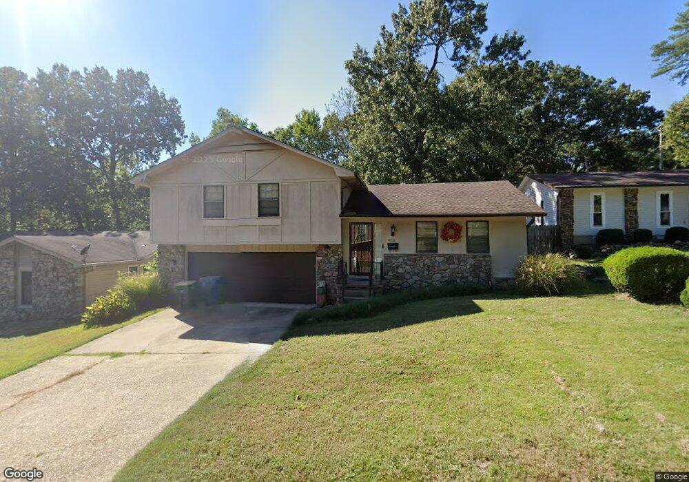
2216 Vancouver Dr Little Rock, AR 72204
John Barrow NeighborhoodEstimated Value: $125,655 - $171,000
--
Bed
2
Baths
1,500
Sq Ft
$97/Sq Ft
Est. Value
About This Home
This home is located at 2216 Vancouver Dr, Little Rock, AR 72204 and is currently estimated at $145,664, approximately $97 per square foot. 2216 Vancouver Dr is a home located in Pulaski County with nearby schools including Bale Elementary School, J.A. Fair K8 Preparatory School, and Henderson Middle School.
Ownership History
Date
Name
Owned For
Owner Type
Purchase Details
Closed on
Jan 10, 2005
Sold by
Broady Carlos and Broady Lesia
Bought by
Wheeler Michelle
Current Estimated Value
Home Financials for this Owner
Home Financials are based on the most recent Mortgage that was taken out on this home.
Original Mortgage
$85,000
Outstanding Balance
$53,274
Interest Rate
9.63%
Mortgage Type
Purchase Money Mortgage
Estimated Equity
$92,390
Create a Home Valuation Report for This Property
The Home Valuation Report is an in-depth analysis detailing your home's value as well as a comparison with similar homes in the area
Home Values in the Area
Average Home Value in this Area
Purchase History
| Date | Buyer | Sale Price | Title Company |
|---|---|---|---|
| Wheeler Michelle | $77,000 | Stewart Title Of Arkansas |
Source: Public Records
Mortgage History
| Date | Status | Borrower | Loan Amount |
|---|---|---|---|
| Open | Wheeler Michelle | $85,000 |
Source: Public Records
Tax History Compared to Growth
Tax History
| Year | Tax Paid | Tax Assessment Tax Assessment Total Assessment is a certain percentage of the fair market value that is determined by local assessors to be the total taxable value of land and additions on the property. | Land | Improvement |
|---|---|---|---|---|
| 2025 | $1,145 | $21,367 | $1,000 | $20,367 |
| 2024 | $1,050 | $21,367 | $1,000 | $20,367 |
| 2023 | $1,050 | $21,367 | $1,000 | $20,367 |
| 2022 | $1,002 | $21,367 | $1,000 | $20,367 |
| 2021 | $962 | $13,640 | $3,000 | $10,640 |
| 2020 | $580 | $13,640 | $3,000 | $10,640 |
| 2019 | $580 | $13,640 | $3,000 | $10,640 |
| 2018 | $605 | $13,640 | $3,000 | $10,640 |
| 2017 | $605 | $13,640 | $3,000 | $10,640 |
| 2016 | $815 | $16,640 | $3,600 | $13,040 |
| 2015 | $1,151 | $16,640 | $3,600 | $13,040 |
| 2014 | $1,151 | $16,417 | $3,600 | $12,817 |
Source: Public Records
Map
Nearby Homes
- 3918 W 23rd St
- 8212 W 24th St
- 8300 W 23rd St
- 1710 Village Lake Dr
- 2522 Quebec Dr
- 8001 Kanis Pines Dr
- 1625 Village Lake Dr
- 0000 Kanis Pines Dr
- Lot 42R Kanis Pines Dr
- Lot 39R Kanis Pines Dr
- 7922 Kanis Pines Dr
- 1622 Village Lake Dr
- 7921 Kanis Oaks Dr
- Lot 10 Kanis Oaks Dr
- Lot 9 Kanis Oaks Dr
- Lot 8 Kanis Oaks Dr
- 8010 Kanis Oaks Dr
- 2701 Dorchester Dr
- 7800 W 29th St
- 2918 Vancouver Dr
- 2210 Vancouver Dr
- 2222 Vancouver Dr
- 2300 Vancouver Dr
- 2211 Singleton Cove
- 2204 Vancouver Dr
- 2207 Singleton Cove
- 7925 W 22nd St
- 2215 Singleton Cove
- 2217 Vancouver Dr
- 2211 Vancouver Dr
- 2223 Vancouver Dr
- 2306 Vancouver Dr
- 0 Vancouver
- 7919 Parkwood Dr
- 2301 Vancouver Dr
- 2219 Singleton Cove
- 2201 Singleton Cove
- 2310 Vancouver Dr
- 2307 Vancouver Dr
- 8000 W 22nd St