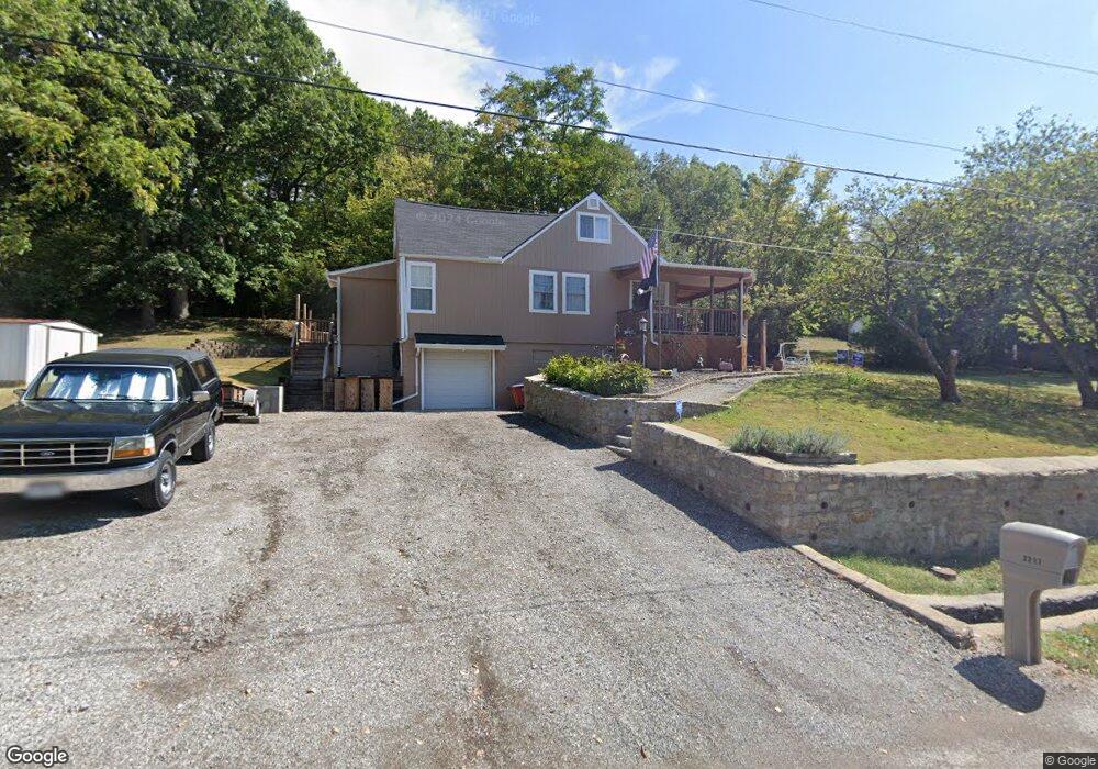
2217 Hillside Dr Oak Grove, MO 64075
Estimated Value: $162,832 - $284,000
2
Beds
1
Bath
1,907
Sq Ft
$117/Sq Ft
Est. Value
About This Home
This home is located at 2217 Hillside Dr, Oak Grove, MO 64075 and is currently estimated at $223,958, approximately $117 per square foot. 2217 Hillside Dr is a home located in Jackson County with nearby schools including Mason Elementary School, Bernard C. Campbell Middle School, and Lee's Summit North High School.
Ownership History
Date
Name
Owned For
Owner Type
Purchase Details
Closed on
Dec 12, 2002
Sold by
Allison Robert G
Bought by
Allison Carl L and Robert G Allison Living Trust
Current Estimated Value
Purchase Details
Closed on
Mar 5, 2002
Sold by
Allison Robert G
Bought by
Allison Carl L and Robert G Allison Living Trust
Purchase Details
Closed on
Aug 27, 1996
Sold by
Nold Catherine A
Bought by
Allison Carl L and Allison Cindy C
Home Financials for this Owner
Home Financials are based on the most recent Mortgage that was taken out on this home.
Original Mortgage
$51,850
Outstanding Balance
$4,121
Interest Rate
8.27%
Mortgage Type
Purchase Money Mortgage
Estimated Equity
$219,837
Create a Home Valuation Report for This Property
The Home Valuation Report is an in-depth analysis detailing your home's value as well as a comparison with similar homes in the area
Home Values in the Area
Average Home Value in this Area
Purchase History
| Date | Buyer | Sale Price | Title Company |
|---|---|---|---|
| Allison Carl L | -- | -- | |
| Allison Carl L | -- | -- | |
| Allison Carl L | -- | -- |
Source: Public Records
Mortgage History
| Date | Status | Borrower | Loan Amount |
|---|---|---|---|
| Open | Allison Carl L | $51,850 |
Source: Public Records
Tax History Compared to Growth
Tax History
| Year | Tax Paid | Tax Assessment Tax Assessment Total Assessment is a certain percentage of the fair market value that is determined by local assessors to be the total taxable value of land and additions on the property. | Land | Improvement |
|---|---|---|---|---|
| 2025 | $1,099 | $18,136 | $3,591 | $14,545 |
| 2024 | $1,088 | $15,770 | $171 | $15,599 |
| 2023 | $1,088 | $15,770 | $171 | $15,599 |
| 2022 | $1,222 | $15,580 | $143 | $15,437 |
| 2021 | $1,168 | $15,580 | $143 | $15,437 |
| 2020 | $1,124 | $14,856 | $143 | $14,713 |
| 2019 | $1,094 | $14,856 | $143 | $14,713 |
| 2018 | $1,293 | $16,195 | $316 | $15,879 |
| 2017 | $1,293 | $16,195 | $316 | $15,879 |
| 2016 | $1,278 | $15,789 | $203 | $15,586 |
| 2014 | $1,332 | $16,144 | $203 | $15,941 |
Source: Public Records
Map
Nearby Homes
- 0 Hillside Dr Unit HMS2576697
- 2332 Park Ln
- 0 Park Ln
- Lot 47 - 48 Park Ln
- Lot 73 - 76 Green Forest Way
- 1604 SW Stonewall Dr
- 304 SW 17th St
- 1503 SW Stonewall Dr
- 1500 SW Stonewall Dr
- 30500 E Litchford Rd
- 8820 S Hardsaw Rd
- 8005 S Buckner Tarsney Rd
- 9707 S Corn Rd
- 10310 S Brown Rd
- 8919 S Hardsaw Rd
- Lot E E Old Major Rd
- Lot D E Old Major Rd
- Lot C E Old Major Rd
- Lot B E Old Major Rd
- Lot A E Old Major Rd
- 2220 Hillside Dr
- 2214 Hillside Dr
- 2224 Hillside Dr
- 1815 Sunset Dr
- 2210 Hillside Dr
- 2226 Overhill St
- 2227 Overhill St
- 1905 Sunset Dr
- 1812 Sunset Dr
- 2209 Hillside Dr
- 1813 Sunset Dr
- 1926 Summit Dr
- 1925 Summit Dr
- 1923 Summit Dr
- 1923 Summit Dr
- 1906 Sunset Dr
- 2302 Beach Dr
- 1818 Lookout Dr
- 1908 Sunset Dr
- 2101 Overhill St