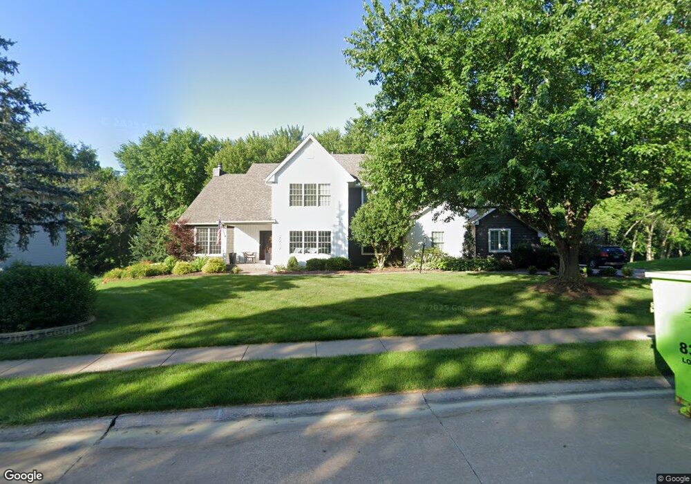
2217 Saint Andrews Cir Bettendorf, IA 52722
Estimated Value: $649,000 - $1,000,000
4
Beds
5
Baths
3,331
Sq Ft
$245/Sq Ft
Est. Value
About This Home
This home is located at 2217 Saint Andrews Cir, Bettendorf, IA 52722 and is currently estimated at $816,874, approximately $245 per square foot. 2217 Saint Andrews Cir is a home located in Scott County with nearby schools including Grant Wood Elementary School, Bettendorf Middle School, and Bettendorf High School.
Ownership History
Date
Name
Owned For
Owner Type
Purchase Details
Closed on
Dec 15, 2020
Sold by
Rushek Karla Ann and Rushek Carl John
Bought by
Kadavy Kevn D and Kadavy Melanie E
Current Estimated Value
Home Financials for this Owner
Home Financials are based on the most recent Mortgage that was taken out on this home.
Original Mortgage
$535,500
Outstanding Balance
$388,800
Interest Rate
2.71%
Mortgage Type
New Conventional
Estimated Equity
$428,074
Create a Home Valuation Report for This Property
The Home Valuation Report is an in-depth analysis detailing your home's value as well as a comparison with similar homes in the area
Home Values in the Area
Average Home Value in this Area
Purchase History
| Date | Buyer | Sale Price | Title Company |
|---|---|---|---|
| Kadavy Kevn D | $595,000 | None Available |
Source: Public Records
Mortgage History
| Date | Status | Borrower | Loan Amount |
|---|---|---|---|
| Open | Kadavy Kevn D | $535,500 |
Source: Public Records
Tax History Compared to Growth
Tax History
| Year | Tax Paid | Tax Assessment Tax Assessment Total Assessment is a certain percentage of the fair market value that is determined by local assessors to be the total taxable value of land and additions on the property. | Land | Improvement |
|---|---|---|---|---|
| 2025 | $9,246 | $719,400 | $196,200 | $523,200 |
| 2024 | $9,170 | $608,000 | $117,300 | $490,700 |
| 2023 | $9,050 | $608,000 | $117,300 | $490,700 |
| 2022 | $8,958 | $523,010 | $117,330 | $405,680 |
| 2021 | $8,958 | $523,010 | $117,330 | $405,680 |
| 2020 | $8,234 | $462,560 | $117,330 | $345,230 |
| 2019 | $8,480 | $462,560 | $117,330 | $345,230 |
| 2018 | $8,476 | $462,560 | $117,330 | $345,230 |
| 2017 | $2,573 | $462,560 | $117,330 | $345,230 |
| 2016 | $9,536 | $519,900 | $0 | $0 |
| 2015 | $9,536 | $500,610 | $0 | $0 |
| 2014 | $9,288 | $500,610 | $0 | $0 |
| 2013 | $9,086 | $0 | $0 | $0 |
| 2012 | -- | $504,730 | $134,090 | $370,640 |
Source: Public Records
Map
Nearby Homes
- 6202 Crow Valley Dr
- 2614 Heather Glen Cir
- 4150 E 60th St Unit 1004
- 6401 Utica Ridge Rd Unit 4
- 9 E 61st Ct
- 2744 Rosehill Ave
- 2605 Hunter Rd
- 4906 Fox Ridge Rd
- 6559 Cardinal Rd
- 6547 Cardinal Rd
- 1918 E 59th Ct
- 1912 E 59th Ct
- 1906 E 59th Ct
- 4725 Kynnelworth Dr Unit 8
- 2946 Summertree Ave
- 3115 Meridith Way
- 4006 Kathleen Way
- 3347 Glenbrook Cir N
- 3271 Valleywynds Dr
- 1908 Katie Ct
- 2209 Saint Andrews Cir
- 2209 St Andrews Cir
- 2225 Saint Andrews Cir
- 2208 Saint Andrews Cir
- 2208 St Andrews
- 2237 Saint Andrews Cir
- 2237 St Andrews
- 2220 Saint Andrews Cir
- 2201 Saint Andrews Cir
- 2236 St Andrews
- 2189 Saint Andrews Cir
- 2236 Saint Andrews Cir
- 2249 Saint Andrews Cir
- 2244 Saint Andrews Cir
- 2244 St Andrews Cir
- 2257 Saint Andrews Cir
- 2257 St Andrews
- 2192 Saint Andrews Cir
- 2173 Saint Andrews Cir
- 2173 St Andrews