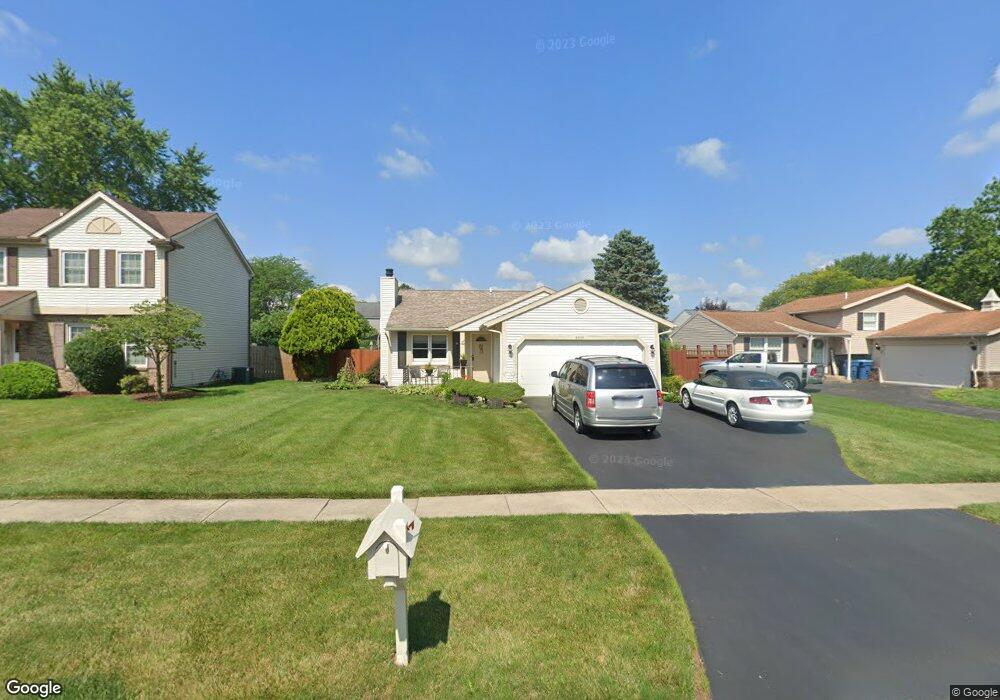
2218 Longport Dr Maumee, OH 43537
Estimated Value: $198,169 - $247,000
3
Beds
2
Baths
1,068
Sq Ft
$209/Sq Ft
Est. Value
About This Home
This home is located at 2218 Longport Dr, Maumee, OH 43537 and is currently estimated at $223,042, approximately $208 per square foot. 2218 Longport Dr is a home located in Lucas County with nearby schools including Holloway Elementary School, Springfield Middle School, and Springfield High School.
Ownership History
Date
Name
Owned For
Owner Type
Purchase Details
Closed on
Jan 19, 2007
Sold by
Ware Richard A and Ware Kay E
Bought by
Ware Richard A and Ware Kay E
Current Estimated Value
Home Financials for this Owner
Home Financials are based on the most recent Mortgage that was taken out on this home.
Original Mortgage
$120,000
Outstanding Balance
$70,042
Interest Rate
6.16%
Mortgage Type
New Conventional
Estimated Equity
$153,000
Purchase Details
Closed on
Aug 29, 1997
Sold by
Matanick Ronald
Bought by
Ware Richard A
Home Financials for this Owner
Home Financials are based on the most recent Mortgage that was taken out on this home.
Original Mortgage
$101,915
Interest Rate
7.57%
Mortgage Type
Balloon
Purchase Details
Closed on
Mar 8, 1993
Sold by
Mcwilliam John L and Mcwilliam Sue A
Create a Home Valuation Report for This Property
The Home Valuation Report is an in-depth analysis detailing your home's value as well as a comparison with similar homes in the area
Home Values in the Area
Average Home Value in this Area
Purchase History
| Date | Buyer | Sale Price | Title Company |
|---|---|---|---|
| Ware Richard A | -- | Attorney | |
| Ware Richard A | $119,900 | -- | |
| -- | $85,100 | -- |
Source: Public Records
Mortgage History
| Date | Status | Borrower | Loan Amount |
|---|---|---|---|
| Open | Ware Richard A | $120,000 | |
| Closed | Ware Richard A | $101,915 |
Source: Public Records
Tax History
| Year | Tax Paid | Tax Assessment Tax Assessment Total Assessment is a certain percentage of the fair market value that is determined by local assessors to be the total taxable value of land and additions on the property. | Land | Improvement |
|---|---|---|---|---|
| 2025 | -- | $48,790 | $11,585 | $37,205 |
| 2024 | $1,199 | $48,790 | $11,585 | $37,205 |
| 2023 | $2,614 | $46,480 | $9,835 | $36,645 |
| 2022 | $2,639 | $46,480 | $9,835 | $36,645 |
| 2021 | $2,483 | $46,480 | $9,835 | $36,645 |
| 2020 | $2,322 | $40,705 | $8,225 | $32,480 |
| 2019 | $2,268 | $40,705 | $8,225 | $32,480 |
| 2018 | $2,139 | $40,705 | $8,225 | $32,480 |
| 2017 | $2,029 | $35,385 | $10,255 | $25,130 |
| 2016 | $2,047 | $101,100 | $29,300 | $71,800 |
| 2015 | $2,044 | $101,100 | $29,300 | $71,800 |
| 2014 | $1,777 | $34,020 | $9,870 | $24,150 |
| 2013 | $1,777 | $34,020 | $9,870 | $24,150 |
Source: Public Records
Map
Nearby Homes
- 6418 Scarsdale Rd
- 2165 Glenacres Ct
- 2001 Perrysburg Holland Rd
- 2024 Inglewood Rd
- 6655 Garden Rd Unit 6655
- 6705 Garden Rd Unit 6705
- 6652 Sue Ln
- 6731 Garden Rd Unit 6731
- 6856 Morningdew Blvd
- 36 Wolf Ridge Dr
- 7009 Shadowcreek Dr
- 2437 Knights Hill Ln
- 38 Walnut Creek Dr
- 7063 Nightingale Dr
- 8939 Airport Hwy
- 5741 Heatherbank Rd
- 2822 Pleasant Hill Rd
- 2324 Mill Race Ct
- 7342 Woodshire Ln
- 5637 Swan Creek Dr
- 2212 Longport Dr
- 2226 Longport Dr
- 2217 Kingston Dr
- 2225 Kingston Dr
- 2232 Longport Dr
- 2211 Kingston Dr
- 2231 Kingston Dr
- 2219 Longport Dr
- 2225 Longport Dr
- 2211 Longport Dr
- 2203 Kingston Dr
- 2184 Longport Dr
- 2237 Kingston Dr
- 2203 Longport Dr
- 2238 Longport Dr
- 2233 Longport Dr
- 2177 Kingston Dr
- 2245 Kingston Dr
- 2176 Longport Dr
- 6502 Scarsdale Rd
Your Personal Tour Guide
Ask me questions while you tour the home.