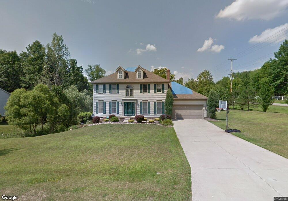
2219 Weston Dr Hudson, OH 44236
Estimated Value: $481,000 - $558,000
4
Beds
3
Baths
2,728
Sq Ft
$192/Sq Ft
Est. Value
About This Home
This home is located at 2219 Weston Dr, Hudson, OH 44236 and is currently estimated at $524,702, approximately $192 per square foot. 2219 Weston Dr is a home located in Summit County with nearby schools including Ellsworth Hill Elementary School, East Woods Intermediate School, and Hudson Middle School.
Ownership History
Date
Name
Owned For
Owner Type
Purchase Details
Closed on
May 27, 2003
Sold by
Marie Smith James E and Marie Louise
Bought by
Mcclain James D and Mcclain Nancy B
Current Estimated Value
Home Financials for this Owner
Home Financials are based on the most recent Mortgage that was taken out on this home.
Original Mortgage
$180,000
Outstanding Balance
$79,535
Interest Rate
5.9%
Mortgage Type
Purchase Money Mortgage
Estimated Equity
$445,167
Purchase Details
Closed on
Jul 21, 1995
Sold by
Encore Homes Inc
Bought by
Smith James E and Smith Louise M
Home Financials for this Owner
Home Financials are based on the most recent Mortgage that was taken out on this home.
Original Mortgage
$173,520
Interest Rate
7.5%
Mortgage Type
New Conventional
Create a Home Valuation Report for This Property
The Home Valuation Report is an in-depth analysis detailing your home's value as well as a comparison with similar homes in the area
Home Values in the Area
Average Home Value in this Area
Purchase History
| Date | Buyer | Sale Price | Title Company |
|---|---|---|---|
| Mcclain James D | $242,000 | -- | |
| Smith James E | $216,900 | -- |
Source: Public Records
Mortgage History
| Date | Status | Borrower | Loan Amount |
|---|---|---|---|
| Open | Mcclain James D | $180,000 | |
| Previous Owner | Smith James E | $173,520 |
Source: Public Records
Tax History Compared to Growth
Tax History
| Year | Tax Paid | Tax Assessment Tax Assessment Total Assessment is a certain percentage of the fair market value that is determined by local assessors to be the total taxable value of land and additions on the property. | Land | Improvement |
|---|---|---|---|---|
| 2025 | $8,534 | $162,376 | $37,702 | $124,674 |
| 2024 | $8,534 | $162,376 | $37,702 | $124,674 |
| 2023 | $8,534 | $162,376 | $37,702 | $124,674 |
| 2022 | $6,345 | $110,600 | $25,648 | $84,952 |
| 2021 | $6,356 | $110,600 | $25,648 | $84,952 |
| 2020 | $7,095 | $110,600 | $25,650 | $84,950 |
| 2019 | $7,393 | $104,740 | $20,350 | $84,390 |
| 2018 | $7,339 | $104,740 | $20,350 | $84,390 |
| 2017 | $8,219 | $104,740 | $20,350 | $84,390 |
| 2016 | $6,166 | $93,600 | $20,350 | $73,250 |
| 2015 | $8,219 | $93,600 | $20,350 | $73,250 |
| 2014 | $8,155 | $93,600 | $20,350 | $73,250 |
| 2013 | $9,059 | $97,070 | $20,350 | $76,720 |
Source: Public Records
Map
Nearby Homes
- 5465 Park Vista Ct
- 5473 Young Rd
- 5431 Diana Lynn Dr
- V/L Norton Rd
- 2749 Norton Rd
- 1884 Village Ct Unit X66
- 1759 E Sapphire Dr
- 5139 Rockport Cove
- 4901 Pebblehurst Dr
- 1620 Sapphire Dr
- 5241 Brockton Dr
- 2327 Crockett Cir
- 4731 Haughton Ct
- 2380 Port Williams Dr Unit 2380
- 4917 Independence Cir Unit B
- 2444 Port Charles Dr
- 1705 Barlow Rd
- V/L Ravenna Rd
- 0 Stow Rd Unit 5102979
- 4901 Independence Cir Unit B
- 2209 Weston Dr
- 5419 Brooklands Dr
- 2197 Weston Dr
- 5420 Brooklands Dr
- 5411 Brooklands Dr
- 2185 Weston Dr
- 5401 Brooklands Dr
- 5410 Brooklands Dr
- 2186 Weston Dr
- 5468 Stow Rd
- 2331 Brafferton Ave
- 5400 Brooklands Dr
- 5391 Brooklands Dr
- 2177 Weston Dr
- 5447 Stow Rd
- 2343 Brafferton Ave
- 5457 Stow Rd
- 2193 Bristol Ct
- 5444 Stow Rd
- 5390 Brooklands Dr