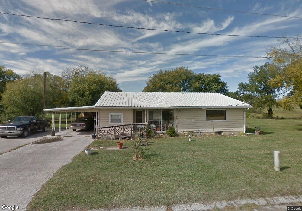
222 9th St Osawatomie, KS 66064
Estimated Value: $227,000 - $248,932
3
Beds
2
Baths
1,916
Sq Ft
$125/Sq Ft
Est. Value
About This Home
This home is located at 222 9th St, Osawatomie, KS 66064 and is currently estimated at $240,233, approximately $125 per square foot. 222 9th St is a home located in Miami County with nearby schools including Swenson Early Childhood Education Center, Trojan Elementary School, and Osawatomie Middle School.
Ownership History
Date
Name
Owned For
Owner Type
Purchase Details
Closed on
May 22, 2006
Sold by
Barnett James D
Bought by
Aldridge Lester L and Aldridge Joann C
Current Estimated Value
Home Financials for this Owner
Home Financials are based on the most recent Mortgage that was taken out on this home.
Original Mortgage
$114,207
Outstanding Balance
$66,521
Interest Rate
6.5%
Mortgage Type
FHA
Estimated Equity
$173,712
Create a Home Valuation Report for This Property
The Home Valuation Report is an in-depth analysis detailing your home's value as well as a comparison with similar homes in the area
Home Values in the Area
Average Home Value in this Area
Purchase History
| Date | Buyer | Sale Price | Title Company |
|---|---|---|---|
| Aldridge Lester L | -- | Osa Title |
Source: Public Records
Mortgage History
| Date | Status | Borrower | Loan Amount |
|---|---|---|---|
| Open | Aldridge Lester L | $114,207 |
Source: Public Records
Tax History Compared to Growth
Tax History
| Year | Tax Paid | Tax Assessment Tax Assessment Total Assessment is a certain percentage of the fair market value that is determined by local assessors to be the total taxable value of land and additions on the property. | Land | Improvement |
|---|---|---|---|---|
| 2025 | $4,707 | $26,220 | $2,493 | $23,727 |
| 2024 | $4,734 | $26,427 | $1,923 | $24,504 |
| 2023 | $4,475 | $24,461 | $1,516 | $22,945 |
| 2022 | $3,858 | $20,217 | $1,663 | $18,554 |
| 2021 | $1,483 | $0 | $0 | $0 |
| 2020 | $2,539 | $0 | $0 | $0 |
| 2019 | $2,118 | $0 | $0 | $0 |
| 2018 | $2,092 | $0 | $0 | $0 |
| 2017 | $2,078 | $0 | $0 | $0 |
| 2016 | -- | $0 | $0 | $0 |
| 2015 | -- | $0 | $0 | $0 |
| 2014 | -- | $0 | $0 | $0 |
| 2013 | -- | $0 | $0 | $0 |
Source: Public Records
Map
Nearby Homes