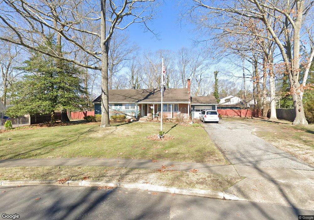
222 Barbara Cir Toms River, NJ 08753
Estimated Value: $513,000 - $577,000
3
Beds
2
Baths
2,834
Sq Ft
$193/Sq Ft
Est. Value
About This Home
This home is located at 222 Barbara Cir, Toms River, NJ 08753 and is currently estimated at $546,569, approximately $192 per square foot. 222 Barbara Cir is a home located in Ocean County with nearby schools including St Joseph Grade School and Donovan Catholic High School.
Ownership History
Date
Name
Owned For
Owner Type
Purchase Details
Closed on
Jun 20, 2006
Sold by
Sandberg Joanne and Hitchings Randall
Bought by
Cali John M and Slane Patricia L
Current Estimated Value
Home Financials for this Owner
Home Financials are based on the most recent Mortgage that was taken out on this home.
Original Mortgage
$200,000
Outstanding Balance
$117,715
Interest Rate
6.59%
Mortgage Type
Purchase Money Mortgage
Estimated Equity
$428,854
Purchase Details
Closed on
Jun 10, 2004
Sold by
Sandberg Joanne
Bought by
Sandberg Joanne and Hitchings Randall
Purchase Details
Closed on
Jul 14, 2000
Sold by
Irons Jesse
Bought by
Sandberg Joanne
Home Financials for this Owner
Home Financials are based on the most recent Mortgage that was taken out on this home.
Original Mortgage
$112,000
Interest Rate
8.18%
Create a Home Valuation Report for This Property
The Home Valuation Report is an in-depth analysis detailing your home's value as well as a comparison with similar homes in the area
Home Values in the Area
Average Home Value in this Area
Purchase History
| Date | Buyer | Sale Price | Title Company |
|---|---|---|---|
| Cali John M | $370,000 | No Boundaries Title Llc | |
| Sandberg Joanne | -- | Lawyers Title Insurance Corp | |
| Sandberg Joanne | $140,000 | -- |
Source: Public Records
Mortgage History
| Date | Status | Borrower | Loan Amount |
|---|---|---|---|
| Open | Cali John M | $200,000 | |
| Previous Owner | Sandberg Joanne | $112,000 |
Source: Public Records
Tax History Compared to Growth
Tax History
| Year | Tax Paid | Tax Assessment Tax Assessment Total Assessment is a certain percentage of the fair market value that is determined by local assessors to be the total taxable value of land and additions on the property. | Land | Improvement |
|---|---|---|---|---|
| 2025 | $6,719 | $369,000 | $120,000 | $249,000 |
| 2024 | $6,387 | $369,000 | $120,000 | $249,000 |
| 2023 | $6,159 | $369,000 | $120,000 | $249,000 |
| 2022 | $6,159 | $369,000 | $120,000 | $249,000 |
| 2021 | $6,077 | $242,600 | $100,000 | $142,600 |
| 2020 | $6,050 | $242,600 | $100,000 | $142,600 |
| 2019 | $5,788 | $242,600 | $100,000 | $142,600 |
| 2018 | $5,711 | $242,600 | $100,000 | $142,600 |
| 2017 | $5,662 | $242,600 | $100,000 | $142,600 |
| 2016 | $5,514 | $242,600 | $100,000 | $142,600 |
| 2015 | $5,306 | $242,600 | $100,000 | $142,600 |
| 2014 | $5,051 | $242,600 | $100,000 | $142,600 |
Source: Public Records
Map
Nearby Homes
- 711 Bay Ave
- 241 Lester Rd
- 718 Arrow Dr
- 830 Brookside Dr
- 741 Spruce Hill Dr
- 939 Alden Dr
- 308 Cedar Grove Rd
- 507 Sloop Ct
- 751 High Meadow Dr
- 308 Tradewinds Ave
- 707 Cedar Point Ct
- 348 Cedar Grove Rd
- 679 Clifton Ave
- 73 Cedar Grove Rd
- 696 Schoolhouse Ln
- 14 Turnberry Cir Unit 117
- 22 Turnberry Cir Unit 121
- 821 Oak Ave
- 823 Oak Ave
- 819 Oak Ave
- 218 Barbara Cir
- 226 Barbara Cir
- 905 Roundtree Dr
- 10 Brookside Ct
- 909 Roundtree Dr
- 6 Brookside Ct
- 901 Roundtree Dr
- 214 Barbara Cir
- 14 Brookside Ct
- 230 Barbara Cir
- 913 Roundtree Dr
- 895 Brookside Dr
- 891 Brookside Dr
- 899 Brookside Dr
- 210 Barbara Ln
- 18 Brookside Ct
- 9 Brookside Ct
- 902 Roundtree Dr
- 906 Roundtree Dr
- 225 Barbara Ln