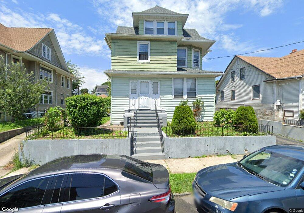
222 Bronx Ave Unit 224 Bridgeport, CT 06606
Brooklawn-Saint Vincent NeighborhoodEstimated Value: $493,002 - $674,000
6
Beds
4
Baths
3,017
Sq Ft
$198/Sq Ft
Est. Value
About This Home
This home is located at 222 Bronx Ave Unit 224, Bridgeport, CT 06606 and is currently estimated at $596,751, approximately $197 per square foot. 222 Bronx Ave Unit 224 is a home located in Fairfield County with nearby schools including Madison School, Central High School, and Catholic Academy of Bridgeport-St. Raphael Academy.
Ownership History
Date
Name
Owned For
Owner Type
Purchase Details
Closed on
Jul 5, 2001
Sold by
Cardoso Antonio A and Cardoso Irene
Bought by
Burnett Isaac and Burnett Effela
Current Estimated Value
Home Financials for this Owner
Home Financials are based on the most recent Mortgage that was taken out on this home.
Original Mortgage
$162,400
Outstanding Balance
$62,903
Interest Rate
7.21%
Estimated Equity
$533,848
Create a Home Valuation Report for This Property
The Home Valuation Report is an in-depth analysis detailing your home's value as well as a comparison with similar homes in the area
Home Values in the Area
Average Home Value in this Area
Purchase History
| Date | Buyer | Sale Price | Title Company |
|---|---|---|---|
| Burnett Isaac | $239,900 | -- | |
| Burnett Isaac | $239,900 | -- |
Source: Public Records
Mortgage History
| Date | Status | Borrower | Loan Amount |
|---|---|---|---|
| Open | Burnett Isaac | $162,400 | |
| Closed | Burnett Isaac | $162,400 |
Source: Public Records
Tax History Compared to Growth
Tax History
| Year | Tax Paid | Tax Assessment Tax Assessment Total Assessment is a certain percentage of the fair market value that is determined by local assessors to be the total taxable value of land and additions on the property. | Land | Improvement |
|---|---|---|---|---|
| 2025 | $9,126 | $210,040 | $76,060 | $133,980 |
| 2024 | $9,126 | $210,040 | $76,060 | $133,980 |
| 2023 | $9,126 | $210,040 | $76,060 | $133,980 |
| 2022 | $9,126 | $210,040 | $76,060 | $133,980 |
| 2021 | $9,126 | $210,040 | $76,060 | $133,980 |
| 2020 | $8,359 | $154,830 | $42,910 | $111,920 |
| 2019 | $8,359 | $154,830 | $42,910 | $111,920 |
| 2018 | $8,418 | $154,830 | $42,910 | $111,920 |
| 2017 | $8,418 | $154,830 | $42,910 | $111,920 |
| 2016 | $8,418 | $154,830 | $42,910 | $111,920 |
| 2015 | $8,502 | $201,480 | $51,930 | $149,550 |
| 2014 | $8,502 | $201,480 | $51,930 | $149,550 |
Source: Public Records
Map
Nearby Homes
- 106 Manhattan Ave Unit 108
- 123 Harlem Ave
- 25 Manhattan Ave Unit 27
- 508 Hawley Ave
- 203 Wayne St
- 252 Harlem Ave Unit B6
- 252 Harlem Ave Unit B5
- 105 Tremont Ave Unit E
- 105 Tremont Ave Unit B
- 631 Fairview Ave
- 119 Madison Terrace
- 234 Savoy St
- 485 Westfield Ave
- 376 Savoy St
- 241 Sampson St
- 936 Lindley St
- 724 Capitol Ave Unit 726
- 11 Myron Ave
- 330 French St
- 1265 Lindley St
- 212 Bronx Ave
- 232 Bronx Ave Unit 234
- 242 Bronx Ave
- 211 Bronx Ave Unit 213
- 233 Bronx Ave
- 213 Bronx Ave
- 205 Bronx Ave
- 135 Manhattan Ave
- 231 Bronx Ave Unit 233
- 231 Bronx Ave Unit 3rdfl
- 231 Bronx Ave Unit 2ndfl
- 115 Manhattan Ave
- 201 Bronx Ave Unit 203
- 194 Bronx Ave
- 223 Bronx Ave
- 127 Manhattan Ave
- 203 Bronx Ave
- 147 Manhattan Ave
- 105 Manhattan Ave
- 105 Manhattan Ave Unit 2