222 Dwayne Rd Parrottsville, TN 37843
Estimated Value: $178,719 - $243,000
--
Bed
1
Bath
1,434
Sq Ft
$144/Sq Ft
Est. Value
About This Home
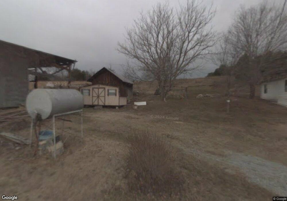
This home is located at 222 Dwayne Rd, Parrottsville, TN 37843 and is currently estimated at $206,930, approximately $144 per square foot. 222 Dwayne Rd is a home located in Cocke County with nearby schools including Parrottsville Elementary School and Cocke County High School.
Ownership History
Date
Name
Owned For
Owner Type
Purchase Details
Closed on
Jan 16, 2025
Sold by
Nease Diane Gregg
Bought by
Williamson Brenda Gregg
Current Estimated Value
Purchase Details
Closed on
Feb 23, 2021
Sold by
Gregg Jimmy Dewayne and Gregg Vera Luster
Bought by
Gregg Jimmy Dewayne and Nease Diane Gregg
Purchase Details
Closed on
May 20, 2004
Sold by
Gregg Vera
Bought by
State Of Tennessee
Purchase Details
Closed on
Dec 6, 2001
Sold by
Gregg Vera
Bought by
Nease Jason W
Create a Home Valuation Report for This Property
The Home Valuation Report is an in-depth analysis detailing your home's value as well as a comparison with similar homes in the area
Home Values in the Area
Average Home Value in this Area
Purchase History
| Date | Buyer | Sale Price | Title Company |
|---|---|---|---|
| Williamson Brenda Gregg | -- | Mcsween Title | |
| Williamson Brenda Gregg | -- | Mcsween Title | |
| Gregg Jimmy Dewayne | -- | None Available | |
| State Of Tennessee | -- | -- | |
| Nease Jason W | $1,000 | -- |
Source: Public Records
Tax History Compared to Growth
Tax History
| Year | Tax Paid | Tax Assessment Tax Assessment Total Assessment is a certain percentage of the fair market value that is determined by local assessors to be the total taxable value of land and additions on the property. | Land | Improvement |
|---|---|---|---|---|
| 2024 | $779 | $30,425 | $10,000 | $20,425 |
| 2023 | $779 | $19,475 | $10,000 | $9,475 |
| 2022 | $500 | $19,475 | $10,000 | $9,475 |
| 2021 | $500 | $19,475 | $10,000 | $9,475 |
| 2020 | $500 | $19,475 | $10,000 | $9,475 |
| 2019 | $531 | $18,750 | $10,000 | $8,750 |
| 2018 | $531 | $18,750 | $10,000 | $8,750 |
| 2017 | $544 | $18,750 | $10,000 | $8,750 |
| 2016 | $485 | $18,750 | $10,000 | $8,750 |
| 2015 | $559 | $18,750 | $10,000 | $8,750 |
| 2014 | $559 | $18,750 | $10,000 | $8,750 |
| 2013 | $559 | $23,300 | $12,725 | $10,575 |
Source: Public Records
Map
Nearby Homes
- 167 Loftis Rd
- 2895 Looney Rd
- 0 London Way
- 1086 Highland Meadow
- 1066 Highland Meadow
- 2644 Union Hill Rd
- 765 Poplar Springs Rd
- Tbd 49.60 Looney Rd
- 0 Looney Rd Unit 304968
- 0 Looney Rd Unit 1290581
- 0000 Looney Rd
- 0 Trentham Hollow
- 5245 Poplar Springs Rd
- 453 Trentham Hollow Rd
- 749 Franklin Rd
- 795 Sunlight Rd
- 1866 Old Newport Hwy
- Tract 6 Topaz Way
- Tract 7 Topaz Way
- Tracts 1-3 Topaz Way
- 225 Dwayne Rd
- 210 Dwayne Rd
- 211 Dwayne Rd
- 205 Dwayne Rd
- 206 Dwayne Rd
- 203 Dwayne Rd
- 3154 Highway 321
- 270 Dwayne Rd
- 3180 W Highway 321 Unit 1
- 3188 Highway 321 & #3190
- 2981 Old Parrottsville Hwy
- 3165 Old Parrottsville Hwy
- 3145 Sable Rd
- 3102 Sable Rd
- 3057 Old Parrottsville Hwy
- 1335 N
- 3051 Sable Rd
- 2969 Old Parrottsville Hwy
- 3180 Highway 321
- 3110 Old Parrottsville Hwy