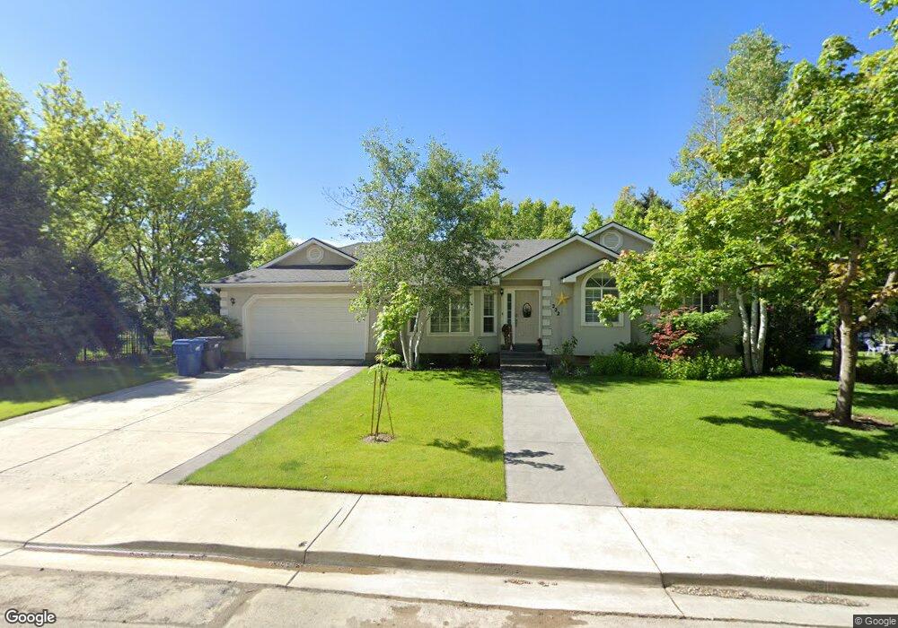
222 E 450 N Lindon, UT 84042
Estimated Value: $704,000 - $741,000
About This Home
This home is located at 222 E 450 N, Lindon, UT 84042 and is currently estimated at $724,784, approximately $277 per square foot. 222 E 450 N is a home located in Utah County with nearby schools including Lindon Elementary School, Oak Canyon Junior High School, and Pleasant Grove High School.
Ownership History
We collect this data history from publicly available records. To have your information removed, we recommend requesting removal directly through your county’s website.
Purchase Details
Home Financials for this Owner
Home Financials are based on the most recent Mortgage that was taken out on this home.Purchase Details
Purchase Details
Home Financials for this Owner
Home Financials are based on the most recent Mortgage that was taken out on this home.Purchase Details
Home Financials for this Owner
Home Financials are based on the most recent Mortgage that was taken out on this home.Home Values in the Area
Average Home Value in this Area
Purchase History
We collect this data history from publicly available records. To have your information removed, we recommend requesting removal directly through your county’s website.
| Date | Buyer | Sale Price | Title Company |
|---|---|---|---|
| -- | Legends Title Llc | ||
| -- | Legends Title Llc | ||
| -- | Pro Title & Escrow Inc | ||
| -- | North American Title | ||
| -- | Access Title Company |
Mortgage History
We collect this data history from publicly available records. To have your information removed, we recommend requesting removal directly through your county’s website.
| Date | Status | Borrower | Loan Amount |
|---|---|---|---|
| Open | $86,500 | ||
| Previous Owner | $390,500 | ||
| Previous Owner | $236,944 |
Tax History
We collect this data history from publicly available records. To have your information removed, we recommend requesting removal directly through your county’s website.
| Year | Tax Paid | Tax Assessment Tax Assessment Total Assessment is a certain percentage of the fair market value that is determined by local assessors to be the total taxable value of land and additions on the property. | Land | Improvement |
|---|---|---|---|---|
| 2025 | $2,874 | $379,335 | -- | -- |
| 2024 | $2,874 | $354,255 | $0 | $0 |
| 2023 | $2,679 | $354,695 | $0 | $0 |
| 2022 | $2,730 | $349,140 | $0 | $0 |
| 2021 | $2,477 | $477,800 | $288,600 | $189,200 |
| 2020 | $2,225 | $422,400 | $240,500 | $181,900 |
| 2019 | $2,013 | $398,700 | $240,500 | $158,200 |
| 2018 | $2,157 | $402,900 | $227,800 | $175,100 |
| 2017 | $2,097 | $209,990 | $0 | $0 |
| 2016 | $2,068 | $191,565 | $0 | $0 |
| 2015 | $1,593 | $139,480 | $0 | $0 |
| 2014 | -- | $119,240 | $0 | $0 |
Map
- 245 E 400 N
- 379 E 400 N
- 271 N 400 E Unit 1
- 628 N 120 E
- 308 E 750 N
- 517 N 80 W
- 190 E 800 N Unit 4
- 150 E 800 N Unit 2
- 170 E 800 N Unit 3
- 130 E 800 N Unit 1
- 433 N Locust Ave
- 240 E Center St
- 133 Canal Dr
- 669 E 680 N Unit 14
- 90 S 200 E
- 1172 E Murdock Dr
- 717 S 1100 E
- 655 Mohawk Ave
- 341 W 600 N
- 669 S 1600 E
Ask me questions while you tour the home.