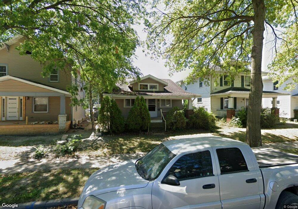
222 E Branning Ave Fort Wayne, IN 46806
Calhoun Place NeighborhoodEstimated Value: $77,000 - $132,830
2
Beds
1
Bath
1,758
Sq Ft
$54/Sq Ft
Est. Value
About This Home
This home is located at 222 E Branning Ave, Fort Wayne, IN 46806 and is currently estimated at $94,958, approximately $54 per square foot. 222 E Branning Ave is a home located in Allen County with nearby schools including Harrison Hill Elementary School, Kekionga Middle School, and South Side High School.
Ownership History
Date
Name
Owned For
Owner Type
Purchase Details
Closed on
Apr 14, 2006
Sold by
Macias Eliberto
Bought by
Macias Erick A
Current Estimated Value
Purchase Details
Closed on
Dec 1, 2004
Sold by
Macias Erick
Bought by
Macias Eliberto
Purchase Details
Closed on
Jun 15, 2004
Sold by
Hartland Real Estate Inc
Bought by
Macias Erick
Purchase Details
Closed on
Feb 23, 2001
Sold by
Hair Dean R
Bought by
Hartland Real Estate Inc
Home Financials for this Owner
Home Financials are based on the most recent Mortgage that was taken out on this home.
Original Mortgage
$21,000
Interest Rate
7.06%
Create a Home Valuation Report for This Property
The Home Valuation Report is an in-depth analysis detailing your home's value as well as a comparison with similar homes in the area
Home Values in the Area
Average Home Value in this Area
Purchase History
| Date | Buyer | Sale Price | Title Company |
|---|---|---|---|
| Macias Erick A | -- | None Available | |
| Macias Eliberto | $32,223 | -- | |
| Macias Erick | -- | -- | |
| Hartland Real Estate Inc | -- | Three Rivers Title Company I |
Source: Public Records
Mortgage History
| Date | Status | Borrower | Loan Amount |
|---|---|---|---|
| Previous Owner | Hartland Real Estate Inc | $21,000 |
Source: Public Records
Tax History
| Year | Tax Paid | Tax Assessment Tax Assessment Total Assessment is a certain percentage of the fair market value that is determined by local assessors to be the total taxable value of land and additions on the property. | Land | Improvement |
|---|---|---|---|---|
| 2025 | $1,781 | $73,500 | $22,500 | $51,000 |
| 2024 | $1,674 | $77,900 | $22,500 | $55,400 |
| 2022 | $1,270 | $56,500 | $7,200 | $49,300 |
| 2021 | $1,033 | $46,100 | $5,100 | $41,000 |
| 2020 | $1,088 | $49,700 | $5,100 | $44,600 |
| 2019 | $780 | $35,800 | $5,100 | $30,700 |
| 2018 | $776 | $35,400 | $5,100 | $30,300 |
| 2017 | $690 | $31,200 | $5,100 | $26,100 |
| 2016 | $874 | $40,100 | $5,100 | $35,000 |
| 2014 | $671 | $32,300 | $5,100 | $27,200 |
| 2013 | -- | $32,600 | $5,100 | $27,500 |
Source: Public Records
Map
Nearby Homes
- 121 E Branning Ave
- 211 Lexington Ct
- 112 Lexington Ct
- 326 Lexington Ct
- 4122 Lafayette St
- 4405 Marquette Dr
- 4102 Warsaw St
- 4442 Kenilworth St
- 309 N Seminole Cir
- 4021 Monroe St
- 4522 S Calhoun St
- 353 French Ave
- 4014 Hanna St
- 3805 Monroe St
- 4533 E Lafayette Esplanade
- 407 Lexington Ave
- 4202 Hanna St
- 356 S Cornell Cir
- 225 W Darrow Ave
- 4519 Avondale Dr
- 228 E Branning Ave
- 218 E Branning Ave
- 214 E Branning Ave
- 302 E Branning Ave
- 210 E Branning Ave
- 221 Lexington Ct
- 219 Lexington Ct
- 206 E Branning Ave
- 310 E Branning Ave
- 213 Lexington Ct
- 303 Lexington Ct
- 221 E Branning Ave
- 217 E Branning Ave
- 202 E Branning Ave
- 301 E Branning Ave
- 305 Lexington Ct
- 213 E Branning Ave
- 314 E Branning Ave
- 205 Lexington Ct
- 305 E Branning Ave
Your Personal Tour Guide
Ask me questions while you tour the home.