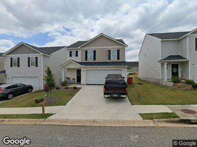
222 Hawthorn Trail Unit 2305621-60398 Macon, GA 31210
Estimated Value: $209,000 - $257,301
3
Beds
2
Baths
1,566
Sq Ft
$152/Sq Ft
Est. Value
About This Home
This home is located at 222 Hawthorn Trail Unit 2305621-60398, Macon, GA 31210 and is currently estimated at $238,575, approximately $152 per square foot. 222 Hawthorn Trail Unit 2305621-60398 is a home located in Bibb County with nearby schools including Carter Elementary School, Howard Middle School, and Howard High School.
Ownership History
Date
Name
Owned For
Owner Type
Purchase Details
Closed on
Feb 13, 2023
Sold by
Wjh Llc
Bought by
Edwards Jessica
Current Estimated Value
Home Financials for this Owner
Home Financials are based on the most recent Mortgage that was taken out on this home.
Original Mortgage
$196,367
Outstanding Balance
$192,508
Interest Rate
6.33%
Mortgage Type
FHA
Purchase Details
Closed on
Sep 29, 2011
Sold by
State Bank & Trust Co
Bought by
Vja Llc
Purchase Details
Closed on
May 4, 2010
Sold by
Highland Plantation Llc
Bought by
State Bank & Trust Co
Create a Home Valuation Report for This Property
The Home Valuation Report is an in-depth analysis detailing your home's value as well as a comparison with similar homes in the area
Home Values in the Area
Average Home Value in this Area
Purchase History
| Date | Buyer | Sale Price | Title Company |
|---|---|---|---|
| Edwards Jessica | $200,000 | -- | |
| Vja Llc | $748,600 | -- | |
| State Bank & Trust Co | $2,780,000 | -- |
Source: Public Records
Mortgage History
| Date | Status | Borrower | Loan Amount |
|---|---|---|---|
| Open | Edwards Jessica | $196,367 |
Source: Public Records
Tax History Compared to Growth
Tax History
| Year | Tax Paid | Tax Assessment Tax Assessment Total Assessment is a certain percentage of the fair market value that is determined by local assessors to be the total taxable value of land and additions on the property. | Land | Improvement |
|---|---|---|---|---|
| 2024 | $1,990 | $78,371 | $8,000 | $70,371 |
| 2023 | $1,990 | $78,371 | $8,000 | $70,371 |
| 2022 | $429 | $12,400 | $12,400 | $0 |
| 2021 | $343 | $9,021 | $9,021 | $0 |
| 2020 | $54 | $1,400 | $1,400 | $0 |
| 2019 | $55 | $1,400 | $1,400 | $0 |
| 2018 | $84 | $1,400 | $1,400 | $0 |
| 2017 | $52 | $1,400 | $1,400 | $0 |
| 2016 | $48 | $1,400 | $1,400 | $0 |
| 2015 | $69 | $1,400 | $1,400 | $0 |
| 2014 | $69 | $1,400 | $1,400 | $0 |
Source: Public Records
Map
Nearby Homes
- 137 Caroline Ct
- 131 Caroline Ct
- 205 Conner Ct
- 534 Ivy Brook Way
- 536 Ivy Brook Way
- 251 Hawthorn Trail
- 631 Ivy Brook Way
- 4516 Bon Ayer Cir
- 4515 Bon Ayer Cir
- 4260 Villa Ave
- 4149 Forest Ave W
- 3949 Bernice Ave
- 4266 Mumford Rd
- 798 Saint Andrews Dr
- 4348 Ayers Rd
- 4109 Brookdale Ave
- 4089 Brookdale Ave
- 4348 Barrington Place
- 4354 Barrington Place
- 222 Hawthorn Trail Unit 2305621-60398
- 222 Hawthorn Trail
- 224 Hawthorn Trail
- 218 Hawthorn Trail
- 226 Hawthorn Trail
- 169 Cold Creek Pkwy
- 216 Hawthorn Trail
- 167 Cold Creek Pkwy
- 228 Hawthorn Trail
- 165 Cold Creek Pkwy
- 171 Cold Creek Pkwy
- 163 Cold Creek Pkwy
- 173 Cold Creek Pkwy
- 161 Cold Creek Pkwy
- 175 Cold Creek Pkwy
- 212 Hawthorn Trail
- 177 Cold Creek Pkwy
- 221 Hawthorn Trail
- 159 Cold Creek Pkwy
- 223 Hawthorn Trail