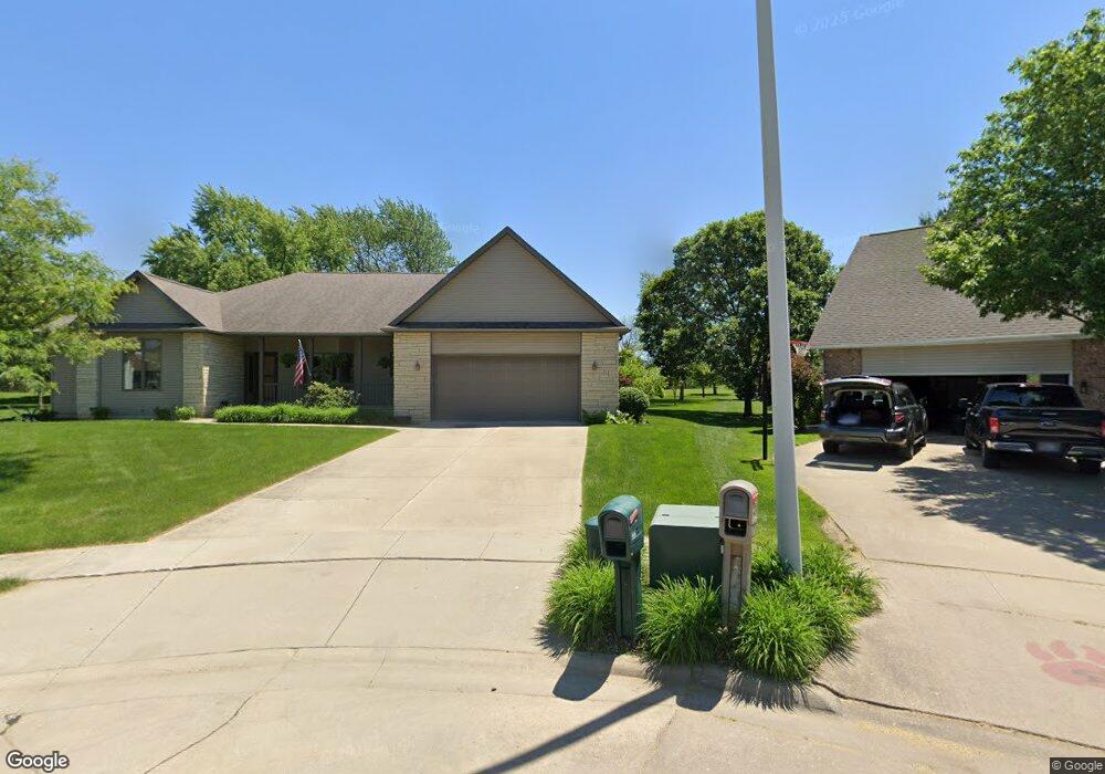
222 Kaspend Place Cedar Falls, IA 50613
Estimated Value: $446,000 - $524,000
3
Beds
5
Baths
2,577
Sq Ft
$189/Sq Ft
Est. Value
About This Home
This home is located at 222 Kaspend Place, Cedar Falls, IA 50613 and is currently estimated at $486,018, approximately $188 per square foot. 222 Kaspend Place is a home located in Black Hawk County with nearby schools including Helen A. Hansen Elementary School, Holmes Junior High School, and Cedar Falls High School.
Ownership History
Date
Name
Owned For
Owner Type
Purchase Details
Closed on
Oct 24, 2016
Sold by
Sullivan Sally A
Bought by
Sullivan Sally A and Sally A Sullivan Revocable Trust
Current Estimated Value
Purchase Details
Closed on
Mar 24, 2010
Sold by
Co Burg Construction Inc
Bought by
Co Lg Companies Llc
Home Financials for this Owner
Home Financials are based on the most recent Mortgage that was taken out on this home.
Original Mortgage
$266,000
Outstanding Balance
$176,475
Interest Rate
5%
Mortgage Type
Purchase Money Mortgage
Estimated Equity
$309,543
Create a Home Valuation Report for This Property
The Home Valuation Report is an in-depth analysis detailing your home's value as well as a comparison with similar homes in the area
Home Values in the Area
Average Home Value in this Area
Purchase History
| Date | Buyer | Sale Price | Title Company |
|---|---|---|---|
| Sullivan Sally A | -- | None Available | |
| Co Lg Companies Llc | $37,000 | None Available |
Source: Public Records
Mortgage History
| Date | Status | Borrower | Loan Amount |
|---|---|---|---|
| Open | Co Lg Companies Llc | $266,000 |
Source: Public Records
Tax History Compared to Growth
Tax History
| Year | Tax Paid | Tax Assessment Tax Assessment Total Assessment is a certain percentage of the fair market value that is determined by local assessors to be the total taxable value of land and additions on the property. | Land | Improvement |
|---|---|---|---|---|
| 2025 | $90 | $497,960 | $74,260 | $423,700 |
| 2024 | $90 | $417,520 | $74,260 | $343,260 |
| 2023 | $104 | $397,220 | $74,260 | $322,960 |
| 2022 | $104 | $381,070 | $74,260 | $306,810 |
| 2021 | $100 | $381,070 | $74,260 | $306,810 |
| 2020 | $98 | $378,320 | $71,510 | $306,810 |
| 2019 | $98 | $378,320 | $71,510 | $306,810 |
| 2018 | $100 | $378,320 | $71,510 | $306,810 |
| 2017 | $100 | $350,390 | $71,510 | $278,880 |
| 2016 | $6,615 | $350,390 | $71,510 | $278,880 |
| 2015 | $6,192 | $350,390 | $71,510 | $278,880 |
| 2014 | $6,014 | $336,450 | $71,510 | $264,940 |
Source: Public Records
Map
Nearby Homes
- 3702 Apollo St
- 3413 Pheasant Dr
- 2906 W 3rd St
- 2907 W 3rd St
- 3603 Apollo St
- 223 Winding Ridge Rd
- 538 Fireside Dr
- 0 W Glen Development Land
- Lots 1-2 Nordic Dr
- Lots 3-4 Nordic Dr
- Lots 5-6 Nordic Dr
- 4124 Thresher Ct Unit 306
- 4128 Shocker Rd
- 2607 Feather Run Trail
- 4032 Wynnewood Dr
- 4209 Thresher Ct
- 4416 Wynnewood Dr
- 2201 W 8th St
- 2214 Coventry Ln
- 4305 Autumn Ridge Rd Unit 209
- 227 Kaspend Place
- 216 Kaspend Place
- 221 Kaspend Place
- 206 Kaspend Place
- 215 Kaspend Place
- 128 Kaspend Place
- 205 Kaspend Place
- 127 Kaspend Place
- 118 Kaspend Place
- 117 Kaspend Place
- 3118 Pheasant Dr
- 3108 Pheasant Dr
- 108 Kaspend Place
- 3308 Pheasant Dr
- 3036 Pheasant Dr
- 3006 W 4th St
- 3324 Pheasant Dr
- 3011 W 4th St
- 3201 Pheasant Dr
- 3211 Pheasant Dr