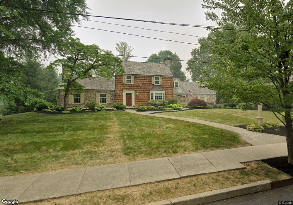
222 N 29th St Unit 230 Allentown, PA 18104
West End Allentown NeighborhoodEstimated Value: $602,000 - $759,000
4
Beds
5
Baths
3,376
Sq Ft
$193/Sq Ft
Est. Value
About This Home
This home is located at 222 N 29th St Unit 230, Allentown, PA 18104 and is currently estimated at $651,792, approximately $193 per square foot. 222 N 29th St Unit 230 is a home located in Lehigh County with nearby schools including Muhlenberg Elementary School, San Rafael Junior High School, and Trexler Middle School.
Ownership History
Date
Name
Owned For
Owner Type
Purchase Details
Closed on
Oct 26, 1999
Sold by
Huston Eva K
Bought by
Harries Darryl W and Harries Barbara G
Current Estimated Value
Purchase Details
Closed on
Aug 24, 1994
Sold by
Huston Samuel R and Huston Eva K
Bought by
Huston Eva K
Purchase Details
Closed on
Aug 21, 1986
Sold by
Smoyer T E Et Al Trustee
Bought by
Huston Samuel R and Huston Eva K
Create a Home Valuation Report for This Property
The Home Valuation Report is an in-depth analysis detailing your home's value as well as a comparison with similar homes in the area
Home Values in the Area
Average Home Value in this Area
Purchase History
| Date | Buyer | Sale Price | Title Company |
|---|---|---|---|
| Harries Darryl W | $242,500 | -- | |
| Huston Eva K | -- | -- | |
| Huston Samuel R | $206,000 | -- |
Source: Public Records
Tax History Compared to Growth
Tax History
| Year | Tax Paid | Tax Assessment Tax Assessment Total Assessment is a certain percentage of the fair market value that is determined by local assessors to be the total taxable value of land and additions on the property. | Land | Improvement |
|---|---|---|---|---|
| 2025 | $10,788 | $323,800 | $41,400 | $282,400 |
| 2024 | $10,788 | $323,800 | $41,400 | $282,400 |
| 2023 | $10,788 | $323,800 | $41,400 | $282,400 |
| 2022 | $10,419 | $323,800 | $282,400 | $41,400 |
| 2021 | $10,216 | $323,800 | $41,400 | $282,400 |
| 2020 | $9,956 | $323,800 | $41,400 | $282,400 |
| 2019 | $9,799 | $323,800 | $41,400 | $282,400 |
| 2018 | $9,108 | $323,800 | $41,400 | $282,400 |
| 2017 | $8,883 | $323,800 | $41,400 | $282,400 |
| 2016 | -- | $323,800 | $41,400 | $282,400 |
| 2015 | -- | $323,800 | $41,400 | $282,400 |
| 2014 | -- | $323,800 | $41,400 | $282,400 |
Source: Public Records
Map
Nearby Homes
- 525 N Main St Unit 527
- 2702-2710 Liberty St Unit 2702
- 514 N Broad St Unit 520
- 81 S Cedar Crest Blvd
- 2823 Hamilton Blvd
- 615 N 27th St
- 712 N 30th St
- 2895 Hamilton Blvd Unit 104
- 737 N 27th St
- 521 N 25th St
- 303 College Dr
- 19 Spring Wood Dr
- 3275 W Fairview St
- 2411 Union St
- 419 S Ott St
- 614 N 23rd St
- 921 N 26th St
- 525 N Leh St
- 2140 W Gordon St
- 2133 W Gordon St Unit 2135
- 221 N Arch St Unit 229
- 2904 W Chew St Unit 2912
- 2903 W Turner St Unit 2911
- 2921 W Turner St
- 2918 W Chew St Unit 2924
- 2840 W Chew St Unit 2846
- 143 N 29th St Unit 217
- 228 N Main St Unit 230
- 220 212-228 N Main St
- 222 N Arch St
- 2830 W Chew St Unit 2840
- 2908 W Turner St
- 2904 W Turner St Unit 2912
- 2918 W Turner St Unit 2924
- 2920 W Turner St
- 135 N 29th St Unit 141
- 2930 W Chew St Unit 2950
- 2929 W Turner St Unit 2949
- 142 N Main St Unit 202
- 2933 W Turner St