Estimated Value: $183,000 - $202,000
3
Beds
3
Baths
1,932
Sq Ft
$99/Sq Ft
Est. Value
About This Home
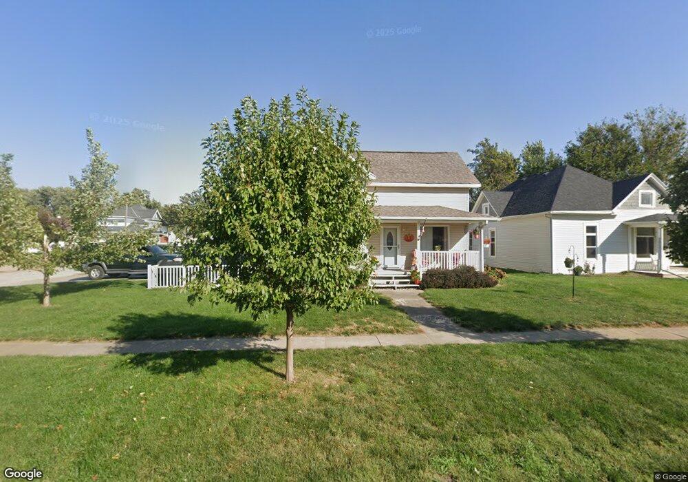
This home is located at 222 N 2nd Ave, Logan, IA 51546 and is currently estimated at $192,117, approximately $99 per square foot. 222 N 2nd Ave is a home located in Harrison County with nearby schools including Logan-Magnolia Elementary School and Logan-Magnolia Junior/Senior High School.
Ownership History
Date
Name
Owned For
Owner Type
Purchase Details
Closed on
Aug 21, 2020
Sold by
Seguin Kristopher Don and Seguin Teena M
Bought by
Thompson William R and Thompson Vicki L
Current Estimated Value
Purchase Details
Closed on
Jul 15, 2007
Sold by
Jacobsen Irene P
Bought by
Mchugh Thompson Teena
Home Financials for this Owner
Home Financials are based on the most recent Mortgage that was taken out on this home.
Original Mortgage
$83,120
Interest Rate
6.76%
Mortgage Type
New Conventional
Create a Home Valuation Report for This Property
The Home Valuation Report is an in-depth analysis detailing your home's value as well as a comparison with similar homes in the area
Home Values in the Area
Average Home Value in this Area
Purchase History
| Date | Buyer | Sale Price | Title Company |
|---|---|---|---|
| Thompson William R | $139,500 | Blair Abstract & Title Co | |
| Mchugh Thompson Teena | $104,000 | None Available |
Source: Public Records
Mortgage History
| Date | Status | Borrower | Loan Amount |
|---|---|---|---|
| Previous Owner | Mchugh Thompson Teena | $83,120 |
Source: Public Records
Tax History Compared to Growth
Tax History
| Year | Tax Paid | Tax Assessment Tax Assessment Total Assessment is a certain percentage of the fair market value that is determined by local assessors to be the total taxable value of land and additions on the property. | Land | Improvement |
|---|---|---|---|---|
| 2025 | $2,586 | $176,040 | $9,450 | $166,590 |
| 2024 | $2,586 | $157,380 | $9,450 | $147,930 |
| 2023 | $2,474 | $156,300 | $9,450 | $146,850 |
| 2022 | $2,056 | $114,343 | $9,450 | $104,893 |
| 2021 | $2,056 | $114,343 | $9,450 | $104,893 |
| 2020 | $1,838 | $105,838 | $9,450 | $96,388 |
| 2019 | $2,058 | $105,838 | $9,450 | $96,388 |
| 2018 | $2,012 | $111,275 | $0 | $0 |
| 2017 | $2,012 | $111,275 | $0 | $0 |
| 2016 | $2,110 | $111,275 | $0 | $0 |
| 2015 | $2,110 | $100,247 | $0 | $0 |
| 2014 | $1,838 | $100,247 | $0 | $0 |
Source: Public Records
Map
Nearby Homes
- 721 Glen Rd
- 114 E 10th St
- 1010 Skyline Dr
- 415 Wessar Dr
- Lot 18 Mulligan Trail
- 2607 220th St
- 2144 Norton Ave
- LOT 27 Mulligan Trail
- 2484 280th St
- LOT 26 Lmvcc Estates
- 2464 Mulligan Trail
- LOT 20 Lmvcc Estates
- LOT 17 Lmvcc Estates
- Lot 17 Lmvcc Estates Trail
- LOT 15 Mulligan Trail
- 2853 Preston Place
- 2740 Whitetail Dr
- LOT D Fieldcrest Dr
- LOT E & K Fieldcrest Dr
- LOT C Fieldcrest Dr