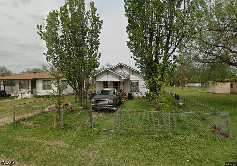
222 S Locust St Pauls Valley, OK 73075
Estimated Value: $69,000 - $91,000
2
Beds
1
Bath
1,102
Sq Ft
$72/Sq Ft
Est. Value
About This Home
This home is located at 222 S Locust St, Pauls Valley, OK 73075 and is currently estimated at $79,434, approximately $72 per square foot. 222 S Locust St is a home located in Garvin County with nearby schools including Pauls Valley Elementary School, Pauls Valley Intermediate School, and Jackson Elementary School.
Ownership History
Date
Name
Owned For
Owner Type
Purchase Details
Closed on
Aug 29, 2016
Sold by
Nanney Margaget L and Powell Wanda
Bought by
Nanney Margaret L and Nanney Billy Ray
Current Estimated Value
Purchase Details
Closed on
Dec 9, 2015
Sold by
Nanney Margaret L
Bought by
Nanney Margaret L and Powell Wanda
Purchase Details
Closed on
Jul 24, 2015
Sold by
Powell Wanda and Nanney Jimmy D
Bought by
Nanney Margaret L
Purchase Details
Closed on
Oct 28, 2008
Sold by
Nanney Margaret L and Powell Wanda
Bought by
Powell Wanda and Nanney Jimmy D
Purchase Details
Closed on
Jul 23, 2003
Sold by
Nanney Willie and Nanney Margaret
Bought by
Nanney Margaret
Create a Home Valuation Report for This Property
The Home Valuation Report is an in-depth analysis detailing your home's value as well as a comparison with similar homes in the area
Home Values in the Area
Average Home Value in this Area
Purchase History
| Date | Buyer | Sale Price | Title Company |
|---|---|---|---|
| Nanney Margaret L | -- | None Available | |
| Nanney Margaret L | -- | None Available | |
| Nanney Margaret L | -- | None Available | |
| Powell Wanda | -- | -- | |
| Nanney Margaret | -- | -- |
Source: Public Records
Tax History Compared to Growth
Tax History
| Year | Tax Paid | Tax Assessment Tax Assessment Total Assessment is a certain percentage of the fair market value that is determined by local assessors to be the total taxable value of land and additions on the property. | Land | Improvement |
|---|---|---|---|---|
| 2024 | $371 | $3,740 | $622 | $3,118 |
| 2023 | $371 | $3,562 | $619 | $2,943 |
| 2022 | $328 | $3,392 | $614 | $2,778 |
| 2021 | $323 | $3,231 | $608 | $2,623 |
| 2020 | $310 | $3,078 | $571 | $2,507 |
| 2019 | $303 | $2,930 | $534 | $2,396 |
| 2018 | $282 | $2,791 | $501 | $2,290 |
| 2017 | $229 | $2,658 | $277 | $2,381 |
| 2016 | $218 | $2,531 | $277 | $2,254 |
| 2015 | $211 | $2,411 | $277 | $2,134 |
| 2014 | $202 | $2,296 | $277 | $2,019 |
Source: Public Records
Map
Nearby Homes
- 615 E Charles Ave
- 116 S Locust St
- 213 S Elm St
- 120 S Cherry St
- 400 E Wagner Ave
- 1113 Evergreen Dr
- 420 N Elm St
- 718 N Santa fe St
- 730 N Santa fe St
- 601 N Walnut St
- 220 S Edith Ave
- 804 N Willow St
- 201 S Oak St
- 813 N Willow St
- 202 W Lee St
- 219 N Cedar St
- 1006 S Chickasaw St
- 311 S Bertha Ave
- 828 N Pine St
- 425 Mohawk Dr
- 220 S Locust St
- 216 S Locust St
- 214 S Locust St
- 221 S Pear St
- 219 S Pear St
- 225 S Pear St
- 225 S Locust St
- 219 S Locust St
- 217 S Pear St
- 708 E Charles Ave
- 700 E Charles Ave
- 217 S Locust St
- 229 S Locust St
- 706 E Garvin Ave
- 712 E Charles Ave
- 303 S Pear St
- 620 E Charles Ave
- 201 S Pear St
- 303 E Garvin Ave
- 301 S Pear St