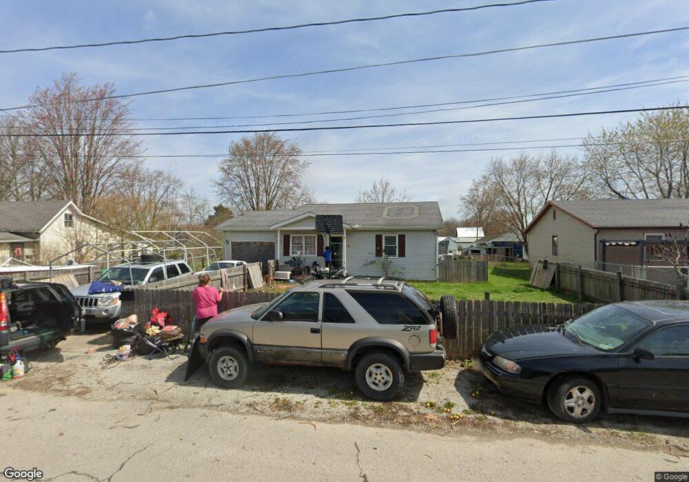
222 Toland St London, OH 43140
Estimated Value: $161,000 - $202,477
3
Beds
1
Bath
952
Sq Ft
$195/Sq Ft
Est. Value
About This Home
This home is located at 222 Toland St, London, OH 43140 and is currently estimated at $185,369, approximately $194 per square foot. 222 Toland St is a home located in Madison County with nearby schools including London Elementary School, London Middle School, and London High School.
Ownership History
Date
Name
Owned For
Owner Type
Purchase Details
Closed on
Jun 6, 2008
Sold by
Brown Christopher J and Brown Jammie
Bought by
Dennison Tabitha
Current Estimated Value
Home Financials for this Owner
Home Financials are based on the most recent Mortgage that was taken out on this home.
Original Mortgage
$78,764
Outstanding Balance
$50,543
Interest Rate
6.05%
Mortgage Type
FHA
Estimated Equity
$134,826
Purchase Details
Closed on
Feb 19, 2002
Sold by
Jackson Madge V
Bought by
Brown Christopher J
Create a Home Valuation Report for This Property
The Home Valuation Report is an in-depth analysis detailing your home's value as well as a comparison with similar homes in the area
Home Values in the Area
Average Home Value in this Area
Purchase History
| Date | Buyer | Sale Price | Title Company |
|---|---|---|---|
| Dennison Tabitha | $80,000 | Attorney | |
| Brown Christopher J | $61,000 | -- |
Source: Public Records
Mortgage History
| Date | Status | Borrower | Loan Amount |
|---|---|---|---|
| Open | Dennison Tabitha | $78,764 |
Source: Public Records
Tax History Compared to Growth
Tax History
| Year | Tax Paid | Tax Assessment Tax Assessment Total Assessment is a certain percentage of the fair market value that is determined by local assessors to be the total taxable value of land and additions on the property. | Land | Improvement |
|---|---|---|---|---|
| 2024 | $1,670 | $54,610 | $8,670 | $45,940 |
| 2023 | $1,670 | $54,610 | $8,670 | $45,940 |
| 2022 | $1,380 | $41,260 | $7,140 | $34,120 |
| 2021 | $1,374 | $41,260 | $7,140 | $34,120 |
| 2020 | $1,374 | $41,260 | $7,140 | $34,120 |
| 2019 | $1,249 | $37,130 | $6,430 | $30,700 |
| 2018 | $1,359 | $37,130 | $6,430 | $30,700 |
| 2017 | $1,148 | $37,130 | $6,430 | $30,700 |
| 2016 | $1,156 | $32,660 | $6,430 | $26,230 |
| 2015 | $1,149 | $32,660 | $6,430 | $26,230 |
| 2014 | $1,324 | $32,660 | $6,430 | $26,230 |
| 2013 | -- | $24,700 | $5,400 | $19,300 |
Source: Public Records
Map
Nearby Homes
- 224 Toland St
- 220 Toland St
- 203 W Lincoln Ave
- 223 Toland St
- 218 Toland St
- 20 Fairview Ave
- 9 Antietam St
- 18 Fairview Ave
- 221 Toland St
- 217 Toland St
- 22 Fairview Ave
- 16 Fairview Ave
- 225 Toland St
- 216 Toland St
- 227 Toland St
- 31 Antietam St
- 80 Antietam St
- 222 Jenkinson Ave
- 214 Toland St
- 223 W Lincoln Ave