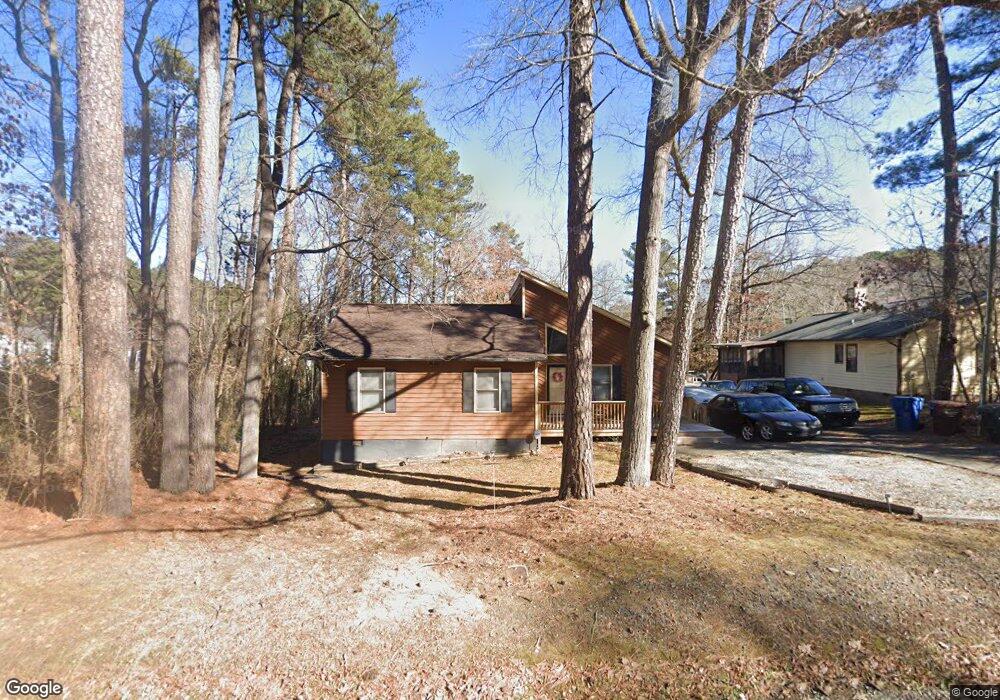
222 W Cornwallis Rd Durham, NC 27707
Rockwood NeighborhoodEstimated Value: $295,000 - $324,000
3
Beds
2
Baths
1,240
Sq Ft
$254/Sq Ft
Est. Value
About This Home
This home is located at 222 W Cornwallis Rd, Durham, NC 27707 and is currently estimated at $314,453, approximately $253 per square foot. 222 W Cornwallis Rd is a home located in Durham County with nearby schools including C. C. Spaulding Elementary, Morehead Montessori, and Sherwood Githens Middle.
Ownership History
Date
Name
Owned For
Owner Type
Purchase Details
Closed on
Aug 28, 2025
Sold by
Burns Labrena Nolette
Bought by
City Of Durham
Current Estimated Value
Purchase Details
Closed on
Jan 29, 2001
Sold by
Martin I Jarvis and Martin Norma B
Bought by
Burns Labrena Nolette
Home Financials for this Owner
Home Financials are based on the most recent Mortgage that was taken out on this home.
Original Mortgage
$108,938
Interest Rate
7.18%
Mortgage Type
FHA
Purchase Details
Closed on
Sep 15, 2000
Sold by
Walton Jr Louis E and Walton Felecia S
Bought by
Martin I Jarvis and Martin Norma B
Create a Home Valuation Report for This Property
The Home Valuation Report is an in-depth analysis detailing your home's value as well as a comparison with similar homes in the area
Home Values in the Area
Average Home Value in this Area
Purchase History
| Date | Buyer | Sale Price | Title Company |
|---|---|---|---|
| City Of Durham | $9,000 | None Listed On Document | |
| Burns Labrena Nolette | $110,000 | -- | |
| Martin I Jarvis | $71,486 | -- |
Source: Public Records
Mortgage History
| Date | Status | Borrower | Loan Amount |
|---|---|---|---|
| Previous Owner | Burns Labrena Nolette | $108,938 |
Source: Public Records
Tax History
| Year | Tax Paid | Tax Assessment Tax Assessment Total Assessment is a certain percentage of the fair market value that is determined by local assessors to be the total taxable value of land and additions on the property. | Land | Improvement |
|---|---|---|---|---|
| 2025 | $3,101 | $312,773 | $153,750 | $159,023 |
| 2024 | $3,055 | $219,033 | $70,610 | $148,423 |
| 2023 | $2,869 | $219,033 | $70,610 | $148,423 |
| 2022 | $2,803 | $219,033 | $70,610 | $148,423 |
| 2021 | $2,790 | $219,033 | $70,610 | $148,423 |
| 2020 | $2,725 | $219,033 | $70,610 | $148,423 |
| 2019 | $2,725 | $219,033 | $70,610 | $148,423 |
| 2018 | $1,727 | $127,342 | $30,700 | $96,642 |
| 2017 | $1,715 | $127,342 | $30,700 | $96,642 |
| 2016 | $1,657 | $127,342 | $30,700 | $96,642 |
| 2015 | $1,549 | $111,914 | $23,555 | $88,359 |
| 2014 | $1,549 | $111,914 | $23,555 | $88,359 |
Source: Public Records
Map
Nearby Homes
- 2146 Charles St Unit 12
- 2146 Charles St Unit 37
- 2146 Charles St Unit 40
- 2214 Oak Ridge Blvd
- 101 W Woodridge Dr
- 212 Barnhill St
- 3014 Hope Valley Rd
- 226 Barnhill St
- 5 Glenmore Dr
- 2203 University Dr
- 104 Archdale Dr
- 2106 University Dr
- 2810 Beechwood Dr
- 4 Chantilly Place
- 2235 Alpine Rd
- 2833 Wyeth Ave
- 2708 Sarah Ave
- 801 Springdale Dr
- 302 Normandy St
- 2831 Beechwood Dr
- 3 Burgess Ln
- 7 Burgess Ln
- 2737 E Shoreham St
- 2733 E Shoreham St
- 2729 E Shoreham St
- 9 Burgess Ln
- 221 W Cornwallis Rd
- 227 W Cornwallis Rd
- 2 Burgess Ln
- 6 Burgess Ln
- 2725 E Shoreham St
- 217 W Cornwallis Rd
- 2801 Shoreham St
- 11 Burgess Ln
- 2723 E Shoreham St
- 10 Burgess Ln
- 210 W Cornwallis Rd
- 228 Monticello Ave
- 15 Burgess Ln
- 232 Monticello Ave
Your Personal Tour Guide
Ask me questions while you tour the home.