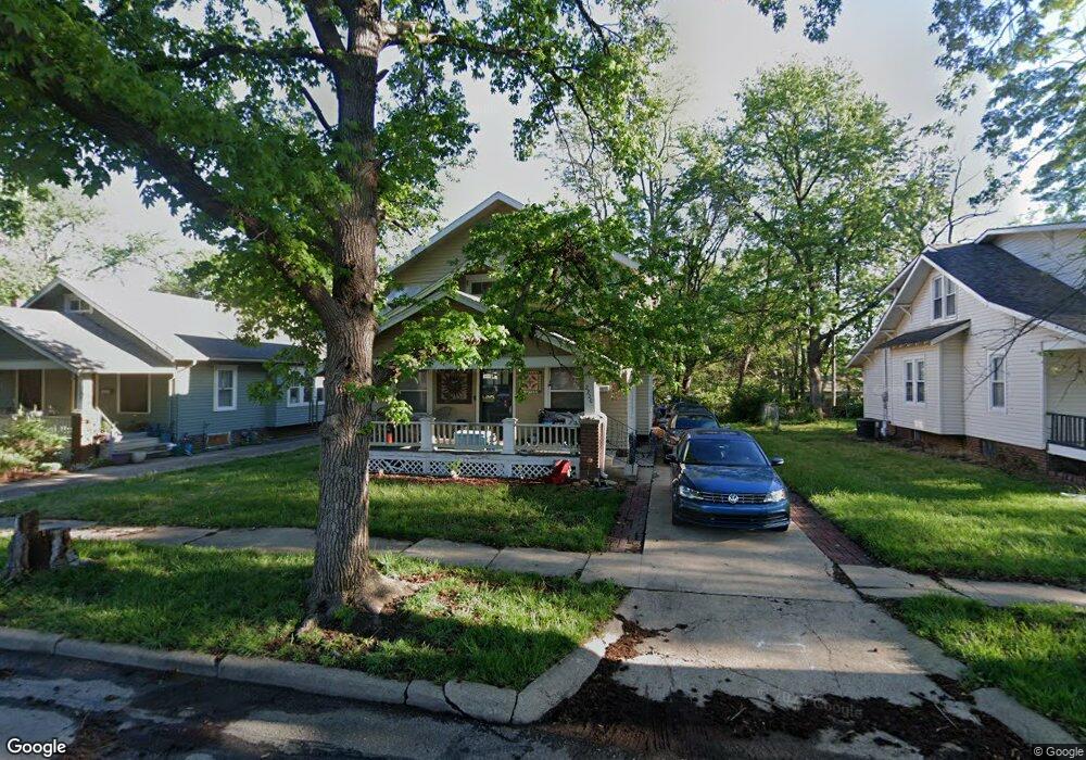
2220 SW Kensington Ct Topeka, KS 66606
Central Topeka NeighborhoodEstimated Value: $130,000 - $150,000
4
Beds
2
Baths
1,518
Sq Ft
$92/Sq Ft
Est. Value
About This Home
This home is located at 2220 SW Kensington Ct, Topeka, KS 66606 and is currently estimated at $140,390, approximately $92 per square foot. 2220 SW Kensington Ct is a home located in Shawnee County with nearby schools including Lowman Hill Elementary School, Landon Middle School, and Topeka High School.
Ownership History
Date
Name
Owned For
Owner Type
Purchase Details
Closed on
Jul 23, 2008
Sold by
Department Of Veterans Affairs
Bought by
Dykstra Patrick C
Current Estimated Value
Home Financials for this Owner
Home Financials are based on the most recent Mortgage that was taken out on this home.
Original Mortgage
$28,763
Outstanding Balance
$18,928
Interest Rate
6.47%
Mortgage Type
VA
Estimated Equity
$121,462
Purchase Details
Closed on
Jul 17, 2007
Sold by
Haggerty Ronald D and Exum Haggerty Renee M
Bought by
The Secretary Of Veterans Affairs
Create a Home Valuation Report for This Property
The Home Valuation Report is an in-depth analysis detailing your home's value as well as a comparison with similar homes in the area
Home Values in the Area
Average Home Value in this Area
Purchase History
| Date | Buyer | Sale Price | Title Company |
|---|---|---|---|
| Dykstra Patrick C | -- | First American Title | |
| The Secretary Of Veterans Affairs | $62,531 | None Available |
Source: Public Records
Mortgage History
| Date | Status | Borrower | Loan Amount |
|---|---|---|---|
| Open | Dykstra Patrick C | $28,763 |
Source: Public Records
Tax History Compared to Growth
Tax History
| Year | Tax Paid | Tax Assessment Tax Assessment Total Assessment is a certain percentage of the fair market value that is determined by local assessors to be the total taxable value of land and additions on the property. | Land | Improvement |
|---|---|---|---|---|
| 2025 | $1,755 | $13,332 | -- | -- |
| 2023 | $1,755 | $12,097 | $0 | $0 |
| 2022 | $1,535 | $10,519 | $0 | $0 |
| 2021 | $1,418 | $9,148 | $0 | $0 |
| 2020 | $1,333 | $8,712 | $0 | $0 |
| 2019 | $1,314 | $8,540 | $0 | $0 |
| 2018 | $1,276 | $8,292 | $0 | $0 |
| 2017 | $1,279 | $8,292 | $0 | $0 |
| 2014 | $1,395 | $8,931 | $0 | $0 |
Source: Public Records
Map
Nearby Homes
- 2204 SW Kensington Ct
- 808 SW Lindenwood Ave
- 1022 SW MacVicar Ave
- 801 SW Lindenwood Ave
- 734 SW Lindenwood Ave
- 2208 SW Kenilworth Ct
- 1026 SW Medford Ave
- 1038 SW Medford Ave
- 619 SW Lindenwood Ave
- 1156 SW Woodward Ave
- 1164 SW MacVicar Ave
- 615 SW High Ave
- 1180 SW Woodward Ave
- 712 SW Webster Ave
- 1181 SW MacVicar Ave
- 1191 SW Boswell Ave
- 1191 SW MacVicar Ave
- 614 SW Webster Ave
- 348 SW Jewell Ave
- 716 SW Vesper Ave
- 2224 SW Kensington Ct
- 2216 SW Kensington Ct
- 2228 SW Kensington Ct
- 2212 SW Kensington Ct
- 840 SW Plass Ave
- 941 SW Glenn Ct
- 2208 SW Kensington Ct
- 838 SW Plass Ave
- 2221 SW Kensington Ct
- 2213 SW Kensington Ct
- 2223 SW Kensington Ct
- 939 SW Glenn Ct
- 2209 SW Kensington Ct
- 834 SW Plass Ave
- 931 SW Glenn Ct
- 2205 SW Kensington Ct
- 911 SW Plass Ave
- 903 SW Plass Ave
- 927 SW Glenn Ct
- 2201 SW Kensington Ct