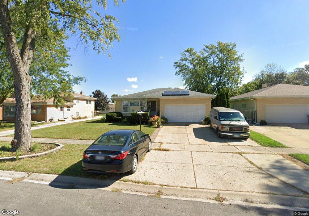
2221 Ash St Des Plaines, IL 60018
Estimated Value: $382,000 - $453,000
3
Beds
1
Bath
1,221
Sq Ft
$335/Sq Ft
Est. Value
About This Home
This home is located at 2221 Ash St, Des Plaines, IL 60018 and is currently estimated at $408,791, approximately $334 per square foot. 2221 Ash St is a home located in Cook County with nearby schools including Plainfield Elementary School, Algonquin Middle School, and Maine West High School.
Ownership History
Date
Name
Owned For
Owner Type
Purchase Details
Closed on
Jun 23, 2009
Sold by
Rutkowski Zbigniew
Bought by
Rutkowski Zbigniew and Rutkowski Kmitta Violet
Current Estimated Value
Purchase Details
Closed on
May 28, 2009
Sold by
Hrbacek Martha and Wurmbach Monica
Bought by
Rutkowski Zbigniew
Purchase Details
Closed on
Jul 27, 2004
Sold by
Mueller Katharina
Bought by
Mueller Katharina and The Alexander Mueller Family Trust
Purchase Details
Closed on
Apr 5, 2000
Sold by
Mueller Alexander and Mueller Katharina
Bought by
Mueller Alexander and Mueller Katharina
Create a Home Valuation Report for This Property
The Home Valuation Report is an in-depth analysis detailing your home's value as well as a comparison with similar homes in the area
Home Values in the Area
Average Home Value in this Area
Purchase History
| Date | Buyer | Sale Price | Title Company |
|---|---|---|---|
| Rutkowski Zbigniew | -- | Mid America Title Company | |
| Rutkowski Zbigniew | $250,000 | None Available | |
| Mueller Katharina | -- | -- | |
| Mueller Alexander | -- | -- |
Source: Public Records
Tax History Compared to Growth
Tax History
| Year | Tax Paid | Tax Assessment Tax Assessment Total Assessment is a certain percentage of the fair market value that is determined by local assessors to be the total taxable value of land and additions on the property. | Land | Improvement |
|---|---|---|---|---|
| 2024 | $6,864 | $32,000 | $7,315 | $24,685 |
| 2023 | $6,650 | $32,000 | $7,315 | $24,685 |
| 2022 | $6,650 | $32,000 | $7,315 | $24,685 |
| 2021 | $5,623 | $24,286 | $4,754 | $19,532 |
| 2020 | $5,652 | $24,286 | $4,754 | $19,532 |
| 2019 | $5,682 | $27,288 | $4,754 | $22,534 |
| 2018 | $4,479 | $21,849 | $4,206 | $17,643 |
| 2017 | $4,634 | $21,849 | $4,206 | $17,643 |
| 2016 | $6,071 | $21,849 | $4,206 | $17,643 |
| 2015 | $5,021 | $21,105 | $3,657 | $17,448 |
| 2014 | $5,486 | $21,105 | $3,657 | $17,448 |
| 2013 | $5,332 | $21,105 | $3,657 | $17,448 |
Source: Public Records
Map
Nearby Homes
- 2131 Ash St Unit G
- 2055 Lee St
- 2061 Pine St Unit C
- 2017 Pine St Unit B
- 1857 Pine St
- 1847 Dexter Ln
- 1783 Lee St
- 1629 E Touhy Ave
- 2025 Plainfield Dr
- 1641 E Touhy Ave
- 1624 Estes Ave
- 2209 Douglas Ave
- 2358 Westview Dr
- 1765 Prospect Ave
- 1776 Stockton Ave
- 1668 S Cora St
- 1721 Linden St
- 1895 Welwyn Ave
- 2054 Birch St
- 614 Birchwood Ave