Estimated Value: $139,168 - $148,000
3
Beds
1
Bath
1,176
Sq Ft
$122/Sq Ft
Est. Value
About This Home
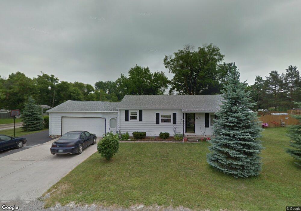
This home is located at 2221 Lambden Rd, Flint, MI 48532 and is currently estimated at $143,792, approximately $122 per square foot. 2221 Lambden Rd is a home located in Genesee County with nearby schools including Carman-Ainsworth High School, Genesee STEM Academy, and St. Paul Lutheran School.
Ownership History
Date
Name
Owned For
Owner Type
Purchase Details
Closed on
Mar 16, 2020
Sold by
Boutell Allyne Faith and Boutell Robert W
Bought by
Wilson Christine
Current Estimated Value
Purchase Details
Closed on
Nov 2, 2010
Sold by
Boutell Robert W and Boutell Allyne Faith
Bought by
Wilson Christine
Purchase Details
Closed on
Apr 2, 2007
Sold by
Boutell Robert W and Boutell Fay R
Bought by
Boutell Robert W
Purchase Details
Closed on
Jul 19, 1999
Sold by
Britton Loretta D and Britton Harry L
Bought by
Boutell Robert W and Boutell Fay R
Create a Home Valuation Report for This Property
The Home Valuation Report is an in-depth analysis detailing your home's value as well as a comparison with similar homes in the area
Home Values in the Area
Average Home Value in this Area
Purchase History
| Date | Buyer | Sale Price | Title Company |
|---|---|---|---|
| Wilson Christine | $43,000 | None Available | |
| Wilson Christine | -- | First American Title Ins Co | |
| Boutell Robert W | -- | None Available | |
| Boutell Robert W | $72,000 | Guaranty Title Company |
Source: Public Records
Tax History Compared to Growth
Tax History
| Year | Tax Paid | Tax Assessment Tax Assessment Total Assessment is a certain percentage of the fair market value that is determined by local assessors to be the total taxable value of land and additions on the property. | Land | Improvement |
|---|---|---|---|---|
| 2025 | $1,413 | $67,400 | $0 | $0 |
| 2024 | $708 | $59,200 | $0 | $0 |
| 2023 | $676 | $54,900 | $0 | $0 |
| 2022 | $636 | $40,400 | $0 | $0 |
| 2021 | $1,416 | $34,600 | $0 | $0 |
| 2020 | $894 | $33,400 | $0 | $0 |
| 2019 | $599 | $30,100 | $0 | $0 |
| 2018 | $1,154 | $28,600 | $0 | $0 |
| 2017 | $1,116 | $28,600 | $0 | $0 |
| 2016 | $1,142 | $28,400 | $0 | $0 |
| 2015 | $1,006 | $26,100 | $0 | $0 |
| 2014 | $597 | $25,000 | $0 | $0 |
| 2012 | -- | $29,400 | $29,400 | $0 |
Source: Public Records
Map
Nearby Homes
- 18.41 Taft Rd
- 2468 Ketzler Dr
- 2470 Tandy Dr
- 3321 Hogarth Ave
- 2496 Ketzler Dr
- 3277 Whitney Ave
- 3011 Curtis Dr
- 1540 Pound Dr
- VL Clairmont St
- 10 Acres T A Mansour Blvd
- 3045 Old Farm Rd
- 1600 Houran St
- 3075 Wagon Trail
- 4335 Lennon Rd
- 1574 Houran St
- 3918 Larchmont St
- 4474 Corunna Rd
- 1455 S Linden Rd
- 3813 Larchmont St
- 4480 Corunna Rd
- 2227 Lambden Rd
- 4045 Larchmont St
- 4052 Larchmont St
- 4044 Larchmont St
- 4035 Larchmont St
- 4038 Larchmont St
- 4030 Hogarth Ave
- 4031 Larchmont St
- 4034 Larchmont St
- 4053 Hogarth Ave
- 4028 Larchmont St
- 4045 Clairmont St
- 4078 Arlene Dr
- 4020 Hogarth Ave
- 4024 Larchmont St
- 4035 Hogarth Ave
- 4035 Clairmont St
- 4048 Beveridge Rd
- 4064 Arlene Dr
- 4029 Clairmont Ave