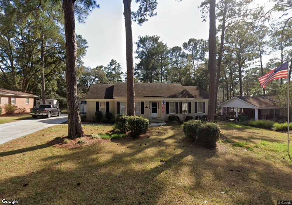
2221 Riverside Dr Valdosta, GA 31602
Estimated Value: $219,000 - $270,000
3
Beds
2
Baths
1,706
Sq Ft
$145/Sq Ft
Est. Value
About This Home
This home is located at 2221 Riverside Dr, Valdosta, GA 31602 and is currently estimated at $247,861, approximately $145 per square foot. 2221 Riverside Dr is a home located in Lowndes County with nearby schools including S.L. Mason Elementary School, Valdosta Middle School, and Valdosta High School.
Ownership History
Date
Name
Owned For
Owner Type
Purchase Details
Closed on
Oct 23, 2014
Sold by
Pirowski Michael
Bought by
Tyson Johnny A and Tyson Sheila Anne
Current Estimated Value
Home Financials for this Owner
Home Financials are based on the most recent Mortgage that was taken out on this home.
Original Mortgage
$150,000
Outstanding Balance
$115,670
Interest Rate
4.26%
Mortgage Type
VA
Estimated Equity
$132,191
Purchase Details
Closed on
Apr 22, 2004
Sold by
Pirowski Michael
Bought by
Pirowski Michael and Skelly Lisa C
Purchase Details
Closed on
Aug 11, 1998
Bought by
Etheridge Leah M
Purchase Details
Closed on
Apr 9, 1970
Bought by
Swipes Felix J and Swipes Elda
Purchase Details
Closed on
Apr 21, 1969
Bought by
Christian Frank G
Create a Home Valuation Report for This Property
The Home Valuation Report is an in-depth analysis detailing your home's value as well as a comparison with similar homes in the area
Home Values in the Area
Average Home Value in this Area
Purchase History
| Date | Buyer | Sale Price | Title Company |
|---|---|---|---|
| Tyson Johnny A | $150,000 | -- | |
| Pirowski Michael | -- | -- | |
| Pirowski Michael | $125,400 | -- | |
| Etheridge Leah M | $9,600 | -- | |
| Swipes Felix J | $28,300 | -- | |
| Christian Frank G | $5,000 | -- |
Source: Public Records
Mortgage History
| Date | Status | Borrower | Loan Amount |
|---|---|---|---|
| Open | Tyson Johnny A | $150,000 |
Source: Public Records
Tax History Compared to Growth
Tax History
| Year | Tax Paid | Tax Assessment Tax Assessment Total Assessment is a certain percentage of the fair market value that is determined by local assessors to be the total taxable value of land and additions on the property. | Land | Improvement |
|---|---|---|---|---|
| 2024 | $1,837 | $71,777 | $18,000 | $53,777 |
| 2023 | $1,837 | $90,446 | $18,000 | $72,446 |
| 2022 | $2,380 | $76,432 | $18,000 | $58,432 |
| 2021 | $2,147 | $67,747 | $18,000 | $49,747 |
| 2020 | $2,193 | $67,747 | $18,000 | $49,747 |
| 2019 | $2,192 | $67,747 | $18,000 | $49,747 |
| 2018 | $2,223 | $67,830 | $18,000 | $49,830 |
| 2017 | $2,242 | $67,913 | $18,000 | $49,913 |
| 2016 | $2,241 | $67,996 | $18,000 | $49,996 |
| 2015 | $1,703 | $57,318 | $18,000 | $39,318 |
| 2014 | $1,744 | $57,688 | $18,000 | $39,688 |
Source: Public Records
Map
Nearby Homes
- 5983 Lakeshore Dr
- 2213 Riverside Dr
- 2206 Briarcliff Dr
- 2210 Lakeshore Cir
- 2411 Riverside Dr
- 2523 Buena Vista Cir
- 2316 Riverhill Dr
- 2201 Riverside Dr
- 2115 Westfield Dr
- 21701 Highpoint Dr
- 2115 Pinecliff Dr
- 1921 Gornto Rd Unit 19
- 1921 Gornto Rd Unit 5
- 1921 Gornto Rd Unit 6
- 2206 Gornto Rd
- 2005 Baytree Rd
- 2243 Oakgrove Cir
- 2008 Baytree Rd
- 2121 Northwood Cir
- 2092 S Sherwood Dr Unit L100
- 2219 Riverside Dr
- 2303 Riverside Dr
- 2128 Lakeshore Dr
- 2216 Briarcliff Dr
- 2217 Riverside Dr
- 2132 Lakeshore Dr
- 2317 N Sherwood Dr
- LT 6 Lakeshore Dr
- LT 2 Lakeshore Dr
- 2126 Lakeshore Dr
- 2215 Briarcliff Dr
- 2215 Riverside Dr
- 2401 Riverside Dr
- 2214 Briarcliff Dr
- 2133 Lakeshore Dr
- Tract 1 S Lakeshore Dr
- 2315 N Sherwood Dr
- 2200 Lakeshore Dr
- 2135 Lakeshore Dr