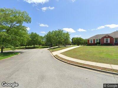
22220 Diamond Pointe Dr Athens, AL 35613
Estimated Value: $467,000 - $591,000
--
Bed
1
Bath
3,178
Sq Ft
$162/Sq Ft
Est. Value
About This Home
This home is located at 22220 Diamond Pointe Dr, Athens, AL 35613 and is currently estimated at $515,723, approximately $162 per square foot. 22220 Diamond Pointe Dr is a home with nearby schools including Brookhill Elementary School, Athens Intermediate School, and Athens Middle School.
Ownership History
Date
Name
Owned For
Owner Type
Purchase Details
Closed on
Jan 4, 2008
Sold by
Bank Of New York
Bought by
Bridgeforth Theodore and Bridgeforth Alicia
Current Estimated Value
Purchase Details
Closed on
Nov 14, 2007
Sold by
Angle Joseph D and Angle Jennifer
Bought by
Bank Of New York
Purchase Details
Closed on
May 5, 2006
Sold by
Wilson William T and Wilson Judy
Bought by
Angle Joseph D and Angle Jennifer
Home Financials for this Owner
Home Financials are based on the most recent Mortgage that was taken out on this home.
Original Mortgage
$212,960
Interest Rate
6.39%
Mortgage Type
Purchase Money Mortgage
Create a Home Valuation Report for This Property
The Home Valuation Report is an in-depth analysis detailing your home's value as well as a comparison with similar homes in the area
Home Values in the Area
Average Home Value in this Area
Purchase History
| Date | Buyer | Sale Price | Title Company |
|---|---|---|---|
| Bridgeforth Theodore | -- | -- | |
| Bank Of New York | $237,400 | -- | |
| Angle Joseph D | $266,200 | -- | |
| Wilson William | $266,200 | -- |
Source: Public Records
Mortgage History
| Date | Status | Borrower | Loan Amount |
|---|---|---|---|
| Open | Bridgeforth Theodore | $243,000 | |
| Previous Owner | Wilson William | $212,960 | |
| Previous Owner | Wilson William | $53,240 | |
| Closed | Bridgeforth Theodore | $0 |
Source: Public Records
Tax History Compared to Growth
Tax History
| Year | Tax Paid | Tax Assessment Tax Assessment Total Assessment is a certain percentage of the fair market value that is determined by local assessors to be the total taxable value of land and additions on the property. | Land | Improvement |
|---|---|---|---|---|
| 2024 | $1,973 | $50,640 | $0 | $0 |
| 2023 | $1,973 | $48,380 | $0 | $0 |
| 2022 | $1,421 | $36,840 | $0 | $0 |
| 2021 | $1,199 | $31,300 | $0 | $0 |
| 2020 | $1,133 | $29,660 | $0 | $0 |
| 2019 | $1,149 | $30,040 | $0 | $0 |
| 2018 | $1,172 | $30,620 | $0 | $0 |
| 2017 | $1,172 | $30,620 | $0 | $0 |
| 2016 | $1,172 | $306,000 | $0 | $0 |
| 2015 | $1,172 | $30,620 | $0 | $0 |
| 2014 | $1,149 | $0 | $0 | $0 |
Source: Public Records
Map
Nearby Homes
- 22180 Diamond Pointe Dr
- 14335 Crooked Stick Place
- 22326 Kennemer Ln
- 22376 Kennemer Ln
- 14293 Leadenhall Ln
- 14243 Leadenhall Ln
- 14700 Mountain Stream Dr
- 14618 Mountain Stream Dr
- 21587 Ginn Point Rd
- 21986 Natures Cove Dr
- 22005 Natures Cove Dr
- 14951 Willow Rose Ln
- 14907 Willow Rose Ln
- 14209 Muirfield Dr
- 2043 Lindsay Ln S
- 21782 Hemlock Dr
- 21838 Shearwater Dr
- 21773 Hemlock Dr
- 21774 Hemlock Dr
- 14511 London Ln
- 22220 Diamond Pointe Dr
- 22204 Diamond Pointe Dr
- 22254 Diamond Pointe Dr
- 14513 Turnberry Ln
- 22219 Diamond Pointe Dr
- 22191 Diamond Pointe Dr
- 22280 Troon Dr
- 14507 Turnberry Ln
- 22237 Diamond Pointe Dr
- 22255 Diamond Pointe Dr
- 22285 Troon Dr
- 22162 Diamond Pointe Dr
- 14493 Crooked Stick Place
- 22284 Troon Dr
- 14739 Crown Ct
- 14478 Crooked Stick Place
- 14512 Turnberry Ln
- 14740 Crown Ct
- 14490 Crooked Stick Place
- 14481 Crooked Stick Place
