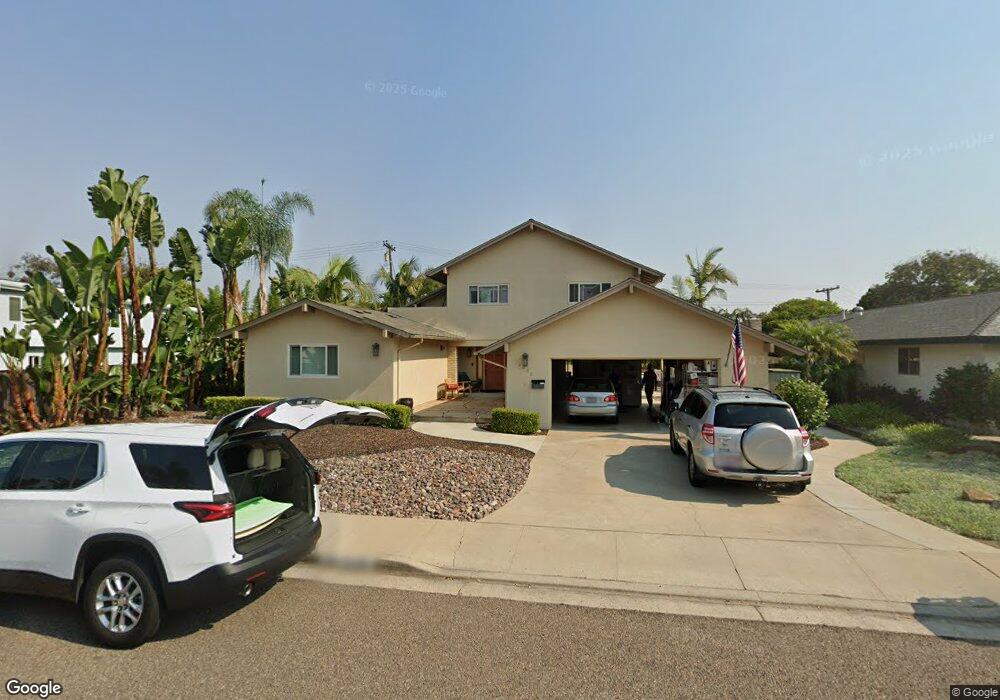
2226 Cameo Rd Carlsbad, CA 92008
Olde Carlsbad NeighborhoodEstimated Value: $1,726,000 - $2,103,000
4
Beds
4
Baths
2,530
Sq Ft
$745/Sq Ft
Est. Value
About This Home
This home is located at 2226 Cameo Rd, Carlsbad, CA 92008 and is currently estimated at $1,884,633, approximately $744 per square foot. 2226 Cameo Rd is a home located in San Diego County with nearby schools including Magnolia Elementary, Carlsbad High School, and Sage Creek High.
Ownership History
Date
Name
Owned For
Owner Type
Purchase Details
Closed on
Jun 10, 2002
Sold by
Trostrud Arville T and Trostrud Beverlee N
Bought by
Trostrud Arville T and Trostrud Beverlee N
Current Estimated Value
Home Financials for this Owner
Home Financials are based on the most recent Mortgage that was taken out on this home.
Original Mortgage
$200,000
Interest Rate
6.74%
Mortgage Type
Credit Line Revolving
Create a Home Valuation Report for This Property
The Home Valuation Report is an in-depth analysis detailing your home's value as well as a comparison with similar homes in the area
Home Values in the Area
Average Home Value in this Area
Purchase History
| Date | Buyer | Sale Price | Title Company |
|---|---|---|---|
| Trostrud Arville T | -- | First American Title Ins Co | |
| Trostrud Arville T | -- | First American Title Co |
Source: Public Records
Mortgage History
| Date | Status | Borrower | Loan Amount |
|---|---|---|---|
| Closed | Trostrud Arville T | $200,000 |
Source: Public Records
Tax History
| Year | Tax Paid | Tax Assessment Tax Assessment Total Assessment is a certain percentage of the fair market value that is determined by local assessors to be the total taxable value of land and additions on the property. | Land | Improvement |
|---|---|---|---|---|
| 2025 | $2,054 | $195,323 | $29,313 | $166,010 |
| 2024 | $2,054 | $191,494 | $28,739 | $162,755 |
| 2023 | $2,042 | $187,740 | $28,176 | $159,564 |
| 2022 | $2,009 | $184,060 | $27,624 | $156,436 |
| 2021 | $1,993 | $180,452 | $27,083 | $153,369 |
| 2020 | $1,980 | $178,603 | $26,806 | $151,797 |
| 2019 | $1,944 | $175,102 | $26,281 | $148,821 |
| 2018 | $1,863 | $171,669 | $25,766 | $145,903 |
| 2017 | $1,512 | $138,696 | $25,261 | $113,435 |
| 2016 | $1,037 | $96,762 | $24,766 | $71,996 |
| 2015 | $1,032 | $95,309 | $24,394 | $70,915 |
| 2014 | $1,015 | $93,443 | $23,917 | $69,526 |
Source: Public Records
Map
Nearby Homes
- 3768 Skyline Rd
- 3736 Donna Ct
- 3630 Donna Dr
- 3920 Holly Brae Ln
- 3354 Seacrest Dr
- 2622 Half Dome Place
- 2334 Kimberly Ct
- 2726 Naples Ct
- 3201 Via Pescado
- 4640 Coralwood Cir
- 4623 Telescope Ave
- 1733 Schooner Way Unit 1
- 4669 Coralwood Cir
- 3235 Donna Dr
- 4378 Shasta Place
- 2038 Avenue of The Trees
- 1199 Tamarack Ave
- 4269 Hillside Dr
- 4390 Yuki Ln
- 3492 Corvallis St
Your Personal Tour Guide
Ask me questions while you tour the home.