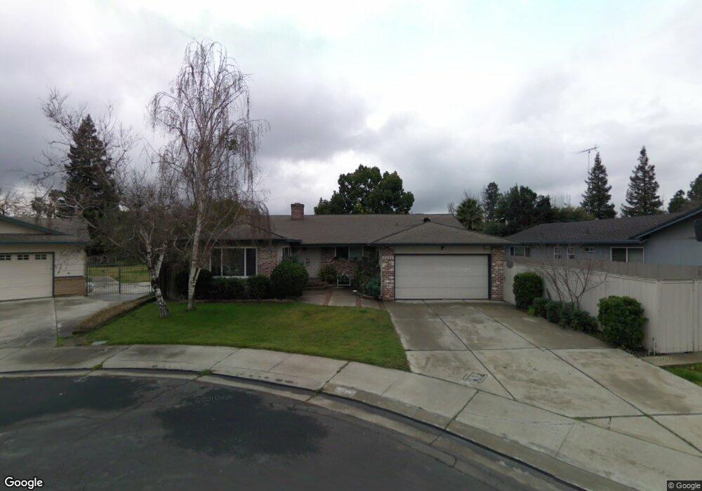
2226 Colonial Ct Stockton, CA 95209
Colonial Heights NeighborhoodEstimated Value: $418,000 - $537,000
4
Beds
2
Baths
2,017
Sq Ft
$242/Sq Ft
Est. Value
About This Home
This home is located at 2226 Colonial Ct, Stockton, CA 95209 and is currently estimated at $487,626, approximately $241 per square foot. 2226 Colonial Ct is a home located in San Joaquin County with nearby schools including Colonial Heights School, Sierra Middle School, and Lincoln High School.
Ownership History
Date
Name
Owned For
Owner Type
Purchase Details
Closed on
Oct 25, 2004
Sold by
Baker Baker R and Baker Delores M
Bought by
Lima Wilson W and Lima Vilma E
Current Estimated Value
Home Financials for this Owner
Home Financials are based on the most recent Mortgage that was taken out on this home.
Original Mortgage
$350,000
Outstanding Balance
$174,196
Interest Rate
5.74%
Mortgage Type
Purchase Money Mortgage
Estimated Equity
$313,430
Purchase Details
Closed on
Apr 9, 1998
Sold by
Baker Delores M
Bought by
Baker R D
Purchase Details
Closed on
Nov 21, 1996
Sold by
Ohlendorf Leonard R and Ohlendorf C E
Bought by
Baker Baker R and Baker Delores M
Home Financials for this Owner
Home Financials are based on the most recent Mortgage that was taken out on this home.
Original Mortgage
$95,200
Interest Rate
7.91%
Mortgage Type
Balloon
Create a Home Valuation Report for This Property
The Home Valuation Report is an in-depth analysis detailing your home's value as well as a comparison with similar homes in the area
Home Values in the Area
Average Home Value in this Area
Purchase History
| Date | Buyer | Sale Price | Title Company |
|---|---|---|---|
| Lima Wilson W | $350,000 | Alliance Title Co | |
| Baker R D | -- | Fidelity National Title Co | |
| Baker Baker R | $119,000 | Alliance Title Company | |
| Ohlendorf Leonard Roy | -- | Alliance Title Company |
Source: Public Records
Mortgage History
| Date | Status | Borrower | Loan Amount |
|---|---|---|---|
| Open | Lima Wilson W | $350,000 | |
| Previous Owner | Baker Baker R | $95,200 |
Source: Public Records
Tax History Compared to Growth
Tax History
| Year | Tax Paid | Tax Assessment Tax Assessment Total Assessment is a certain percentage of the fair market value that is determined by local assessors to be the total taxable value of land and additions on the property. | Land | Improvement |
|---|---|---|---|---|
| 2025 | $5,249 | $457,600 | $135,000 | $322,600 |
| 2024 | $5,461 | $478,272 | $143,481 | $334,791 |
| 2023 | $5,421 | $468,895 | $140,668 | $328,227 |
| 2022 | $5,284 | $459,702 | $137,910 | $321,792 |
| 2021 | $4,424 | $380,000 | $90,000 | $290,000 |
| 2020 | $3,480 | $292,500 | $90,000 | $202,500 |
| 2019 | $3,490 | $292,500 | $90,000 | $202,500 |
| 2018 | $3,775 | $317,500 | $90,000 | $227,500 |
| 2017 | $3,321 | $278,000 | $83,000 | $195,000 |
| 2016 | $2,880 | $237,000 | $71,000 | $166,000 |
| 2014 | $2,444 | $197,000 | $59,000 | $138,000 |
Source: Public Records
Map
Nearby Homes
- 2112 Portola Ave
- 2019 San Gabriel Way
- 8347 San Pablo Way
- 2417 Segarini Way
- 2454 Golden Bear Cir
- 1816 Cortez Ave
- 1629 Cortez Ave
- 2640 Javete Way
- 7724 Peppertree Dr Unit 10
- 8811 Davis Rd
- 7523 Oakcreek Dr
- 9027 Casterbridge Dr
- 7512 Heather Dr
- 1355 Paloma Ave
- 2708 Madrone Ave
- 8011 N Pershing Ave
- 9409 Carter Ct
- 9421 Carter Ct
- 1235 Briarwood Way
- 1418 Woodcreek Way
- 2232 Colonial Ct
- 2220 Colonial Ct
- 8410 Colonial Dr
- 8434 Colonial Dr
- 8436 Colonial Dr
- 8402 Colonial Dr
- 2204 Colonial Ct
- 8422 Colonial Dr
- 2211 Colonial Ct
- 2217 Colonial Ct
- 2205 Colonial Ct
- 8431 Arroyo Way
- 8443 Arroyo Way
- 8502 Colonial Dr
- 8419 Arroyo Way
- 8455 Arroyo Way
- 8368 Colonial Dr
- 8407 Arroyo Way
- 8435 Colonial Dr
- 8447 Colonial Dr